more stats
3,488 ft
Distance
11 ft
Climb
-451 ft
Descent
00:03:34
Avg time
-441 ft
Altitude change
430 ft
Altitude min
872 ft
Altitude max
872 ft
Altitude start
431 ft
Altitude end
-89.283%
Grade max
24.373%
Grade min
97 ft
Distance climb
3,110 ft
Distance down
270 ft
Distance flat
00:03:34
Avg time

Old Emerald Details

  • Activities
    • Mountain Bike
    • Horse
    • Hike
    • Trail Running
  • Riding Area
    Laguna Coast Wilderness Park
    Laguna Beach, California
  • Difficulty Rating
  • Voted Difficulty
    Blue (4 votes)
  • Local Popularity
    95 in Mountain Biking [+]
    • 60 in Trail Running
    • 70 in Hiking
    • 5 in Horseback
  • Global Ranking
    #34053 in Mountain Biking [+]
    • #71934 in Trail Running
    • #81320 in Hiking
    • #969 in Horseback
  • Trail Type
    Singletrack
  • Bike Type
    DH, AM, XC, CX
  • Direction
    Downhill Only
    Popular Direction Shown
  • Climb Difficulty
    Black Diamond
  • Physical Rating
    Hard
  • Trail Visibility
    Always easy to follow
  • eBike Allowed
  • TTFs on Trail
    Drop
  • Land Owner
    Laguna Canyon Foundation

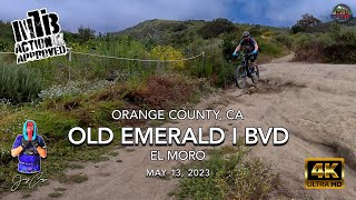
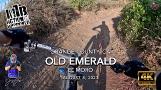
Rocky trail with very little drops
DH MTB Travel only starting June 1st as part of the OC Parks Trail Pilot Project. Please respect the directions.
https://www.ocparks.com/sites/ocparks/files/2021-07/Laguna%20Coast%20Map_Pilot%20Project_2021-07-08.pdf

Access Info

Off of Bommer Ridge

Local Trail Association
Traditionally Indigenous Territory

Recent Activity on Trail

Past Week
  • 5 rides
  • 13 miles average
6 Months
  • 152 rides
  • 13 miles avg distance
All
  • 1,291 rides
  • Last: Jun 15, 2026
c1c2c3c4
January
February
March
April
May
June
July
August
September
October
November
December
update trails status or condition

Old Emerald Trail Reports

statusdatedescription
Apr 11, 2026 @ 9:22am (America/Los_Angeles)
Apr 11, 2026
Dec 8, 2025 @ 10:33am (America/Los_Angeles)
Dec 8, 2025
OCparks smoothed out some of the ruts in the lower half. There is still a large one but not a disaster if you get into it. You can ride out of it...
Nov 27, 2025 @ 12:12pm (America/Los_Angeles)
Nov 27, 2025
Hero dirt throughout the trail. Recent rain has developed giant ruts down the last quarter of the trail. Narrow bottom section has a pretty...
Sep 13, 2025 @ 8:30am (America/Los_Angeles)
Sep 13, 2025
Great downhill, dry and cut up but what isn’t in September in So Cal?
Sep 1, 2025 @ 9:12am
Sep 1, 2025
Can’t wait for a little moisture in Laguna
more »
Status:
on Apr 11, 2026
Ideal
Avg: 4.07 (22 votes)
Your vote: 0

view (12,095)
close
3D
Trail Conditions
  • Unknown
  • Snow Groomed
  • Snow Packed
  • Snow Covered
  • Snow Cover Partial
  • Freeze/thaw Cycle
  • Icy
  • Prevalent Mud
  • Wet
  • Variable
  • Ideal
  • Dry
  • Very Dry
Trail Flow (Ridden Direction)
Trailforks scans users ridelogs to determine the most popular direction each trail is ridden. A good flowing trail network will have most trails flowing in a single direction according to their intension.
The colour categories are based on what percentage of riders are riding a trail in its intended direction.
  • > 96%
  • > 90%
  • > 80%
  • > 70%
  • > 50%
  • < 50%
  • bi-directional trail
  • no data
Trail Last Ridden
Trailforks scans ridelogs to determine the last time a trail was ridden.
  • < 2 days
  • < 1 week
  • < 2 weeks
  • < 1 month
  • < 6 months
  • > 6 months
Trail Ridden Direction
The intended direction a trail should be ridden.
  • Downhill Only
  • Downhill Primary
  • Both Directions
  • Uphill Primary
  • Uphill Only
  • One Direction
Contribute Details
Colors indicate trail is missing specified detail.
  • Description
  • Photos
  • Description & Photos
  • Videos
Trail Popularity ?
Trailforks scans ridelogs to determine which trails are ridden the most in the last 9 months. Trails are compared with nearby trails in the same city region with a possible 25 colour shades. Think of this as a heatmap, more rides = more kinetic energy = warmer colors.
  • most popular
  • popular
  • less popular
  • not popular
ATV/ORV/OHV Filter
Max Vehicle Width
inches
US Cell Coverage
Legend
cell carrier legend

Radar Time
Activity Recordings
Trailforks uses anonymized public activity data. ?
Activity Recordings
Trailforks uses anonymized public activity data. ?
Personal Heatmap
Activity Types
all / none
Options
2
Date range month
Winter Trails
Warning A routing network for winter maps does not exist. Selecting trails using the winter trails layer has been disabled.
Missing Trails
Most Popular
Least Popular
Trails are colored based on popularity. The more popular a trail is, the more red. Less popular trails trend towards green.
Jump Magnitude Heatmap
Heatmap of where riders jump on trails. Zoom in to see individual jumps, click circles to view jump details.
BC Backroad Status

Service Road Atlas is a free to use, community-driven service for viewing and creating reports on the numerous back-country service roads around B.C. and Alberta.

map legend
Slope Aspect
Direction the slope faces
Flat N NE E SE S SW W NW
Trails Deemphasized
Trails are shown in grey.
disable
Only show trails with no bike usage.
Enable
Suggested Layers
Based on selected activity type

    Save the current map location and zoom level as your default home location whenever this page is loaded.

    Save
        Directions to old-emerald trailhead (33.576270, -117.776620)

        Photos

        5 more »
        55 |
        May 22, 2023 @ 12:26pm
        May 22, 2023
        57 |
        May 22, 2023 @ 12:25pm
        May 22, 2023
        117 |
        Nov 30, 2021 @ 5:05pm
        Nov 30, 2021
        156 |
        Jan 11, 2021 @ 8:48am
        Jan 11, 2021

        Videos

        29 more »
        youtuber MTB Riding Old Emerald + BVD at El Moro, May...
        10:40 | 205 | May 16, 2023 , Laguna Beach
        youtuber MTB Riding Old Emerald at El Moro, March 15,...
        5:14 | 166 | Mar 16, 2024 , Laguna Beach
        youtuber MTB Riding Old Emerald at El Moro, August 8,...
        3:31 | 132 | Aug 15, 2023 , Laguna Beach
        youtuber MTB Riding Old Emerald at El Moro, August 8,...
        3:31 | 120 | Aug 15, 2023 , Laguna Beach

        Trail Lists

        Routes with this trail

        5.0 27 miles 3,783 ft 24 Loop
        Take a tour through 3 different outdoor parks with this route! Nothing too difficult here- as long as you...
        5.0 19 miles 3,228 ft 11 Loop
        This route will get you 4 popular black diamond runs in this area.
        3.0 7 miles 1,015 ft 13 Loop
        Laguna Coast Wilderness Park is a coastal park in Orange County. Trails in Laguna are known for being...

        8 Reviews & Comments


        We hope you've been enjoying Trailforks!

        Create a FREE account to view trail comments and much more.

        • By zdrenduro67 & contributors
        • #21947 - 6,496 views

        Frequently Asked Questions About Old Emerald

        Where is Old Emerald located?
        Old Emerald is located in Laguna Coast Wilderness Park, Laguna Beach, California, United States. It is part of the Laguna Coast Wilderness Park trail network. The trailhead is located at coordinates 33.57627, -117.77662.
        How hard is Old Emerald?
        Old Emerald is rated as Blue difficulty. The physical rating is Hard. The climb difficulty is rated Black Diamond.
        What is the elevation gain for Old Emerald?
        Old Emerald has 11 ft of elevation gain. The trail has 451 ft of elevation descent. The elevation ranges from 430 ft to 872 ft.
        Is Old Emerald a point to point trail?
        Yes, Old Emerald is a point to point trail. The direction is Downhill Only. The trail type is singletrack.

        Hit the Trail

        Open in App

        Get this trail on your phone instantly.
        open trail in app

        Download Trail

        Save to wishlist, Garmin & download.
        save the trail

        Find Related Routes

        Find routes and users activities that include this trail.
        find routes for this trail

        You must enter a description before submitting.