more stats
2.4 miles
Distance
82 ft
Climb
-1,723 ft
Descent
00:26:54
Avg time
-1,642 ft
Altitude change
2,024 ft
Altitude min
3,730 ft
Altitude max
3,690 ft
Altitude start
2,047 ft
Altitude end
-13%
Grade
-74.2%
Grade max
29%
Grade min
833 ft
Distance climb
2 miles
Distance down
295 ft
Distance flat
00:26:54
Avg time

Oltrefinale Details

  • Activities
    • Mountain Bike
    • E-Bike
  • Riding Area
    Finale Outdoor Region
    Finale Ligure
  • Ref Number
    #341
  • AKA
    Oltre Finale
  • Difficulty Rating
  • Voted Difficulty
    Blue (6 votes)
  • Local Popularity
    75 in Mountain Biking [+]
    • 75 in E-Biking
  • Global Ranking
    #2510 in Mountain Biking [+]
    • #869 in E-Biking
  • Trail Type
    Singletrack
  • Bike Type
    DH, AM
  • Direction
    Downhill Only
    Popular Direction Shown
  • Climb Difficulty
    Blue
  • Physical Rating
    Moderate
  • Trail Visibility
    Sometimes hard to follow
  • Season
    All-year round
  • Dogs Allowed
    Yes
  • eBike Allowed
    Yes up to Class 1
  • Land Owner
    Finale Outdoor Region

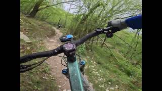
Also called Sentiero delle Caselle, Oltrefinale starts from the switchback before the Giogo di Giustenice. It touches and links pre-existing trails and moves beside old Neviere (holes dug in the ground used in the old days to store snow and ice) and reaches Pian delle Bosse hut before keeping going towards the Cabanun. From the end of this trail, you can reach Giustenice, Ranzi or even Verzi di Loano.

source: ...
Access Info

Exit the E80 highway in Pietra Ligure. Keep going towards the sea and you'll get to Pietra Ligure. You'll then be able to drive toward the mountains in order to reach Val Maremola towns and trails.
Other option would be the E80 exit in Finale Ligure. Keep going towards the sea until you catch the SS1 Via Aurelia and move west until Pietra Ligure.

Disclaimer

Given its nature, the trail can change after weather happenings and season changes. Always pay attention.

Trail Supporters
Local Trail Association

Recent Activity on Trail

Past Week
  • 1 rides
  • 32 miles average
6 Months
  • 126 rides
  • 25 miles avg distance
All
  • 591 rides
  • Last: Jun 13, 2026
c1c2c3c4
January
February
March
April
May
June
July
August
September
October
November
December
update trails status or condition

Oltrefinale Trail Reports

statusdatedescription
May 12, 2026 @ 8:31pm (Europe/Rome)
May 12, 2026
Apr 27, 2026 @ 9:33am (Europe/Monaco)
Apr 27, 2026
Apr 25, 2026 @ 8:58am (Europe/Monaco)
Apr 24, 2026
Apr 21, 2026 @ 7:59pm (Europe/Rome)
Apr 21, 2026
assez fun mais, c'est plus naturel et cassant et sineux que les classiques du coin, et plus rouge que bleu
Mar 14, 2026 @ 3:11pm (Europe/Rome)
Mar 14, 2026
anche sotto la pioggia sempre Top!
more »
Status:
on May 12, 2026
Avg: 4.35 (49 votes)
Your vote: 0

view (3,190)
close
3D
Trail Conditions
  • Unknown
  • Snow Groomed
  • Snow Packed
  • Snow Covered
  • Snow Cover Partial
  • Freeze/thaw Cycle
  • Icy
  • Prevalent Mud
  • Wet
  • Variable
  • Ideal
  • Dry
  • Very Dry
Trail Flow (Ridden Direction)
Trailforks scans users ridelogs to determine the most popular direction each trail is ridden. A good flowing trail network will have most trails flowing in a single direction according to their intension.
The colour categories are based on what percentage of riders are riding a trail in its intended direction.
  • > 96%
  • > 90%
  • > 80%
  • > 70%
  • > 50%
  • < 50%
  • bi-directional trail
  • no data
Trail Last Ridden
Trailforks scans ridelogs to determine the last time a trail was ridden.
  • < 2 days
  • < 1 week
  • < 2 weeks
  • < 1 month
  • < 6 months
  • > 6 months
Trail Ridden Direction
The intended direction a trail should be ridden.
  • Downhill Only
  • Downhill Primary
  • Both Directions
  • Uphill Primary
  • Uphill Only
  • One Direction
Contribute Details
Colors indicate trail is missing specified detail.
  • Description
  • Photos
  • Description & Photos
  • Videos
Trail Popularity ?
Trailforks scans ridelogs to determine which trails are ridden the most in the last 9 months. Trails are compared with nearby trails in the same city region with a possible 25 colour shades. Think of this as a heatmap, more rides = more kinetic energy = warmer colors.
  • most popular
  • popular
  • less popular
  • not popular
ATV/ORV/OHV Filter
Max Vehicle Width
inches
US Cell Coverage
Legend
cell carrier legend

Radar Time
Activity Recordings
Trailforks uses anonymized public activity data. ?
Activity Recordings
Trailforks uses anonymized public activity data. ?
Personal Heatmap
Activity Types
all / none
Options
2
Date range month
Winter Trails
Warning A routing network for winter maps does not exist. Selecting trails using the winter trails layer has been disabled.
Missing Trails
Most Popular
Least Popular
Trails are colored based on popularity. The more popular a trail is, the more red. Less popular trails trend towards green.
Jump Magnitude Heatmap
Heatmap of where riders jump on trails. Zoom in to see individual jumps, click circles to view jump details.
BC Backroad Status

Service Road Atlas is a free to use, community-driven service for viewing and creating reports on the numerous back-country service roads around B.C. and Alberta.

map legend
Slope Aspect
Direction the slope faces
Flat N NE E SE S SW W NW
Trails Deemphasized
Trails are shown in grey.
disable
Only show trails with no bike usage.
Enable
Suggested Layers
Based on selected activity type

    Save the current map location and zoom level as your default home location whenever this page is loaded.

    Save
        Directions to oltrefinale trailhead (44.182280, 8.190480)

        Photos

        36 more »
        99 |
        Dec 20, 2024 @ 12:23am
        Dec 20, 2024
        196 |
        May 25, 2024 @ 2:49am
        May 25, 2024
        186 |
        May 8, 2024 @ 12:44am
        May 8, 2024
        133 |
        Nov 3, 2023 @ 9:48am
        Nov 3, 2023

        Videos

        9 more »
        Pietra Ligure - Oltrefinale
        8:15 | 59 | May 6, 2026 , Finale Ligure
        Monte Carmo - Oltrefinale
        3:28 | 107 | Nov 19, 2025 , Finale Ligure
        Krásne traily Issalo Extasy a Oltrefinale vo...
        19:21 | 136 | Aug 26, 2025 , Finale Ligure
        MTB FINALE LIGURE Part II
        19:14 | 355 | May 19, 2024 , Finale Ligure

        Trail Lists

        Routes with this trail

        5.0 15 miles 3,848 ft 10 Loop
        Partenza/rientro dal negozio HotBikes. Giro dedicato per E-bike Livello medio/alto Sosta intermedia presso...
        5.0 8 miles 2,425 ft 2 Loop
        keine Beschreibung vorhanden

        13 Reviews & Comments


        We hope you've been enjoying Trailforks!

        Create a FREE account to view trail comments and much more.

        • By Benq00TF Pro & contributors
        • #135979 - 12,755 views

        Frequently Asked Questions About Oltrefinale

        Where is Oltrefinale located?
        Oltrefinale is located in Finale Outdoor Region, Finale Ligure, Italy. It is part of the Finale Outdoor Region trail network. The trailhead is located at coordinates 44.18228, 8.19048.
        How hard is Oltrefinale?
        Oltrefinale is rated as Blue difficulty. The physical rating is Moderate. The average grade is 13%. The climb difficulty is rated Blue.
        What is the elevation gain for Oltrefinale?
        Oltrefinale has 25 m of elevation gain. The trail has 525 m of elevation descent. The elevation ranges from 617 m to 1,137 m.
        Is Oltrefinale a point to point trail?
        Yes, Oltrefinale is a point to point trail. The direction is Downhill Only. The trail type is singletrack.

        Hit the Trail

        Open in App

        Get this trail on your phone instantly.
        open trail in app

        Download Trail

        Save to wishlist, Garmin & download.
        save the trail

        Find Related Routes

        Find routes and users activities that include this trail.
        find routes for this trail

        You must enter a description before submitting.