more stats
2.8 miles
Distance
381 ft
Climb
-405 ft
Descent
00:16:28
Avg time
-25 ft
Altitude change
4,687 ft
Altitude min
4,924 ft
Altitude max
4,713 ft
Altitude start
4,688 ft
Altitude end
-0.2%
Grade
-24.5%
Grade max
28.5%
Grade min
1 mile
Distance climb
1 mile
Distance down
1,053 ft
Distance flat
00:16:28
Avg time

Olympic Details

  • Activities
    • Nordic Ski
    • Mountain Bike
    • E-Bike
    • Gravel Bike
    • Hike
    • Trail Running
  • Riding Area
    Canmore Nordic Centre
    Canmore, Alberta
  • Difficulty Rating
  • Local Popularity
    100 in Nordic Skiing [+]
    • 5 in Mountain Biking
    • 5 in E-Biking
    • 5 in Trail Running
    • 5 in Hiking
  • Global Ranking
    #449 in Nordic Skiing [+]
    • #270745 in Mountain Biking
    • #296479 in Trail Running
    • #312242 in Hiking
  • Winter only trail
  • Trail Type
    Doubletrack
  • Snow Grooming
    Classic / Skating
  • Bike Type
    AM, XC, Gravel
  • Direction
    Both Directions[+]
    Popular Direction Shown
    • Both Directions for Gravel Biking
  • Climb Difficulty
    Blue
  • Physical Rating
    Moderate
  • eBike Allowed

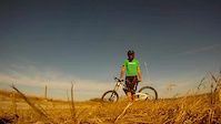
A stunning challenging competition trail with sustained climbs and descents with stunning views of the surrounding mountain ranges. It is also used for access to Rundle, Meadowview, Coyote and King of Sweden.

In the summer, it connects section of the Red Loop and other Mountain Bike singe tracks.

Recent Activity on Trail

Past Week
  • 0 rides
  •  
6 Months
  • 6 rides
  • 12 miles avg distance
All
  • 32 rides
  • Last: Dec 14, 2019
c1c2c3c4
January
February
March
April
May
June
July
August
September
October
November
December
update trails status or condition

Olympic Trail Reports

Status:
on Dec 26, 2020
Variable
no votes yet
Your vote: 0

view (1,269)
close
3D
Trail Conditions
  • Unknown
  • Snow Groomed
  • Snow Packed
  • Snow Covered
  • Snow Cover Partial
  • Freeze/thaw Cycle
  • Icy
  • Prevalent Mud
  • Wet
  • Variable
  • Ideal
  • Dry
  • Very Dry
Trail Flow (Ridden Direction)
Trailforks scans users ridelogs to determine the most popular direction each trail is ridden. A good flowing trail network will have most trails flowing in a single direction according to their intension.
The colour categories are based on what percentage of riders are riding a trail in its intended direction.
  • > 96%
  • > 90%
  • > 80%
  • > 70%
  • > 50%
  • < 50%
  • bi-directional trail
  • no data
Trail Last Ridden
Trailforks scans ridelogs to determine the last time a trail was ridden.
  • < 2 days
  • < 1 week
  • < 2 weeks
  • < 1 month
  • < 6 months
  • > 6 months
Trail Ridden Direction
The intended direction a trail should be ridden.
  • Downhill Only
  • Downhill Primary
  • Both Directions
  • Uphill Primary
  • Uphill Only
  • One Direction
Contribute Details
Colors indicate trail is missing specified detail.
  • Description
  • Photos
  • Description & Photos
  • Videos
Trail Popularity ?
Trailforks scans ridelogs to determine which trails are ridden the most in the last 9 months. Trails are compared with nearby trails in the same city region with a possible 25 colour shades. Think of this as a heatmap, more rides = more kinetic energy = warmer colors.
  • most popular
  • popular
  • less popular
  • not popular
ATV/ORV/OHV Filter
Max Vehicle Width
inches
US Cell Coverage
Legend
cell carrier legend

Radar Time
Activity Recordings
Trailforks uses anonymized public activity data. ?
Activity Recordings
Trailforks uses anonymized public activity data. ?
Personal Heatmap
Activity Types
all / none
Options
2
Date range month
Winter Trails
Warning A routing network for winter maps does not exist. Selecting trails using the winter trails layer has been disabled.
Missing Trails
Most Popular
Least Popular
Trails are colored based on popularity. The more popular a trail is, the more red. Less popular trails trend towards green.
Jump Magnitude Heatmap
Heatmap of where riders jump on trails. Zoom in to see individual jumps, click circles to view jump details.
BC Backroad Status

Service Road Atlas is a free to use, community-driven service for viewing and creating reports on the numerous back-country service roads around B.C. and Alberta.

map legend
Slope Aspect
Direction the slope faces
Flat N NE E SE S SW W NW
Trails Deemphasized
Trails are shown in grey.
disable
Only show trails with no bike usage.
Enable
Suggested Layers
Based on selected activity type

    Save the current map location and zoom level as your default home location whenever this page is loaded.

    Save
        Directions to olympic trailhead (51.090870, -115.386790)

        Photos

        9 more »
        221 |
        Dec 30, 2016 @ 10:46pm
        Dec 30, 2016
        230 |
        Dec 30, 2016 @ 10:46pm
        Dec 30, 2016
        230 |
        Dec 30, 2016 @ 10:46pm
        Dec 30, 2016
        185 |
        Dec 30, 2016 @ 4:09pm
        Dec 30, 2016

        Videos

        19 more »
        Winter is Coming (But Not Today)
        2:20 | 152 | Sep 18, 2015 , Canmore
        Calgary COP Luge run from the top
        0:32 | 512 | Dec 31, 2011 , Canmore
        Summer '09 rough edit
        3:20 | 249 | Sep 17, 2009 , Canmore
        Canada Olympic Park
        7:54 | 135 | Nov 5, 2012 , Canmore

        Routes with this trail

        5.0 30 miles 4,689 ft 48
        CNC Start - Highline - Guy Lafleur - Deadmans to refuel - Reverse - - CNC Hot Lap
        4.0 7 miles 964 ft 2 Race
        Leg 2 of the 2017 Grizzly MTB Marathon 50km course.
        8 miles 1,112 ft 13 Race
        Leg 3 of the 2017 Grizzly MTB Marathon 50km course.

        Reviews / Comments

        No reviews yet, be the first to write a review or ask a question.
        Use trail reports to comment on trail conditions.


        We hope you've been enjoying Trailforks!

        Create a FREE account to view trail comments and much more.

        • By pinkrobe & contributors
        • #67067 - 2,646 views

        Frequently Asked Questions About Olympic

        Where is Olympic located?
        Olympic is located in Canmore Nordic Centre, Canmore, Alberta, Canada. It is part of the Canmore Nordic Centre trail network. The trailhead is located at coordinates 51.09087, -115.38679.
        How hard is Olympic?
        Olympic is rated as Black Diamond difficulty. The physical rating is Moderate. The average grade is 0.2%. The climb difficulty is rated Blue.
        What is the elevation gain for Olympic?
        Olympic has 381 ft of elevation gain. The trail has 405 ft of elevation descent. The elevation ranges from 4,687 ft to 4,924 ft.
        Is Olympic a point to point trail?
        Olympic is not a point to point trail. The direction is Both Directions. The trail type is doubletrack.

        Hit the Trail

        Open in App

        Get this trail on your phone instantly.
        open trail in app

        Download Trail

        Save to wishlist, Garmin & download.
        save the trail

        Find Related Routes

        Find routes and users activities that include this trail.
        find routes for this trail

        You must enter a description before submitting.