


Open in App
Get this trail on your phone instantly.

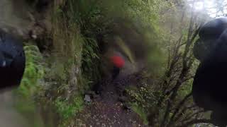
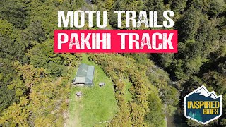
The single track is 20km and is all downhill. An isolated scenic bush ride with 25 bridges including a 25m swingbridge, requires moderate fitness and caution in certain areas due to steep drop offs. Already proving popular another 20km ride will get you back into Opotiki. Toilet and shelter facilities are available at each end of the track.
This is part of the Motu Cycle Trail which can be done as a 92km loop from Opotiki.
From Opotiki drive south on State Highway 2 to Matawai, then turn north to get to Motu. The road narrows and becomes rougher as it climbs into the hills. 10km's past Motu, you reach the top of the ridges. From there it is faster and easier to bike the final 6km's to the start of the Pakihi Track.
| c1 | c2 | c3 | c4 |
|---|---|---|---|
January | February | March | April |
May | June | July | August |
September | October | November | December |

Service Road Atlas is a free to use, community-driven service for viewing and creating reports on the numerous back-country service roads around B.C. and Alberta.
Save the current map location and zoom level as your default home location whenever this page is loaded.
SaveWe hope you've been enjoying Trailforks!
Create a FREE account to view trail comments and much more.
You must enter a description before submitting.

