more stats
2,312 ft
Distance
28 ft
Climb
-214 ft
Descent
00:03:03
Avg time
-186 ft
Altitude change
132 ft
Altitude min
322 ft
Altitude max
318 ft
Altitude start
132 ft
Altitude end
-8.047%
Grade
-30.864%
Grade max
7.88%
Grade min
704 ft
Distance climb
1,560 ft
Distance down
47 ft
Distance flat
00:03:03
Avg time

Palacio Drop Details

  • Activities
    • Mountain Bike
    • E-Bike
    • Adaptive Bike
    • Winter Fat Bike
    • Hike
    • Trail Running
  • Riding Area
    Los Peñasquitos Canyon
    San Diego, California
  • Difficulty Rating
  • Local Popularity
    60 in Mountain Biking [+]
    • 75 in E-Biking
    • 30 in Trail Running
    • 5 in Hiking
  • Global Ranking
    #106176 in Mountain Biking [+]
    • #59873 in E-Biking
    • #127871 in Trail Running
    • #281148 in Hiking
  • Trail Type
    Singletrack
  • Bike Type
    AM, XC, Fat, Adaptive MTB
  • Direction
    Downhill Primary
    Popular Direction Shown
  • Climb Difficulty
    Green
  • Physical Rating
    Moderate
  • Trail Visibility
    Always easy to follow
  • Dogs Allowed
    Yes
  • eBike Allowed
    Yes up to Class 1
  • Land Owner
    City of San Diego

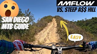
Connecting Del Mar Mesa to Carmel Valley at Carmel Country Rd. Fun downhill sections, almost black diamond.

Adaptive Bike Info
aMTB Black Rating: Advanced obstacles exist, some trail obstructions.

Dilemma: Drainage ditch at bottom. Some slight narrow off camber near the end too

Local Trail Association
Traditionally Indigenous Territory

Recent Activity on Trail

Past Week
  • 0 rides
  •  
6 Months
  • 20 rides
  • 17 miles avg distance
All
  • 203 rides
  • Last: Jun 17, 2026
c1c2c3c4
January
February
March
April
May
June
July
August
September
October
November
December
update trails status or condition

Palacio Drop Trail Reports

statusdatedescription
Nov 2, 2025 @ 8:01am (America/Los_Angeles)
Nov 2, 2025
Apr 28, 2025 @ 4:20pm
Apr 28, 2025
Horses are keeping the trail soft and square-ruts are forming. Stay mostly to the left to avoid ruts.
Sep 7, 2024 @ 6:54am
Sep 7, 2024
Right line is open and voids the worst of the middle sinkhole, rut at the end is rideable but about knee deep
Jul 28, 2024 @ 10:05am
Jul 28, 2024
Still big rut in the middle. Left side seemed ok.
Jun 17, 2023 @ 1:34am
Jun 17, 2023
Watch the big sinkhole in the middle of the high speed downhill section.
more »
Status:
on Nov 2, 2025
Ideal
Avg: 3.89 (4 votes)
Your vote: 0

view (1,600)
close
3D
Trail Conditions
  • Unknown
  • Snow Groomed
  • Snow Packed
  • Snow Covered
  • Snow Cover Partial
  • Freeze/thaw Cycle
  • Icy
  • Prevalent Mud
  • Wet
  • Variable
  • Ideal
  • Dry
  • Very Dry
Trail Flow (Ridden Direction)
Trailforks scans users ridelogs to determine the most popular direction each trail is ridden. A good flowing trail network will have most trails flowing in a single direction according to their intension.
The colour categories are based on what percentage of riders are riding a trail in its intended direction.
  • > 96%
  • > 90%
  • > 80%
  • > 70%
  • > 50%
  • < 50%
  • bi-directional trail
  • no data
Trail Last Ridden
Trailforks scans ridelogs to determine the last time a trail was ridden.
  • < 2 days
  • < 1 week
  • < 2 weeks
  • < 1 month
  • < 6 months
  • > 6 months
Trail Ridden Direction
The intended direction a trail should be ridden.
  • Downhill Only
  • Downhill Primary
  • Both Directions
  • Uphill Primary
  • Uphill Only
  • One Direction
Contribute Details
Colors indicate trail is missing specified detail.
  • Description
  • Photos
  • Description & Photos
  • Videos
Trail Popularity ?
Trailforks scans ridelogs to determine which trails are ridden the most in the last 9 months. Trails are compared with nearby trails in the same city region with a possible 25 colour shades. Think of this as a heatmap, more rides = more kinetic energy = warmer colors.
  • most popular
  • popular
  • less popular
  • not popular
ATV/ORV/OHV Filter
Max Vehicle Width
inches
US Cell Coverage
Legend
cell carrier legend

Radar Time
Activity Recordings
Trailforks uses anonymized public activity data. ?
Activity Recordings
Trailforks uses anonymized public activity data. ?
Personal Heatmap
Activity Types
all / none
Options
2
Date range month
Winter Trails
Warning A routing network for winter maps does not exist. Selecting trails using the winter trails layer has been disabled.
Missing Trails
Most Popular
Least Popular
Trails are colored based on popularity. The more popular a trail is, the more red. Less popular trails trend towards green.
Jump Magnitude Heatmap
Heatmap of where riders jump on trails. Zoom in to see individual jumps, click circles to view jump details.
BC Backroad Status

Service Road Atlas is a free to use, community-driven service for viewing and creating reports on the numerous back-country service roads around B.C. and Alberta.

map legend
Slope Aspect
Direction the slope faces
Flat N NE E SE S SW W NW
Trails Deemphasized
Trails are shown in grey.
disable
Only show trails with no bike usage.
Enable
Suggested Layers
Based on selected activity type

    Save the current map location and zoom level as your default home location whenever this page is loaded.

    Save
        Directions to palacio-drop trailhead (32.943700, -117.199330)

        Photos

        3 more »
        70 |
        Dec 17, 2023 @ 1:12pm
        Dec 17, 2023
        69 |
        Dec 17, 2023 @ 1:11pm
        Dec 17, 2023
        74 |
        Feb 19, 2022 @ 1:25pm
        Feb 19, 2022

        Videos

        5 more »
        Amflow Avinox demo ride vs. steep hill San...
        6:28 | 52 | Apr 22, 2026 , San Diego
        San Diego Mountain Bike Trail Review for...
        15:53 | 48 | Oct 3, 2025 , San Diego
        Palacio Drop HIGHLIGHTS - Adaptive MTB - PQ...
        2:10 | 357 | Apr 1, 2021 , San Diego
        Palacio Drop - Penasquitos Canyon (sorta), San...
        214 | Feb 13, 2021 , San Diego

        Routes with this trail

        4.0 17 miles 1,348 ft 45 Loop
        A customizable, base-idea loop that includes , Deer canyon, Ocean Air/Carmel Mt and PQ canyon. Mostly easy...
        5.0 18 miles 1,648 ft 18 Loop
        One big ass loop with all the good stuff, adding ocean Air and The Shits. Adaptive Info: aMTB riders will...
        22 miles 1,408 ft 22
        This is a sizable loop that showcases the main canyon, Tunnels, Deer Canyon and the Carmel Mountain mesa...

        3 Reviews & Comments


        We hope you've been enjoying Trailforks!

        Create a FREE account to view trail comments and much more.

        • By brianpetryTF Pro TRAILFORKS & contributors
        • #130155 - 1,519 views

        Frequently Asked Questions About Palacio Drop

        Where is Palacio Drop located?
        Palacio Drop is located in Los Peñasquitos Canyon, San Diego, California, United States. It is part of the Los Peñasquitos Canyon trail network. The trailhead is located at coordinates 32.9437, -117.19933.
        How hard is Palacio Drop?
        Palacio Drop is rated as Blue difficulty. The physical rating is Moderate. The average grade is 8.047%. The climb difficulty is rated Green.
        What is the elevation gain for Palacio Drop?
        Palacio Drop has 28 ft of elevation gain. The trail has 214 ft of elevation descent. The elevation ranges from 132 ft to 322 ft.
        Is Palacio Drop a point to point trail?
        Palacio Drop is not a point to point trail. The direction is Downhill Primary. The trail type is singletrack.

        Hit the Trail

        Open in App

        Get this trail on your phone instantly.
        open trail in app

        Download Trail

        Save to wishlist, Garmin & download.
        save the trail

        Find Related Routes

        Find routes and users activities that include this trail.
        find routes for this trail

        You must enter a description before submitting.