more stats
1.7 miles
Distance
21 ft
Climb
-419 ft
Descent
00:10:14
Avg time
-397 ft
Altitude change
5,125 ft
Altitude min
5,544 ft
Altitude max
5,522 ft
Altitude start
5,125 ft
Altitude end
-4.4%
Grade
-17%
Grade max
7.9%
Grade min
617 ft
Distance climb
2 miles
Distance down
338 ft
Distance flat
00:10:14
Avg time

PBR Details

  • Activities
    • Mountain Bike
    • E-Bike
    • Adaptive Bike
    • Winter Fat Bike
    • Hike
    • Trail Running
  • Riding Area
    18 Road
    Fruita, Colorado
  • Difficulty Rating
  • Voted Difficulty
    Blue (3 votes)
  • Local Popularity
    100 in Mountain Biking [+]
    • 100 in E-Biking
    • 45 in Trail Running
    • 80 in Hiking
  • Global Ranking
    #229 in Mountain Biking [+]
    • #71938 in Trail Running
    • #1558 in Hiking
  • Trail Type
    Singletrack
  • Bike Type
    DH, AM, XC, Fat, Adaptive MTB
  • Direction
    Downhill Only
    Popular Direction Shown
  • Dogs Allowed
    Yes
  • eBike Allowed
    Yes up to Class 1
  • Land Owner
    BLM - Mesa County

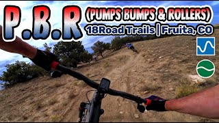
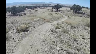
AKA: Pumps, Bumps and Rollers

Lots of little jumps, some doubles, and some tabletops. Banked and bermed turns. Downhill only. A good intermediate trail where everything can be rolled without issue.

Adaptive Bike Info
aMTB Blue Rating: Intermediate features and steeper terrain.

A couple narrow off-camber sections

Trail Supporters
Local Trail Association
Traditionally Indigenous Territory

Recent Activity on Trail

Past Week
  • 8 rides
  • 9 miles average
6 Months
  • 473 rides
  • 13 miles avg distance
All
  • 2,680 rides
  • Last: Jun 20, 2026
c1c2c3c4
January
February
March
April
May
June
July
August
September
October
November
December
Status:
on May 21, 2026
Dry
Avg: 4.22 (92 votes)
Your vote: 0

view (18,079)
close
3D
Trail Conditions
  • Unknown
  • Snow Groomed
  • Snow Packed
  • Snow Covered
  • Snow Cover Partial
  • Freeze/thaw Cycle
  • Icy
  • Prevalent Mud
  • Wet
  • Variable
  • Ideal
  • Dry
  • Very Dry
Trail Flow (Ridden Direction)
Trailforks scans users ridelogs to determine the most popular direction each trail is ridden. A good flowing trail network will have most trails flowing in a single direction according to their intension.
The colour categories are based on what percentage of riders are riding a trail in its intended direction.
  • > 96%
  • > 90%
  • > 80%
  • > 70%
  • > 50%
  • < 50%
  • bi-directional trail
  • no data
Trail Last Ridden
Trailforks scans ridelogs to determine the last time a trail was ridden.
  • < 2 days
  • < 1 week
  • < 2 weeks
  • < 1 month
  • < 6 months
  • > 6 months
Trail Ridden Direction
The intended direction a trail should be ridden.
  • Downhill Only
  • Downhill Primary
  • Both Directions
  • Uphill Primary
  • Uphill Only
  • One Direction
Contribute Details
Colors indicate trail is missing specified detail.
  • Description
  • Photos
  • Description & Photos
  • Videos
Trail Popularity ?
Trailforks scans ridelogs to determine which trails are ridden the most in the last 9 months. Trails are compared with nearby trails in the same city region with a possible 25 colour shades. Think of this as a heatmap, more rides = more kinetic energy = warmer colors.
  • most popular
  • popular
  • less popular
  • not popular
ATV/ORV/OHV Filter
Max Vehicle Width
inches
US Cell Coverage
Legend
cell carrier legend

Radar Time
Activity Recordings
Trailforks uses anonymized public activity data. ?
Activity Recordings
Trailforks uses anonymized public activity data. ?
Personal Heatmap
Activity Types
all / none
Options
2
Date range month
Winter Trails
Warning A routing network for winter maps does not exist. Selecting trails using the winter trails layer has been disabled.
Missing Trails
Most Popular
Least Popular
Trails are colored based on popularity. The more popular a trail is, the more red. Less popular trails trend towards green.
Jump Magnitude Heatmap
Heatmap of where riders jump on trails. Zoom in to see individual jumps, click circles to view jump details.
BC Backroad Status

Service Road Atlas is a free to use, community-driven service for viewing and creating reports on the numerous back-country service roads around B.C. and Alberta.

map legend
Slope Aspect
Direction the slope faces
Flat N NE E SE S SW W NW
Trails Deemphasized
Trails are shown in grey.
disable
Only show trails with no bike usage.
Enable
Suggested Layers
Based on selected activity type

    Save the current map location and zoom level as your default home location whenever this page is loaded.

    Save
        Directions to pbr-12264 trailhead (39.334220, -108.694650)

        Photos

        2 more »
        335 |
        Mar 24, 2015 @ 7:41pm
        Mar 24, 2015
        107 |
        Apr 3, 2025 @ 10:45am
        Apr 3, 2025

        Videos

        19 more »
        youtuber Pumps, Bumps, & Rollers (PBR) 2018...
        6:28 | 1352 | Apr 25, 2018 , Fruita
        youtuber Mountain Biking PBR, 18 Road, Fruita Colorado...
        9:04 | 1031 | Feb 1, 2018 , Fruita
        PBR Trail, Fruita CO | 18 Road Trail System
        4:09 | 91 | Oct 3, 2025 , Fruita
        Pumps, Bumps and Rollers (PBR) MTB trail at 18...
        8:59 | 56 | Jul 3, 2025 , Fruita

        Trail Lists

        Routes with this trail

        4.2 18 miles 2,188 ft 8 Loop
        This is the route you take if you want to hit all the great downhill runs with minimal effort up. Starts...
        5.0 19 miles 1,849 ft 11 Loop
        Mostly new but some older trails with emphasis on XC. One DH trail ends the loop.
        2.0 4 miles 483 ft 3
        This Route is intended for adaptive riders. Laps on require a climb up which requires assistance. There is...

        8 Reviews & Comments


        We hope you've been enjoying Trailforks!

        Create a FREE account to view trail comments and much more.

        • By toddTF Pro Trailforks & contributors
        • #12264 - 18,073 views

        Frequently Asked Questions About PBR

        Where is PBR located?
        PBR is located in 18 Road, Fruita, Colorado, United States. It is part of the 18 Road trail network. The trailhead is located at coordinates 39.33422, -108.69465.
        How hard is PBR?
        PBR is rated as Blue difficulty. The average grade is 4.4%.
        What is the elevation gain for PBR?
        PBR has 21 ft of elevation gain. The trail has 419 ft of elevation descent. The elevation ranges from 5,125 ft to 5,544 ft.
        Is PBR a point to point trail?
        Yes, PBR is a point to point trail. The direction is Downhill Only. The trail type is singletrack.

        Hit the Trail

        Open in App

        Get this trail on your phone instantly.
        open trail in app

        Download Trail

        Save to wishlist, Garmin & download.
        save the trail

        Find Related Routes

        Find routes and users activities that include this trail.
        find routes for this trail

        You must enter a description before submitting.