more stats
2.9 miles
Distance
478 ft
Climb
-958 ft
Descent
00:27:28
Avg time
-480 ft
Altitude change
3,550 ft
Altitude min
4,401 ft
Altitude max
4,030 ft
Altitude start
3,550 ft
Altitude end
-3.1%
Grade
-47%
Grade max
44.8%
Grade min
1 mile
Distance climb
2 miles
Distance down
902 ft
Distance flat
00:27:28
Avg time

Phillips Trail Details

  • Activities
    • Mountain Bike
    • Winter Fat Bike
    • Hike
    • Trail Running
  • Riding Area
    Crane Mountain Trails
    Bigfork, Montana
  • AKA
    #373
  • Difficulty Rating
  • Local Popularity
    90 in Mountain Biking [+]
    • 5 in Trail Running
    • 85 in Hiking
  • Global Ranking
    #73499 in Mountain Biking [+]
    • #242565 in Trail Running
    • #56412 in Hiking
  • Trail Type
    Singletrack
  • Bike Type
    DH, AM, XC, Fat
  • Direction
    Both Directions
    Popular In Reverse
  • Climb Difficulty
    Blue
  • Physical Rating
    Moderate
  • Season
    June to November
  • Dogs Allowed
    Yes
  • TTFs on Trail
    Drop

From Hwy 35 it's going to be a push for most of us up to one of the best views of Flathead Lake. That's a great out and back that way.
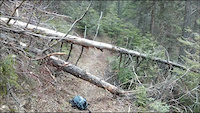
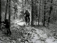
From The Crane Road the trail starts out as a steep climb but only for a short distance then the trail drops and climbs several times. Mauzie Creek is past half-way to the view point. From the view point you can ride down to Hwy 35 to your shuttle rig or ride back the way from which you came. Any way you ride this trail you're gonna like it.

Trail Supporters

  • USFS
    Land Manager
Local Trail Association
Traditionally Indigenous Territory

Recent Activity on Trail

Past Week
  • 0 rides
  •  
6 Months
  • 0 rides
  •  
All
  • 29 rides
  • Last: Jun 4, 2026
c1c2c3c4
January
February
March
April
May
June
July
August
September
October
November
December
update trails status or condition

Phillips Trail Trail Reports

statusdatedescription
Apr 12, 2026 @ 10:35am (America/Denver)
Apr 12, 2026
All clear front and back
Oct 5, 2025 @ 1:05pm (America/Creston)
Oct 5, 2025
2 trees down ( at same place) and 1 other tree down, but great riding otherwise
Aug 23, 2025 @ 2:39pm
Aug 23, 2025
Several big tress across the trail
Aug 15, 2025 @ 5:33pm
Aug 15, 2025
Two trees down. Otherwise riding great.
Apr 18, 2025 @ 6:12pm
Apr 18, 2025
Cleared the rest of trees (12ish) from Mauzey Cr to overlook. In great shape, a little drain work still needed to be completely done
more »
Status:
on Apr 12, 2026
Ideal
Avg: 4.07 (6 votes)
Your vote: 0

view (233)
close
3D
Trail Conditions
  • Unknown
  • Snow Groomed
  • Snow Packed
  • Snow Covered
  • Snow Cover Partial
  • Freeze/thaw Cycle
  • Icy
  • Prevalent Mud
  • Wet
  • Variable
  • Ideal
  • Dry
  • Very Dry
Trail Flow (Ridden Direction)
Trailforks scans users ridelogs to determine the most popular direction each trail is ridden. A good flowing trail network will have most trails flowing in a single direction according to their intension.
The colour categories are based on what percentage of riders are riding a trail in its intended direction.
  • > 96%
  • > 90%
  • > 80%
  • > 70%
  • > 50%
  • < 50%
  • bi-directional trail
  • no data
Trail Last Ridden
Trailforks scans ridelogs to determine the last time a trail was ridden.
  • < 2 days
  • < 1 week
  • < 2 weeks
  • < 1 month
  • < 6 months
  • > 6 months
Trail Ridden Direction
The intended direction a trail should be ridden.
  • Downhill Only
  • Downhill Primary
  • Both Directions
  • Uphill Primary
  • Uphill Only
  • One Direction
Contribute Details
Colors indicate trail is missing specified detail.
  • Description
  • Photos
  • Description & Photos
  • Videos
Trail Popularity ?
Trailforks scans ridelogs to determine which trails are ridden the most in the last 9 months. Trails are compared with nearby trails in the same city region with a possible 25 colour shades. Think of this as a heatmap, more rides = more kinetic energy = warmer colors.
  • most popular
  • popular
  • less popular
  • not popular
ATV/ORV/OHV Filter
Max Vehicle Width
inches
US Cell Coverage
Legend
cell carrier legend

Radar Time
Activity Recordings
Trailforks uses anonymized public activity data. ?
Activity Recordings
Trailforks uses anonymized public activity data. ?
Personal Heatmap
Activity Types
all / none
Options
2
Date range month
Winter Trails
Warning A routing network for winter maps does not exist. Selecting trails using the winter trails layer has been disabled.
Missing Trails
Most Popular
Least Popular
Trails are colored based on popularity. The more popular a trail is, the more red. Less popular trails trend towards green.
Jump Magnitude Heatmap
Heatmap of where riders jump on trails. Zoom in to see individual jumps, click circles to view jump details.
BC Backroad Status

Service Road Atlas is a free to use, community-driven service for viewing and creating reports on the numerous back-country service roads around B.C. and Alberta.

map legend
Slope Aspect
Direction the slope faces
Flat N NE E SE S SW W NW
Trails Deemphasized
Trails are shown in grey.
disable
Only show trails with no bike usage.
Enable
Suggested Layers
Based on selected activity type

    Save the current map location and zoom level as your default home location whenever this page is loaded.

    Save
        Directions to phillips-trail trailhead (47.990660, -114.006680)

        Photos

        35 more »
        92 |
        Oct 5, 2017 @ 5:50am
        Oct 5, 2017
        90 |
        Oct 5, 2017 @ 5:50am
        Oct 5, 2017
        80 |
        Oct 2, 2017 @ 5:48am
        Oct 2, 2017
        114 |
        Oct 2, 2017 @ 5:48am
        Oct 2, 2017

        Videos

        7 more »
        Mountain Biking Phillips Trail in Montana
        233 | Sep 3, 2022 , Bigfork
        Clearing Phillips Trail 2015
        3:15 | 105 | Apr 1, 2015 , Bigfork
        Spring Drops with Gabe
        0:04 | 228 | Mar 10, 2012 , Bigfork
        A Little March Madness
        2:11 | 189 | Mar 17, 2012 , Bigfork

        Routes with this trail

        12 miles 1,935 ft 4 Shuttled
        From the top, to the lake, back to the bottom.

        3 Reviews & Comments


        We hope you've been enjoying Trailforks!

        Create a FREE account to view trail comments and much more.

        • By b-man2uTF Pro & contributors
        • #20224 - 4,619 views

        Frequently Asked Questions About Phillips Trail

        Where is Phillips Trail located?
        Phillips Trail is located in Crane Mountain Trails, Bigfork, Montana, United States. It is part of the Crane Mountain Trails trail network. The trailhead is located at coordinates 47.99066, -114.00668.
        How hard is Phillips Trail?
        Phillips Trail is rated as Blue difficulty. The physical rating is Moderate. The average grade is 3.1%. The climb difficulty is rated Blue.
        What is the elevation gain for Phillips Trail?
        Phillips Trail has 478 ft of elevation gain. The trail has 958 ft of elevation descent. The elevation ranges from 3,550 ft to 4,401 ft.
        Is Phillips Trail a point to point trail?
        Phillips Trail is not a point to point trail. The direction is Both Directions. The trail type is singletrack.

        Hit the Trail

        Open in App

        Get this trail on your phone instantly.
        open trail in app

        Download Trail

        Save to wishlist, Garmin & download.
        save the trail

        Find Related Routes

        Find routes and users activities that include this trail.
        find routes for this trail

        You must enter a description before submitting.