more stats
3,248 ft
Distance
-316 ft
Descent
00:15:18
Avg time
-318 ft
Altitude change
4,181 ft
Altitude min
4,498 ft
Altitude max
4,498 ft
Altitude start
4,180 ft
Altitude end
-9.8%
Grade
-23.7%
Grade max
5.8%
Grade min
108 ft
Distance climb
2,881 ft
Distance down
259 ft
Distance flat
00:15:18
Avg time

Pilgrim (upper) Details

  • Activities
    • Mountain Bike
    • E-Bike
  • Riding Area
    Red Mountain Resort Bike Park
    Rossland, British Columbia
  • Difficulty Rating
  • Local Popularity
    70 in Mountain Biking [+]
    • 50 in E-Biking
  • Global Ranking
    #47882 in Mountain Biking [+]
    • #1540 in E-Biking
  • Trail Type
    Singletrack
  • Bike Type
    DH, AM, XC
  • Direction
    Downhill Only[+]
    Popular Direction Shown
    • Downhill Only for E-Biking
  • Climb Difficulty
    Blue
  • Physical Rating
    Easy
  • Trail Visibility
    Always easy to follow
  • Season
    June- Sept
  • Family Friendly
    Yes
  • eBike Allowed
    Yes up to Class 1
  • TTFs on Trail
    Berm, Bridge
  • Ride in Rain
    Yes
  • Year Opened
    2020
  • Land Owner

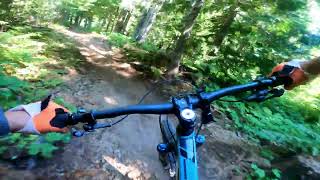
Machine built Technical and flowy mix. Its been revamped with Berms. Generally holding the original line, halfway down it joins into Columbia Ave for a few hundred meters A short up hill on Lower Corkys Rd leads you to Pilgrim again near the Resort water storage Tank. Close to the base it rejoins with Columbia Avenue

Access Info

Grab a Bike Park pass and head up to the Top of Silverload Head North Slightly and down off the road into Pilgrim

Bike Park

Recent Activity on Trail

Past Week
  • 0 rides
  •  
6 Months
  • 0 rides
  •  
All
  • 952 rides
  • Last: Jun 14, 2026
c1c2c3c4
January
February
March
April
May
June
July
August
September
October
November
December
update trails status or condition

Pilgrim (upper) Trail Reports

statusdatedescription
May 26, 2026 @ 1:57pm (America/Vancouver)
May 26, 2026
reporter While we work on getting the Bike Park ready we appreciate your respecting the trails are closed for access. We have machinery and vehicles...
Aug 29, 2025 @ 11:16am
Aug 29, 2025
Jun 21, 2025 @ 6:54am
Jun 21, 2025
reporter
Jun 13, 2025 @ 9:00am
Jun 13, 2025
reporter
Oct 11, 2024 @ 7:04am
Oct 11, 2024
reporter Trails in the Silverlode area at RED Mountain are no longer being managed by the KCTS, as they are being incorporated into RED's lift serviced...
more »
Status:
on May 26, 2026
Dry
Avg: 4.18 (11 votes)
Your vote: 0

view (6,443)
close
3D
Trail Conditions
  • Unknown
  • Snow Groomed
  • Snow Packed
  • Snow Covered
  • Snow Cover Partial
  • Freeze/thaw Cycle
  • Icy
  • Prevalent Mud
  • Wet
  • Variable
  • Ideal
  • Dry
  • Very Dry
Trail Flow (Ridden Direction)
Trailforks scans users ridelogs to determine the most popular direction each trail is ridden. A good flowing trail network will have most trails flowing in a single direction according to their intension.
The colour categories are based on what percentage of riders are riding a trail in its intended direction.
  • > 96%
  • > 90%
  • > 80%
  • > 70%
  • > 50%
  • < 50%
  • bi-directional trail
  • no data
Trail Last Ridden
Trailforks scans ridelogs to determine the last time a trail was ridden.
  • < 2 days
  • < 1 week
  • < 2 weeks
  • < 1 month
  • < 6 months
  • > 6 months
Trail Ridden Direction
The intended direction a trail should be ridden.
  • Downhill Only
  • Downhill Primary
  • Both Directions
  • Uphill Primary
  • Uphill Only
  • One Direction
Contribute Details
Colors indicate trail is missing specified detail.
  • Description
  • Photos
  • Description & Photos
  • Videos
Trail Popularity ?
Trailforks scans ridelogs to determine which trails are ridden the most in the last 9 months. Trails are compared with nearby trails in the same city region with a possible 25 colour shades. Think of this as a heatmap, more rides = more kinetic energy = warmer colors.
  • most popular
  • popular
  • less popular
  • not popular
ATV/ORV/OHV Filter
Max Vehicle Width
inches
US Cell Coverage
Legend
cell carrier legend

Radar Time
Activity Recordings
Trailforks uses anonymized public activity data. ?
Activity Recordings
Trailforks uses anonymized public activity data. ?
Personal Heatmap
Activity Types
all / none
Options
2
Date range month
Winter Trails
Warning A routing network for winter maps does not exist. Selecting trails using the winter trails layer has been disabled.
Missing Trails
Most Popular
Least Popular
Trails are colored based on popularity. The more popular a trail is, the more red. Less popular trails trend towards green.
Jump Magnitude Heatmap
Heatmap of where riders jump on trails. Zoom in to see individual jumps, click circles to view jump details.
BC Backroad Status

Service Road Atlas is a free to use, community-driven service for viewing and creating reports on the numerous back-country service roads around B.C. and Alberta.

map legend
Slope Aspect
Direction the slope faces
Flat N NE E SE S SW W NW
Trails Deemphasized
Trails are shown in grey.
disable
Only show trails with no bike usage.
Enable
Suggested Layers
Based on selected activity type

    Save the current map location and zoom level as your default home location whenever this page is loaded.

    Save
        Directions to pilgrim-upper trailhead (49.107450, -117.834720)

        Photos

        5 more »
        70 |
        Sep 2, 2023 @ 5:09pm
        Sep 2, 2023
        81 |
        Oct 7, 2022 @ 6:24am
        Oct 7, 2022
        68 |
        Jul 24, 2021 @ 9:25pm
        Jul 24, 2021
        40 |
        Aug 29, 2024 @ 5:37pm
        Aug 29, 2024

        Videos

        4 more »
        How Good Is The New Red Mountain Bike Park?
        10:13 | 69 | Sep 23, 2025 , Rossland
        Riding every trail at the Red Mountain Bike Park
        27:34 | 36 | Sep 10, 2025 , Rossland
        Red Mtn Bike Park - Pilgrim (upper & lower)
        3:34 | 50 | Aug 25, 2025 , Rossland
        brunch encounter
        0:26 | 72 | Jul 4, 2022 , Rossland

        Routes with this trail

        6 miles 1,414 ft 6 Loop
        Start from Red Mountain parking lot, using Red bike trails network and finishing at bottom of .
        3.0 63 miles 14,086 ft 43 Loop
        Big loop comprising of most of the iconic trails in the Rossland area.
        6 miles 1,414 ft 6 Point to Point Race
        1st Edition of the Cascade Cup presented by the Muddbunnies Rossland Registration start Friday June 17th...

        1 Review & Comments


        We hope you've been enjoying Trailforks!

        Create a FREE account to view trail comments and much more.

        • By barry-mclane & contributors
        • #309126 - 1,828 views

        Frequently Asked Questions About Pilgrim (upper)

        Where is Pilgrim (upper) located?
        Pilgrim (upper) is located in Red Mountain Resort Bike Park, Rossland, British Columbia, Canada. It is part of the Red Mountain Resort Bike Park trail network. The trailhead is located at coordinates 49.10745, -117.83472.
        How hard is Pilgrim (upper)?
        Pilgrim (upper) is rated as Blue difficulty. The physical rating is Easy. The average grade is 9.8%. The climb difficulty is rated Blue.
        What is the elevation gain for Pilgrim (upper)?
        The trail has 96 m of elevation descent. The elevation ranges from 1,274 m to 1,371 m.
        Is Pilgrim (upper) a point to point trail?
        Yes, Pilgrim (upper) is a point to point trail. The direction is Downhill Only. The trail type is singletrack.

        Hit the Trail

        Open in App

        Get this trail on your phone instantly.
        open trail in app

        Download Trail

        Save to wishlist, Garmin & download.
        save the trail

        Find Related Routes

        Find routes and users activities that include this trail.
        find routes for this trail

        You must enter a description before submitting.