more stats
2,123 ft
Distance
-378 ft
Descent
00:08:06
Avg time
-380 ft
Altitude change
1,133 ft
Altitude min
1,513 ft
Altitude max
1,513 ft
Altitude start
1,132 ft
Altitude end
-17.9%
Grade
-37.6%
Grade max
-2%
Grade min
1,972 ft
Distance down
131 ft
Distance flat
00:08:06
Avg time

Randy's Details

  • Activities
    • Mountain Bike
    • E-Bike
    • Winter Fat Bike
    • Hike
  • Riding Area
    Eagle Mountain
    Coquitlam, British Columbia
  • Difficulty Rating
  • Voted Difficulty
    Black Diamond (1 vote)
  • Local Popularity
    85 in Mountain Biking [+]
    • 75 in E-Biking
    • 90 in Hiking
  • Global Ranking
    #31720 in Mountain Biking [+]
    • #32573 in E-Biking
    • #2892 in Hiking
  • Trail Type
    Singletrack
  • Bike Type
    DH, AM, Fat
  • Dogs Allowed
    Yes
  • eBike Allowed
    Yes up to Class 1
  • TTFs on Trail
    Berm, Bridge, Drop, Jump, Gap Jump, Ladder Bridge, Log Ride, Rock Face, Rock Garden

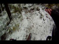
Starts at the cell tower. Rocky and rooty with some 3-5 foot drops and gaps in the mix. Lots of fun

Trail Supporters
Local Trail Association

Recent Activity on Trail

Past Week
  • 3 rides
  • 6 miles average
6 Months
  • 91 rides
  • 7 miles avg distance
All
  • 616 rides
  • Last: Jun 18, 2026
c1c2c3c4
January
February
March
April
May
June
July
August
September
October
November
December
update trails status or condition

Randy's Trail Reports

statusdatedescription
Mar 28, 2026 @ 12:36pm (America/Vancouver)
Mar 28, 2026
reporter
Jan 11, 2026 @ 1:45pm (America/Vancouver)
Jan 11, 2026
reporter
Dec 27, 2025 @ 12:00pm (America/Vancouver)
Dec 27, 2025
reporter
Dec 10, 2025 @ 6:21pm (America/Vancouver)
Dec 10, 2025
reporter Gap jump at the top (before Juan) is falling apart
Dec 8, 2025 @ 12:37pm (America/Vancouver)
Dec 8, 2025
reporter At the request of the City of Port Moody, the left hand line and creek crossing near the end of the trail have been closed, and the right hand...
more »
Status:
on Mar 28, 2026
Variable
Avg: 4.35 (28 votes)
Your vote: 0

view (3,048)
close
3D
Trail Conditions
  • Unknown
  • Snow Groomed
  • Snow Packed
  • Snow Covered
  • Snow Cover Partial
  • Freeze/thaw Cycle
  • Icy
  • Prevalent Mud
  • Wet
  • Variable
  • Ideal
  • Dry
  • Very Dry
Trail Flow (Ridden Direction)
Trailforks scans users ridelogs to determine the most popular direction each trail is ridden. A good flowing trail network will have most trails flowing in a single direction according to their intension.
The colour categories are based on what percentage of riders are riding a trail in its intended direction.
  • > 96%
  • > 90%
  • > 80%
  • > 70%
  • > 50%
  • < 50%
  • bi-directional trail
  • no data
Trail Last Ridden
Trailforks scans ridelogs to determine the last time a trail was ridden.
  • < 2 days
  • < 1 week
  • < 2 weeks
  • < 1 month
  • < 6 months
  • > 6 months
Trail Ridden Direction
The intended direction a trail should be ridden.
  • Downhill Only
  • Downhill Primary
  • Both Directions
  • Uphill Primary
  • Uphill Only
  • One Direction
Contribute Details
Colors indicate trail is missing specified detail.
  • Description
  • Photos
  • Description & Photos
  • Videos
Trail Popularity ?
Trailforks scans ridelogs to determine which trails are ridden the most in the last 9 months. Trails are compared with nearby trails in the same city region with a possible 25 colour shades. Think of this as a heatmap, more rides = more kinetic energy = warmer colors.
  • most popular
  • popular
  • less popular
  • not popular
ATV/ORV/OHV Filter
Max Vehicle Width
inches
US Cell Coverage
Legend
cell carrier legend

Radar Time
Activity Recordings
Trailforks uses anonymized public activity data. ?
Activity Recordings
Trailforks uses anonymized public activity data. ?
Personal Heatmap
Activity Types
all / none
Options
2
Date range month
Winter Trails
Warning A routing network for winter maps does not exist. Selecting trails using the winter trails layer has been disabled.
Missing Trails
Most Popular
Least Popular
Trails are colored based on popularity. The more popular a trail is, the more red. Less popular trails trend towards green.
Jump Magnitude Heatmap
Heatmap of where riders jump on trails. Zoom in to see individual jumps, click circles to view jump details.
BC Backroad Status

Service Road Atlas is a free to use, community-driven service for viewing and creating reports on the numerous back-country service roads around B.C. and Alberta.

map legend
Slope Aspect
Direction the slope faces
Flat N NE E SE S SW W NW
Trails Deemphasized
Trails are shown in grey.
disable
Only show trails with no bike usage.
Enable
Suggested Layers
Based on selected activity type

    Save the current map location and zoom level as your default home location whenever this page is loaded.

    Save
        Directions to randy-s trailhead (49.312240, -122.830100)

        Photos

        191 more »
        596 |
        Aug 7, 2016 @ 12:07am
        Aug 7, 2016
        75 |
        Aug 22, 2024 @ 11:39pm
        Aug 22, 2024
        50 |
        Aug 22, 2024 @ 11:39pm
        Aug 22, 2024
        42 |
        Aug 22, 2024 @ 11:39pm
        Aug 22, 2024

        Videos

        15 more »
        youtuber Randy's | Eagle Mountain, Port Moody, BC | MTB
        3:14 | 1990 | Mar 22, 2020 , Coquitlam
        Randy's - Eagle Mtn
        6:01 | 273 | Oct 4, 2023 , Coquitlam
        Randys - Hypersmooth GoPro7, but old guy...
        4:15 | 479 | Aug 25, 2019 , Coquitlam
        Randy's in the snow
        2:54 | 634 | Mar 27, 2012 , Coquitlam

        Trail Lists

        Routes with this trail

        1.0 4 miles 927 ft 7
        Add a little extra to your ride by continuing up Psychotherapy to More Therapy before connecting with...
        2.5 6 miles 1,867 ft 9 Loop
        Lap of Full Pull, with a few good other bits!
        1 mile 771 ft 6
        Exercise is medicine hike

        8 Reviews & Comments


        We hope you've been enjoying Trailforks!

        Create a FREE account to view trail comments and much more.

        • By canadakaTF Pro Trailforks & contributors
        • #823 - 8,160 views

        Frequently Asked Questions About Randy's

        Where is Randy's located?
        Randy's is located in Eagle Mountain, Coquitlam, British Columbia, Canada. It is part of the Eagle Mountain trail network. The trailhead is located at coordinates 49.31224, -122.8301.
        How hard is Randy's?
        Randy's is rated as Black Diamond difficulty. The average grade is 17.9%.
        What is the elevation gain for Randy's?
        The trail has 115 m of elevation descent. The elevation ranges from 345 m to 461 m.
        How long is Randy's?
        Randy's is 647.0 m long. The trail type is singletrack.

        Hit the Trail

        Open in App

        Get this trail on your phone instantly.
        open trail in app

        Download Trail

        Save to wishlist, Garmin & download.
        save the trail

        Find Related Routes

        Find routes and users activities that include this trail.
        find routes for this trail

        You must enter a description before submitting.