more stats
5.3 miles
Distance
570 ft
Climb
-586 ft
Descent
00:40:58
Avg time
-15 ft
Altitude change
526 ft
Altitude min
734 ft
Altitude max
728 ft
Altitude start
712 ft
Altitude end
-0.1%
Grade
-21.6%
Grade max
39.5%
Grade min
2 miles
Distance climb
2 miles
Distance down
2 miles
Distance flat
00:40:58
Avg time

Ranger Details

  • Activities
    • Mountain Bike
    • E-Bike
    • Hike
    • Trail Running
  • Riding Area
  • Difficulty Rating
  • Local Popularity
    60 in Mountain Biking [+]
    • 65 in E-Biking
    • 60 in Trail Running
    • 5 in Hiking
  • Global Ranking
    #8783 in Mountain Biking [+]
    • #38680 in E-Biking
    • #57461 in Trail Running
  • Blaze Color
  • Trail Type
    Singletrack
  • Bike Type
    XC
  • Direction
    One Direction
  • Climb Difficulty
    Green
  • Physical Rating
    Moderate
  • Season
    Year round
  • Dogs Allowed
    Yes
  • eBike Allowed
    Yes up to Class 1
  • TTFs on Trail
    Bridge

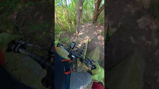
The main loop at Big Cedar...everything else spurs off of this. It includes one of the few sustained descents in the Dallas / Fort Worth metroplex.

Local Trail Association
Traditionally Indigenous Territory

Recent Activity on Trail

Past Week
  • 0 rides
  •  
6 Months
  • 12 rides
  • 12 miles avg distance
All
  • 204 rides
  • Last: May 15, 2026
c1c2c3c4
January
February
March
April
May
June
July
August
September
October
November
December
Status:
on Jun 14, 2026
Avg: 4.11 (11 votes)
Your vote: 0

view (1,196)
close
3D
Trail Conditions
  • Unknown
  • Snow Groomed
  • Snow Packed
  • Snow Covered
  • Snow Cover Partial
  • Freeze/thaw Cycle
  • Icy
  • Prevalent Mud
  • Wet
  • Variable
  • Ideal
  • Dry
  • Very Dry
Trail Flow (Ridden Direction)
Trailforks scans users ridelogs to determine the most popular direction each trail is ridden. A good flowing trail network will have most trails flowing in a single direction according to their intension.
The colour categories are based on what percentage of riders are riding a trail in its intended direction.
  • > 96%
  • > 90%
  • > 80%
  • > 70%
  • > 50%
  • < 50%
  • bi-directional trail
  • no data
Trail Last Ridden
Trailforks scans ridelogs to determine the last time a trail was ridden.
  • < 2 days
  • < 1 week
  • < 2 weeks
  • < 1 month
  • < 6 months
  • > 6 months
Trail Ridden Direction
The intended direction a trail should be ridden.
  • Downhill Only
  • Downhill Primary
  • Both Directions
  • Uphill Primary
  • Uphill Only
  • One Direction
Contribute Details
Colors indicate trail is missing specified detail.
  • Description
  • Photos
  • Description & Photos
  • Videos
Trail Popularity ?
Trailforks scans ridelogs to determine which trails are ridden the most in the last 9 months. Trails are compared with nearby trails in the same city region with a possible 25 colour shades. Think of this as a heatmap, more rides = more kinetic energy = warmer colors.
  • most popular
  • popular
  • less popular
  • not popular
ATV/ORV/OHV Filter
Max Vehicle Width
inches
US Cell Coverage
Legend
cell carrier legend

Radar Time
Activity Recordings
Trailforks uses anonymized public activity data. ?
Activity Recordings
Trailforks uses anonymized public activity data. ?
Personal Heatmap
Activity Types
all / none
Options
2
Date range month
Winter Trails
Warning A routing network for winter maps does not exist. Selecting trails using the winter trails layer has been disabled.
Missing Trails
Most Popular
Least Popular
Trails are colored based on popularity. The more popular a trail is, the more red. Less popular trails trend towards green.
Jump Magnitude Heatmap
Heatmap of where riders jump on trails. Zoom in to see individual jumps, click circles to view jump details.
BC Backroad Status

Service Road Atlas is a free to use, community-driven service for viewing and creating reports on the numerous back-country service roads around B.C. and Alberta.

map legend
Slope Aspect
Direction the slope faces
Flat N NE E SE S SW W NW
Trails Deemphasized
Trails are shown in grey.
disable
Only show trails with no bike usage.
Enable
Suggested Layers
Based on selected activity type

    Save the current map location and zoom level as your default home location whenever this page is loaded.

    Save
        Directions to ranger-4645 trailhead (32.647770, -96.957530)

        Photos

        23 more »
        120 |
        Oct 18, 2025 @ 11:14am
        Oct 18, 2025
        604 |
        Aug 29, 2020 @ 11:55am
        Aug 29, 2020
        559 |
        Jul 12, 2020 @ 12:54pm
        Jul 12, 2020
        630 |
        Jul 12, 2020 @ 12:54pm
        Jul 12, 2020

        Videos

        2 more »
        Challenge on Trail
        2:07 | 43 | May 10, 2026 , Dallas
        Riding Big Cedar | Ranger, Man Bites Dog, I Can
        13:01 | 263 | Oct 4, 2023 , Dallas

        Routes with this trail

        5.0 14 miles 1,331 ft 24 Loop
        Tried to connect the best route of most of Big Cedar including blacks, but not double blacks. trail...
        5 miles 277 ft 5 Loop Race
        This is the main race loop for the 2022 TMBRA race at Big Cedar hosted by DORBA and the Mountain Creek...
        5 miles 278 ft 5 Loop Race
        This is the main race loop for the 2022 TMBRA race at Big Cedar hosted by DORBA and the Mountain Creek...

        3 Reviews & Comments


        We hope you've been enjoying Trailforks!

        Create a FREE account to view trail comments and much more.

        Frequently Asked Questions About Ranger

        Where is Ranger located?
        Ranger is located in Big Cedar Wilderness Trails, Dallas, Texas, United States. It is part of the Big Cedar Wilderness Trails trail network. The trailhead is located at coordinates 32.64777, -96.95753.
        How hard is Ranger?
        Ranger is rated as Blue difficulty. The physical rating is Moderate. The average grade is 0.1%. The climb difficulty is rated Green.
        What is the elevation gain for Ranger?
        Ranger has 570 ft of elevation gain. The trail has 586 ft of elevation descent. The elevation ranges from 526 ft to 734 ft.
        Is Ranger a point to point trail?
        Yes, Ranger is a point to point trail. The direction is One Direction. The trail type is singletrack.

        Hit the Trail

        Open in App

        Get this trail on your phone instantly.
        open trail in app

        Download Trail

        Save to wishlist, Garmin & download.
        save the trail

        Find Related Routes

        Find routes and users activities that include this trail.
        find routes for this trail

        You must enter a description before submitting.