more stats
4,610 ft
Distance
83 ft
Climb
-396 ft
Descent
00:14:30
Avg time
-313 ft
Altitude change
1,507 ft
Altitude min
1,820 ft
Altitude max
1,820 ft
Altitude start
1,506 ft
Altitude end
-6.8%
Grade
-39.6%
Grade max
19.9%
Grade min
1,155 ft
Distance climb
2,884 ft
Distance down
541 ft
Distance flat
00:14:30
Avg time

Recycle Details

  • Activities
    • Mountain Bike
    • E-Bike
  • Riding Area
    Diamond Head
    Squamish, British Columbia
  • Difficulty Rating
  • Local Popularity
    75 in Mountain Biking [+]
    • 75 in E-Biking
  • Global Ranking
    #60996 in Mountain Biking [+]
    • #32220 in E-Biking
  • Trail Type
    Singletrack
  • Bike Type
    AM, XC
  • Direction
    Downhill Primary
    Popular Direction Shown
  • Physical Rating
    Moderate
  • Dogs Allowed
    Yes
  • eBike Allowed
    Yes up to Class 1
  • TTFs on Trail
    Bridge

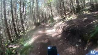
XC trail with lots of ups, downs, twists and turns. Nothing too technical but lots of roots and some short bits of wood work. There's a nice stop at a bench to sit and have a view before finishing up by the shelter.

Access Info

Start of trail marked to the right, just after the start of Half Nelson

Local Trail Association
Traditionally Indigenous Territory

Recent Activity on Trail

Past Week
  • 3 rides
  • 9 miles average
6 Months
  • 55 rides
  • 12 miles avg distance
All
  • 620 rides
  • Last: Jun 24, 2026
c1c2c3c4
January
February
March
April
May
June
July
August
September
October
November
December
update trails status or condition

Recycle Trail Reports

statusdatedescription
Jun 16, 2026 @ 1:18pm (America/Vancouver)
Jun 16, 2026
Tree is near the end of the trail
Jun 4, 2026 @ 10:21am (America/Vancouver)
Jun 4, 2026
there is a ride around for the fallen tree. Ferns are closing in on the trail towards the bottom.
Jun 1, 2026 @ 2:32pm (America/Vancouver)
Jun 1, 2026
LARGE tree down just past the bench/viewpoint. I think you need one of those old timey two person saws or a reroute. 🫠
May 16, 2026 @ 4:35pm (America/Vancouver)
May 16, 2026
roots are a bit slick on the first half, until just after the bench lookout
Dec 13, 2025 @ 4:34pm (America/Vancouver)
Dec 13, 2025
Significant sized tree down right before the Antithesis intersection. Can walk under it, but will require some handy chainsaw work to clear.
more »
Status:
on Jun 16, 2026
Avg: 3.07 (35 votes)
Your vote: 0

view (3,720)
close
3D
Trail Conditions
  • Unknown
  • Snow Groomed
  • Snow Packed
  • Snow Covered
  • Snow Cover Partial
  • Freeze/thaw Cycle
  • Icy
  • Prevalent Mud
  • Wet
  • Variable
  • Ideal
  • Dry
  • Very Dry
Trail Flow (Ridden Direction)
Trailforks scans users ridelogs to determine the most popular direction each trail is ridden. A good flowing trail network will have most trails flowing in a single direction according to their intension.
The colour categories are based on what percentage of riders are riding a trail in its intended direction.
  • > 96%
  • > 90%
  • > 80%
  • > 70%
  • > 50%
  • < 50%
  • bi-directional trail
  • no data
Trail Last Ridden
Trailforks scans ridelogs to determine the last time a trail was ridden.
  • < 2 days
  • < 1 week
  • < 2 weeks
  • < 1 month
  • < 6 months
  • > 6 months
Trail Ridden Direction
The intended direction a trail should be ridden.
  • Downhill Only
  • Downhill Primary
  • Both Directions
  • Uphill Primary
  • Uphill Only
  • One Direction
Contribute Details
Colors indicate trail is missing specified detail.
  • Description
  • Photos
  • Description & Photos
  • Videos
Trail Popularity ?
Trailforks scans ridelogs to determine which trails are ridden the most in the last 9 months. Trails are compared with nearby trails in the same city region with a possible 25 colour shades. Think of this as a heatmap, more rides = more kinetic energy = warmer colors.
  • most popular
  • popular
  • less popular
  • not popular
ATV/ORV/OHV Filter
Max Vehicle Width
inches
US Cell Coverage
Legend
cell carrier legend

Radar Time
Activity Recordings
Trailforks uses anonymized public activity data. ?
Activity Recordings
Trailforks uses anonymized public activity data. ?
Personal Heatmap
Activity Types
all / none
Options
2
Date range month
Winter Trails
Warning A routing network for winter maps does not exist. Selecting trails using the winter trails layer has been disabled.
Missing Trails
Most Popular
Least Popular
Trails are colored based on popularity. The more popular a trail is, the more red. Less popular trails trend towards green.
Jump Magnitude Heatmap
Heatmap of where riders jump on trails. Zoom in to see individual jumps, click circles to view jump details.
BC Backroad Status

Service Road Atlas is a free to use, community-driven service for viewing and creating reports on the numerous back-country service roads around B.C. and Alberta.

map legend
Slope Aspect
Direction the slope faces
Flat N NE E SE S SW W NW
Trails Deemphasized
Trails are shown in grey.
disable
Only show trails with no bike usage.
Enable
Suggested Layers
Based on selected activity type

    Save the current map location and zoom level as your default home location whenever this page is loaded.

    Save
        Directions to recycle trailhead (49.744390, -123.067050)

        Photos

        37 more »
        228 |
        Aug 25, 2017 @ 11:47am
        Aug 25, 2017
        919 |
        Dec 5, 2013 @ 8:35pm
        Dec 5, 2013
        123 |
        Oct 3, 2022 @ 7:53pm
        Oct 3, 2022
        234 |
        Mar 31, 2021 @ 9:56am
        Mar 31, 2021

        Videos

        5 more »
        youtuber Recycle - Squamish, BC, Canada  [Ep#67]
        7:30 | 1660 | Dec 29, 2018 , Squamish
        Squamish Ride With Oscar (Climb Trail &...
        2:41 | 449 | Apr 17, 2022 , Squamish
        youtuber Going green: Recycle || Squamish, BC |...
        8:54 | 1055 | May 24, 2019 , Squamish
        Shameless Self Promotion on Recycle
        0:07 | 945 | Apr 20, 2015 , Squamish

        Routes with this trail

        6 miles 1,399 ft 6
        Legacy Climb Trail - Stl'lhalem Sintl'
        7 miles 1,849 ft 11
        Chill option for people who like Blue trails. Spring Tune up 2024
        20 miles 4,832 ft 12
        gezeichnete Test Strecke für Ferien 2026

        7 Reviews & Comments


        We hope you've been enjoying Trailforks!

        Create a FREE account to view trail comments and much more.

        • By canadakaTF Pro Trailforks & contributors
        • #5075 - 11,376 views

        Frequently Asked Questions About Recycle

        Where is Recycle located?
        Recycle is located in Diamond Head, Squamish, British Columbia, Canada. It is part of the Diamond Head trail network. The trailhead is located at coordinates 49.74439, -123.06705.
        How hard is Recycle?
        Recycle is rated as Blue difficulty. The physical rating is Moderate. The average grade is 6.8%.
        What is the elevation gain for Recycle?
        Recycle has 83 ft of elevation gain. The trail has 396 ft of elevation descent. The elevation ranges from 1,507 ft to 1,820 ft.
        Is Recycle a point to point trail?
        Recycle is not a point to point trail. The direction is Downhill Primary. The trail type is singletrack.

        Hit the Trail

        Open in App

        Get this trail on your phone instantly.
        open trail in app

        Download Trail

        Save to wishlist, Garmin & download.
        save the trail

        Find Related Routes

        Find routes and users activities that include this trail.
        find routes for this trail

        You must enter a description before submitting.