more stats
1.5 miles
Distance
-1,156 ft
Descent
00:16:01
Avg time
-1,156 ft
Altitude change
3,882 ft
Altitude min
5,038 ft
Altitude max
5,038 ft
Altitude start
3,881 ft
Altitude end
-15.1%
Grade
-67.8%
Grade max
-0.3%
Grade min
1 mile
Distance down
184 ft
Distance flat
00:16:01
Avg time

Redhead Details

  • Activities
    • Mountain Bike
    • E-Bike
  • Riding Area
    Red Mountain Community Trails
    Rossland, British Columbia
  • Difficulty Rating
  • Local Popularity
    80 in Mountain Biking [+]
    • 60 in E-Biking
  • Global Ranking
    #103741 in Mountain Biking [+]
    • #90763 in E-Biking
  • Trail Type
    Singletrack
  • Bike Type
    AM
  • Direction
    Downhill Only[+]
    Popular Direction Shown
    • Downhill Only for E-Biking
  • Climb Difficulty
    Blue
  • Physical Rating
    Hard
  • Trail Visibility
    Always easy to follow
  • Dogs Allowed
    Yes
  • eBike Allowed
  • TTFs on Trail
    Berm, Bridge, Drop, Jump, Rock Face, Rock Garden, Roller Coaster

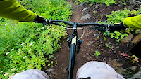
Redhead starts at Poochies cabin and is a local's favorite descent all the way to the bottom of Red Mountain. The trail can be thought of in three sections. Upper Redhead features beautiful views and exposed, technical switchbacks along with some rocky sections which are sure to keep your heart pumping after your Redtop ascent. Middle Redhead is a smooth pumpy rollercoaster winding down through the lower area of 'Poochies trees.' Lower Redhead gets a little steeper and rockier as you drop into the trees. Expect old school roots and rocks peppering a steeper descent. Lower Redhead is a steeper, gnarlier alternative to descending lower Redtop. This trail is for downhill traffic only and is NOT recommended for hiking.

Access Info

From Red Resort, ride up Redtop Lower and Redtop Upper to access the trailhead which is just past Poochies Cabin.

From Rossland, ride up Larry's to Miners to Redtop Upper to access and can add Blue Elephant at the end of the ride to make a loop

Recent Activity on Trail

Past Week
  • 5 rides
  • 13.3 km average
6 Months
  • 21 rides
  • 12.7 km avg distance
All
  • 291 rides
  • Last: Jun 25, 2026
c1c2c3c4
January
February
March
April
May
June
July
August
September
October
November
December
update trails status or condition

Redhead Trail Reports

statusdatedescription
May 31, 2026 @ 4:43pm (America/Vancouver)
May 31, 2026
Cleared the one large tree blocking the trail
May 29, 2026 @ 11:40am (America/Vancouver)
May 29, 2026
Large tree down on upper redhead blocking trail. Maybe 200m or so before the intersection with middle redhead.
May 9, 2026 @ 5:48am (America/Vancouver)
May 9, 2026
reporter The KCTS trail crew completed seasonal inspection and maintenance.
May 6, 2026 @ 6:07pm (America/Vancouver)
May 6, 2026
Great conditions on Lower
May 5, 2026 @ 11:45am (America/Vancouver)
May 5, 2026
reporter Windthrown trees blocking the bottom of the trail have been cleared.
more »
Status:
on May 31, 2026
Avg: 4.15 (20 votes)
Your vote: 0

view (2,089)
close
3D
Trail Conditions
  • Unknown
  • Snow Groomed
  • Snow Packed
  • Snow Covered
  • Snow Cover Partial
  • Freeze/thaw Cycle
  • Icy
  • Prevalent Mud
  • Wet
  • Variable
  • Ideal
  • Dry
  • Very Dry
Trail Flow (Ridden Direction)
Trailforks scans users ridelogs to determine the most popular direction each trail is ridden. A good flowing trail network will have most trails flowing in a single direction according to their intension.
The colour categories are based on what percentage of riders are riding a trail in its intended direction.
  • > 96%
  • > 90%
  • > 80%
  • > 70%
  • > 50%
  • < 50%
  • bi-directional trail
  • no data
Trail Last Ridden
Trailforks scans ridelogs to determine the last time a trail was ridden.
  • < 2 days
  • < 1 week
  • < 2 weeks
  • < 1 month
  • < 6 months
  • > 6 months
Trail Ridden Direction
The intended direction a trail should be ridden.
  • Downhill Only
  • Downhill Primary
  • Both Directions
  • Uphill Primary
  • Uphill Only
  • One Direction
Contribute Details
Colors indicate trail is missing specified detail.
  • Description
  • Photos
  • Description & Photos
  • Videos
Trail Popularity ?
Trailforks scans ridelogs to determine which trails are ridden the most in the last 9 months. Trails are compared with nearby trails in the same city region with a possible 25 colour shades. Think of this as a heatmap, more rides = more kinetic energy = warmer colors.
  • most popular
  • popular
  • less popular
  • not popular
ATV/ORV/OHV Filter
Max Vehicle Width
inches
US Cell Coverage
Legend
cell carrier legend

Radar Time
Activity Recordings
Trailforks uses anonymized public activity data. ?
Activity Recordings
Trailforks uses anonymized public activity data. ?
Personal Heatmap
Activity Types
all / none
Options
2
Date range month
Winter Trails
Warning A routing network for winter maps does not exist. Selecting trails using the winter trails layer has been disabled.
Missing Trails
Most Popular
Least Popular
Trails are colored based on popularity. The more popular a trail is, the more red. Less popular trails trend towards green.
Jump Magnitude Heatmap
Heatmap of where riders jump on trails. Zoom in to see individual jumps, click circles to view jump details.
BC Backroad Status

Service Road Atlas is a free to use, community-driven service for viewing and creating reports on the numerous back-country service roads around B.C. and Alberta.

map legend
Slope Aspect
Direction the slope faces
Flat N NE E SE S SW W NW
Trails Deemphasized
Trails are shown in grey.
disable
Only show trails with no bike usage.
Enable
Suggested Layers
Based on selected activity type

    Save the current map location and zoom level as your default home location whenever this page is loaded.

    Save
        Directions to redhead trailhead (49.091680, -117.819090)

        Photos

        19 more »
        88 |
        Sep 25, 2024 @ 1:33pm
        Sep 25, 2024
        86 |
        Sep 25, 2024 @ 1:33pm
        Sep 25, 2024
        89 |
        Sep 25, 2024 @ 1:33pm
        Sep 25, 2024
        75 |
        Sep 25, 2024 @ 1:33pm
        Sep 25, 2024

        Videos

        2 more »
        youtuber Redhead - Rossland, BC
        9:14 | 1772 | Apr 28, 2020 , Rossland
        Red Mountain - Redhead/top POV
        3:31 | 423 | Apr 4, 2020 , Rossland

        Routes with this trail

        42 miles 9,145 ft 93
        A mainly intermediate tour around Rossland. Epic rides like the new Redhead descent and Crown Point are...
        1.7 7 miles 2,018 ft 9 Loop
        NW Rossland Loop - Start at the Centennial Trail Parking Lot - Head north onto the Centennial Trail - Cut...
        3.0 63 miles 14,086 ft 43 Loop
        Big loop comprising of most of the iconic trails in the Rossland area.

        2 Reviews & Comments


        We hope you've been enjoying Trailforks!

        Create a FREE account to view trail comments and much more.

        • By freerideposerTF Pro KCTS & contributors
        • #94515 - 7,085 views

        Frequently Asked Questions About Redhead

        Where is Redhead located?
        Redhead is located in Red Mountain Community Trails, Rossland, British Columbia, Canada. It is part of the Red Mountain Community Trails trail network. The trailhead is located at coordinates 49.09168, -117.81909.
        How hard is Redhead?
        Redhead is rated as Black Diamond difficulty. The physical rating is Hard. The average grade is 15.1%. The climb difficulty is rated Blue.
        What is the elevation gain for Redhead?
        The trail has 1,156 ft of elevation descent. The elevation ranges from 3,882 ft to 5,038 ft.
        Is Redhead a point to point trail?
        Yes, Redhead is a point to point trail. The direction is Downhill Only. The trail type is singletrack.

        Hit the Trail

        Open in App

        Get this trail on your phone instantly.
        open trail in app

        Download Trail

        Save to wishlist, Garmin & download.
        save the trail

        Find Related Routes

        Find routes and users activities that include this trail.
        find routes for this trail

        You must enter a description before submitting.