more stats
2,713 ft
Distance
2 ft
Climb
-251 ft
Descent
00:04:36
Avg time
-247 ft
Altitude change
819 ft
Altitude min
1,070 ft
Altitude max
1,070 ft
Altitude start
823 ft
Altitude end
-9.1%
Grade
-19.2%
Grade max
5.1%
Grade min
102 ft
Distance climb
2,585 ft
Distance down
26 ft
Distance flat
00:04:36
Avg time

Resurrection Details

  • Activities
    • Mountain Bike
    • E-Bike
  • Riding Area
    Mount Tzouhalem
    Duncan, British Columbia
  • Difficulty Rating
  • Voted Difficulty
    Blue (3 votes)
  • Local Popularity
    95 in Mountain Biking [+]
    • 100 in E-Biking
  • Global Ranking
    #6896 in Mountain Biking [+]
    • #2918 in E-Biking
  • Trail Type
    Singletrack
  • Bike Type
    DH, AM, DJ
  • Direction
    Downhill Only
    Popular Direction Shown
  • Physical Rating
    Moderate
  • Trail Visibility
    Always easy to follow
  • Dogs Allowed
    Yes
  • eBike Allowed
  • TTFs on Trail
    Berm, Bridge, Drop, Jump, Gap Jump
  • Ride in Rain
    Yes
  • Land Owner
    Municipality of North Cowichan

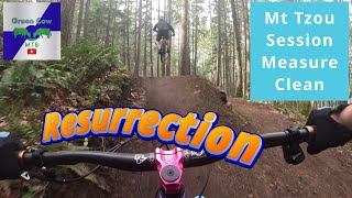
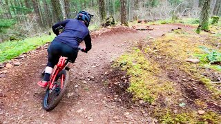
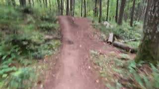
A wonderful new school trail featuring 2 small wood TTF drops followed by a medium gap jump. It then leads into larger hip jumps and optional gaps finishing in flowy, bermy, sweetness with lots of little roots and booters to boost.

**All trail features have safe ride around options making the trail a fun blue rated option.

The trail has been extended in May 2018 to continue along the right hand side of the Mainline road all the way to the parking lot to avoid traffic collision safety risks.

Local Trail Association

Recent Activity on Trail

Past Week
  • 13 rides
  • 7 miles average
6 Months
  • 211 rides
  • 10 miles avg distance
All
  • 2,853 rides
  • Last: Jun 19, 2026
c1c2c3c4
January
February
March
April
May
June
July
August
September
October
November
December
Status:
on May 29, 2026
Ideal
Avg: 4.47 (49 votes)
Your vote: 0

view (14,283)
close
3D
Trail Conditions
  • Unknown
  • Snow Groomed
  • Snow Packed
  • Snow Covered
  • Snow Cover Partial
  • Freeze/thaw Cycle
  • Icy
  • Prevalent Mud
  • Wet
  • Variable
  • Ideal
  • Dry
  • Very Dry
Trail Flow (Ridden Direction)
Trailforks scans users ridelogs to determine the most popular direction each trail is ridden. A good flowing trail network will have most trails flowing in a single direction according to their intension.
The colour categories are based on what percentage of riders are riding a trail in its intended direction.
  • > 96%
  • > 90%
  • > 80%
  • > 70%
  • > 50%
  • < 50%
  • bi-directional trail
  • no data
Trail Last Ridden
Trailforks scans ridelogs to determine the last time a trail was ridden.
  • < 2 days
  • < 1 week
  • < 2 weeks
  • < 1 month
  • < 6 months
  • > 6 months
Trail Ridden Direction
The intended direction a trail should be ridden.
  • Downhill Only
  • Downhill Primary
  • Both Directions
  • Uphill Primary
  • Uphill Only
  • One Direction
Contribute Details
Colors indicate trail is missing specified detail.
  • Description
  • Photos
  • Description & Photos
  • Videos
Trail Popularity ?
Trailforks scans ridelogs to determine which trails are ridden the most in the last 9 months. Trails are compared with nearby trails in the same city region with a possible 25 colour shades. Think of this as a heatmap, more rides = more kinetic energy = warmer colors.
  • most popular
  • popular
  • less popular
  • not popular
ATV/ORV/OHV Filter
Max Vehicle Width
inches
US Cell Coverage
Legend
cell carrier legend

Radar Time
Activity Recordings
Trailforks uses anonymized public activity data. ?
Activity Recordings
Trailforks uses anonymized public activity data. ?
Personal Heatmap
Activity Types
all / none
Options
2
Date range month
Winter Trails
Warning A routing network for winter maps does not exist. Selecting trails using the winter trails layer has been disabled.
Missing Trails
Most Popular
Least Popular
Trails are colored based on popularity. The more popular a trail is, the more red. Less popular trails trend towards green.
Jump Magnitude Heatmap
Heatmap of where riders jump on trails. Zoom in to see individual jumps, click circles to view jump details.
BC Backroad Status

Service Road Atlas is a free to use, community-driven service for viewing and creating reports on the numerous back-country service roads around B.C. and Alberta.

map legend
Slope Aspect
Direction the slope faces
Flat N NE E SE S SW W NW
Trails Deemphasized
Trails are shown in grey.
disable
Only show trails with no bike usage.
Enable
Suggested Layers
Based on selected activity type

    Save the current map location and zoom level as your default home location whenever this page is loaded.

    Save
        Directions to resurrection trailhead (48.790050, -123.622440)

        Photos

        69 more »
        697 |
        Jan 21, 2015 @ 10:27pm
        Jan 21, 2015
        824 |
        Oct 12, 2017 @ 10:18am
        Oct 12, 2017
        866 |
        Feb 14, 2015 @ 9:08am
        Feb 14, 2015
        66 |
        Jan 3, 2024 @ 5:22pm
        Jan 3, 2024

        Videos

        50 more »
        Can we clean Resurrection?
        5:21 | 257 | Apr 8, 2025 , Duncan
        Double D and Loam Line Trail Conditions - Feb 27th
        9:48 | 104 | Mar 4, 2025 , Duncan
        Resurrection
        2:22 | 201 | Aug 23, 2024 , Duncan
        Rip down 'Resurrection' - Pi'paam...
        2:31 | 629 | Jun 11, 2022 , Duncan

        Trail Lists

        Routes with this trail

        3.7 8 miles 2,035 ft 7 Loop
        A nice route with not too much climbing that incorporates all the downhill-only blueish flow trails at...
        5 miles 955 ft 5 Loop
        Cowichan Trail Stewardship Society Poker Run. This will be a short/moderate loop where riders collect 5...
        10 miles 1,877 ft 7 Loop
        This route has a good mix of what Tzouhalem has to offer. Great climbing, stunning views, and a solid...

        3 Reviews & Comments


        We hope you've been enjoying Trailforks!

        Create a FREE account to view trail comments and much more.

        • By highrocker1298TF Pro & contributors
        • #7030 - 10,648 views

        Frequently Asked Questions About Resurrection

        Where is Resurrection located?
        Resurrection is located in Mount Tzouhalem, Duncan, British Columbia, Canada. It is part of the Mount Tzouhalem trail network. The trailhead is located at coordinates 48.79005, -123.62244.
        How hard is Resurrection?
        Resurrection is rated as Black Diamond difficulty. The physical rating is Moderate. The average grade is 9.1%.
        What is the elevation gain for Resurrection?
        Resurrection has 2 ft of elevation gain. The trail has 251 ft of elevation descent. The elevation ranges from 819 ft to 1,070 ft.
        Is Resurrection a point to point trail?
        Yes, Resurrection is a point to point trail. The direction is Downhill Only. The trail type is singletrack.

        Hit the Trail

        Open in App

        Get this trail on your phone instantly.
        open trail in app

        Download Trail

        Save to wishlist, Garmin & download.
        save the trail

        Find Related Routes

        Find routes and users activities that include this trail.
        find routes for this trail

        You must enter a description before submitting.