more stats
1.8 miles
Distance
343 ft
Climb
-340 ft
Descent
00:36:59
Avg time
3 ft
Altitude change
54 ft
Altitude min
155 ft
Altitude max
60 ft
Altitude start
63 ft
Altitude end
0.034%
Grade
-36.718%
Grade max
36.943%
Grade min
4,130 ft
Distance climb
3,827 ft
Distance down
1,655 ft
Distance flat
00:36:59
Avg time

Ripn' Ripon Details

  • Activities
    • Mountain Bike
    • Hike
    • Trail Running
  • Riding Area
    Ripon
    , California
  • Difficulty Rating
  • Local Popularity
    100 in Mountain Biking [+]
    • 5 in Trail Running
    • 5 in Hiking
  • Global Ranking
    #55128 in Mountain Biking [+]
    • #268438 in Trail Running
    • #259579 in Hiking
  • Trail Type
    Singletrack
  • Bike Type
    AM, XC, DJ
  • Direction
    Both Directions
    Popular Direction Shown
  • Climb Difficulty
    Green
  • Physical Rating
    Easy
  • Dogs Allowed
    Yes
  • TTFs on Trail
    Jump, Pump Track

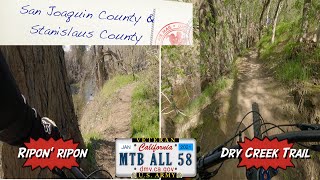
While this little gem might seem like the perfect spot for hobos & tweekers to hide out, the Ripon PD apparently keeps a lid on said element. Stage at 'Army Corps Park Ripon River Crossing' or at the dirt lot where Hammett Rd & Pirrone Rd meet (if the broken window glass scattered about does not scare you). There is single and double track on both sides of highway 99. The single track follows the river side for the most part. Watch out for dead-ends, low hanging trees and sand pits under the leaves. There is also a sketchy dirt jump area in the oak grove. Finish your ride with a deep breath and a rewarding view of the city water treatment plant.

Traditionally Indigenous Territory

Recent Activity on Trail

Past Week
  • 0 rides
  •  
6 Months
  • 0 rides
  •  
All
  • 47 rides
  • Last: May 18, 2026
c1c2c3c4
January
February
March
April
May
June
July
August
September
October
November
December
update trails status or condition

Ripn' Ripon Trail Reports

statusdatedescription
May 4, 2023 @ 8:25am
May 4, 2023
Trail was in great shape, it had been lightly raining the last couple days but the trail wasn't muddy at all. Some construction going on under the...
Jul 17, 2019 @ 7:06pm
Jul 17, 2019
Can access the trail after 5 and weekends through construction area. Multiple trails and loops in the oak park area. Can go along the river...
May 30, 2019 @ 10:49am
May 30, 2019
Down trees blocking part of the path. Unable to cross under the highway due to construction workers blocking path.
Sep 7, 2017 @ 8:09am
Sep 7, 2017
The trail changed a bit due to the floods but it's all clear now
Dec 2, 2016 @ 9:17pm
Dec 2, 2016
more »
Status:
on May 4, 2023
Ideal
Avg: 3.88 (5 votes)
Your vote: 0

view (134)
close
3D
Trail Conditions
  • Unknown
  • Snow Groomed
  • Snow Packed
  • Snow Covered
  • Snow Cover Partial
  • Freeze/thaw Cycle
  • Icy
  • Prevalent Mud
  • Wet
  • Variable
  • Ideal
  • Dry
  • Very Dry
Trail Flow (Ridden Direction)
Trailforks scans users ridelogs to determine the most popular direction each trail is ridden. A good flowing trail network will have most trails flowing in a single direction according to their intension.
The colour categories are based on what percentage of riders are riding a trail in its intended direction.
  • > 96%
  • > 90%
  • > 80%
  • > 70%
  • > 50%
  • < 50%
  • bi-directional trail
  • no data
Trail Last Ridden
Trailforks scans ridelogs to determine the last time a trail was ridden.
  • < 2 days
  • < 1 week
  • < 2 weeks
  • < 1 month
  • < 6 months
  • > 6 months
Trail Ridden Direction
The intended direction a trail should be ridden.
  • Downhill Only
  • Downhill Primary
  • Both Directions
  • Uphill Primary
  • Uphill Only
  • One Direction
Contribute Details
Colors indicate trail is missing specified detail.
  • Description
  • Photos
  • Description & Photos
  • Videos
Trail Popularity ?
Trailforks scans ridelogs to determine which trails are ridden the most in the last 9 months. Trails are compared with nearby trails in the same city region with a possible 25 colour shades. Think of this as a heatmap, more rides = more kinetic energy = warmer colors.
  • most popular
  • popular
  • less popular
  • not popular
ATV/ORV/OHV Filter
Max Vehicle Width
inches
US Cell Coverage
Legend
cell carrier legend

Radar Time
Activity Recordings
Trailforks uses anonymized public activity data. ?
Activity Recordings
Trailforks uses anonymized public activity data. ?
Personal Heatmap
Activity Types
all / none
Options
2
Date range month
Winter Trails
Warning A routing network for winter maps does not exist. Selecting trails using the winter trails layer has been disabled.
Missing Trails
Most Popular
Least Popular
Trails are colored based on popularity. The more popular a trail is, the more red. Less popular trails trend towards green.
Jump Magnitude Heatmap
Heatmap of where riders jump on trails. Zoom in to see individual jumps, click circles to view jump details.
BC Backroad Status

Service Road Atlas is a free to use, community-driven service for viewing and creating reports on the numerous back-country service roads around B.C. and Alberta.

map legend
Slope Aspect
Direction the slope faces
Flat N NE E SE S SW W NW
Trails Deemphasized
Trails are shown in grey.
disable
Only show trails with no bike usage.
Enable
Suggested Layers
Based on selected activity type

    Save the current map location and zoom level as your default home location whenever this page is loaded.

    Save
        Directions to ripn--ripon-17775 trailhead (37.732180, -121.111300)

        Photos

        11 more »
        89 |
        Oct 10, 2020 @ 4:55pm
        Oct 10, 2020
        128 |
        Oct 10, 2020 @ 4:55pm
        Oct 10, 2020
        102 |
        May 18, 2019 @ 5:27pm
        May 18, 2019
        135 |
        May 18, 2019 @ 5:26pm
        May 18, 2019

        Videos

        1 more »
        MTB two more counties  - San Joaquin and...
        18:11 | 384 | Feb 16, 2021 , Ripon

        1 Review & Comments


        We hope you've been enjoying Trailforks!

        Create a FREE account to view trail comments and much more.

        • By CaptainVonAwesomeTF Pro & contributors
        • #17775 - 4,008 views

        Frequently Asked Questions About Ripn' Ripon

        Where is Ripn' Ripon located?
        Ripn' Ripon is located in Ripon, California, United States. It is part of the Ripon trail network. The trailhead is located at coordinates 37.73218, -121.1113.
        How hard is Ripn' Ripon?
        Ripn' Ripon is rated as Green difficulty. The physical rating is Easy. The average grade is 0.034%. The climb difficulty is rated Green.
        What is the elevation gain for Ripn' Ripon?
        Ripn' Ripon has 343 ft of elevation gain. The trail has 340 ft of elevation descent. The elevation ranges from 54 ft to 155 ft.
        Is Ripn' Ripon a point to point trail?
        Ripn' Ripon is not a point to point trail. The direction is Both Directions. The trail type is singletrack.

        Hit the Trail

        Open in App

        Get this trail on your phone instantly.
        open trail in app

        Download Trail

        Save to wishlist, Garmin & download.
        save the trail

        Find Related Routes

        Find routes and users activities that include this trail.
        find routes for this trail

        You must enter a description before submitting.