more stats
1,247 ft
Distance
-248 ft
Descent
00:04:38
Avg time
-248 ft
Altitude change
864 ft
Altitude min
1,112 ft
Altitude max
1,112 ft
Altitude start
864 ft
Altitude end
-19.921%
Grade
-51.79%
Grade max
2.987%
Grade min
16 ft
Distance climb
1,190 ft
Distance down
40 ft
Distance flat
00:04:38
Avg time

Roadeo Details

  • Activities
    • Mountain Bike
    • Hike
    • Trail Running
  • Riding Area
  • Difficulty Rating
  • Local Popularity
    25 in Mountain Biking [+]
    • 5 in Trail Running
    • 5 in Hiking
  • Global Ranking
    #117667 in Mountain Biking [+]
    • #130579 in Trail Running
    • #123672 in Hiking
  • Trail Type
    Singletrack
  • Bike Type
    DH, AM
  • Direction
    Downhill Primary
    Popular Direction Shown
  • Physical Rating
    Moderate
  • Season
    May - November
  • Dogs Allowed
    Yes
  • TTFs on Trail
    Drop, Jump
  • Ride in Rain
    Yes

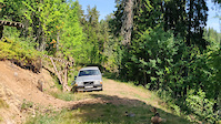
This trail is short and sweet with two pretty big elements, but fortunately you dont have to ride them and its still a cool trail. You drop in on a smooth single track this leads to a jump and a left berm, now you will cross a small road (mind the drop) before you head down a steep hillside. Here comes the huge road gap, please size it up before you attempt it And then its all downhill from there, after two turns you fly out of the woods and can choose to hit a pretty big hip jump. There you have it, its the Roadeo.

Trail Supporters
  • past supporters

  • Holmenkollen Trail Corps
    10 - 50
    Sponsor
Local Trail Association

Recent Activity on Trail

Past Week
  • 0 rides
  •  
6 Months
  • 0 rides
  •  
All
  • 5 rides
  • Last: May 9, 2026
c1c2c3c4
January
February
March
April
May
June
July
August
September
October
November
December
update trails status or condition

Roadeo Trail Reports

Status:
on Jul 8, 2020
Variable
Avg: 4.19 (4 votes)
Your vote: 0

view (84)
close
3D
Trail Conditions
  • Unknown
  • Snow Groomed
  • Snow Packed
  • Snow Covered
  • Snow Cover Partial
  • Freeze/thaw Cycle
  • Icy
  • Prevalent Mud
  • Wet
  • Variable
  • Ideal
  • Dry
  • Very Dry
Trail Flow (Ridden Direction)
Trailforks scans users ridelogs to determine the most popular direction each trail is ridden. A good flowing trail network will have most trails flowing in a single direction according to their intension.
The colour categories are based on what percentage of riders are riding a trail in its intended direction.
  • > 96%
  • > 90%
  • > 80%
  • > 70%
  • > 50%
  • < 50%
  • bi-directional trail
  • no data
Trail Last Ridden
Trailforks scans ridelogs to determine the last time a trail was ridden.
  • < 2 days
  • < 1 week
  • < 2 weeks
  • < 1 month
  • < 6 months
  • > 6 months
Trail Ridden Direction
The intended direction a trail should be ridden.
  • Downhill Only
  • Downhill Primary
  • Both Directions
  • Uphill Primary
  • Uphill Only
  • One Direction
Contribute Details
Colors indicate trail is missing specified detail.
  • Description
  • Photos
  • Description & Photos
  • Videos
Trail Popularity ?
Trailforks scans ridelogs to determine which trails are ridden the most in the last 9 months. Trails are compared with nearby trails in the same city region with a possible 25 colour shades. Think of this as a heatmap, more rides = more kinetic energy = warmer colors.
  • most popular
  • popular
  • less popular
  • not popular
ATV/ORV/OHV Filter
Max Vehicle Width
inches
US Cell Coverage
Legend
cell carrier legend

Radar Time
Activity Recordings
Trailforks uses anonymized public activity data. ?
Activity Recordings
Trailforks uses anonymized public activity data. ?
Personal Heatmap
Activity Types
all / none
Options
2
Date range month
Winter Trails
Warning A routing network for winter maps does not exist. Selecting trails using the winter trails layer has been disabled.
Missing Trails
Most Popular
Least Popular
Trails are colored based on popularity. The more popular a trail is, the more red. Less popular trails trend towards green.
Jump Magnitude Heatmap
Heatmap of where riders jump on trails. Zoom in to see individual jumps, click circles to view jump details.
BC Backroad Status

Service Road Atlas is a free to use, community-driven service for viewing and creating reports on the numerous back-country service roads around B.C. and Alberta.

map legend
Slope Aspect
Direction the slope faces
Flat N NE E SE S SW W NW
Trails Deemphasized
Trails are shown in grey.
disable
Only show trails with no bike usage.
Enable
Suggested Layers
Based on selected activity type

    Save the current map location and zoom level as your default home location whenever this page is loaded.

    Save
        Directions to roadeo trailhead (59.968560, 10.675620)

        Photos

        8 more »
        139 |
        Mar 13, 2022 @ 3:22pm
        Mar 13, 2022
        84 |
        Mar 13, 2022 @ 3:22pm
        Mar 13, 2022
        87 |
        Mar 13, 2022 @ 3:22pm
        Mar 13, 2022
        90 |
        Mar 13, 2022 @ 3:22pm
        Mar 13, 2022

        Videos

        1 more »
        Roadeo road gap
        0:16 | 199 | Oct 11, 2021 , Oslo

        Reviews / Comments

        No reviews yet, be the first to write a review or ask a question.
        Use trail reports to comment on trail conditions.


        We hope you've been enjoying Trailforks!

        Create a FREE account to view trail comments and much more.

        • By Braatenz & contributors
        • #39546 - 2,021 views

        Frequently Asked Questions About Roadeo

        Where is Roadeo located?
        Roadeo is located in Frognerseteren, Oslo, Norway. It is part of the Frognerseteren trail network. The trailhead is located at coordinates 59.96856, 10.67562.
        How hard is Roadeo?
        Roadeo is rated as Black Diamond difficulty. The physical rating is Moderate. The average grade is 19.921%.
        What is the elevation gain for Roadeo?
        The trail has 248 ft of elevation descent. The elevation ranges from 864 ft to 1,112 ft.
        Is Roadeo a point to point trail?
        Roadeo is not a point to point trail. The direction is Downhill Primary. The trail type is singletrack.

        Hit the Trail

        Open in App

        Get this trail on your phone instantly.
        open trail in app

        Download Trail

        Save to wishlist, Garmin & download.
        save the trail

        Find Related Routes

        Find routes and users activities that include this trail.
        find routes for this trail

        You must enter a description before submitting.