more stats
1.4 miles
Distance
168 ft
Climb
-225 ft
Descent
00:12:25
Avg time
-57 ft
Altitude change
5,418 ft
Altitude min
5,574 ft
Altitude max
5,475 ft
Altitude start
5,417 ft
Altitude end
-0.8%
Grade
-20.1%
Grade max
21.6%
Grade min
3,310 ft
Distance climb
3,396 ft
Distance down
722 ft
Distance flat
00:12:25
Avg time

Roasted Starburst Details

  • Activities
    • Mountain Bike
    • E-Bike
    • Winter Fat Bike
    • Hike
    • Trail Running
  • Riding Area
    Manti
    , Utah
  • Difficulty Rating
  • Local Popularity
    35 in Mountain Biking [+]
    • 5 in E-Biking
    • 5 in Trail Running
    • 5 in Hiking
  • Global Ranking
    #248718 in Mountain Biking [+]
    • #14809 in E-Biking
    • #307099 in Trail Running
    • #293816 in Hiking
  • Trail Type
    Singletrack
  • Bike Type
    AM, XC, Fat
  • Direction
    Both Directions
    Popular Direction Shown
  • Climb Difficulty
    Black Diamond
  • Physical Rating
    Hard
  • Trail Visibility
    Always easy to follow
  • Season
    March-November
  • Dogs Allowed
    Yes
  • eBike Allowed
    Yes up to Class 1
  • TTFs on Trail
    Drop, Jump, Rock Garden
  • Year Opened
    2022
  • Land Owner
    BLM/Gunnison Irrigation

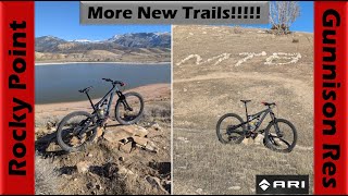
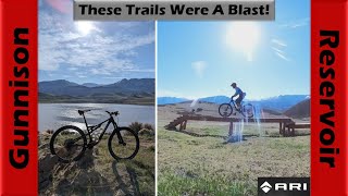
Tough technical mountain bike trail. Can you clean the whole trail without putting your foot down? Very nice cliffside view at the top.

Access Info

Turn at the sign that says "Roasted Sturburst" while you are riding on the southeast part of the Manti Race Course. You can ride it either direction but riding from south to north is the easiest.

Recent Activity on Trail

Past Week
  • 0 rides
  •  
6 Months
  • 1 rides
  • 11 miles avg distance
All
  • 5 rides
  • Last: May 23, 2026
c1c2c3c4
January
February
March
April
May
June
July
August
September
October
November
December
update trails status or condition

Roasted Starburst Trail Reports

statusdatedescription
May 3, 2024 @ 8:44am
May 3, 2024
overgrown, needs tires.
Jun 22, 2023 @ 11:49am
Jun 22, 2023
Dry
more »
Status:
on May 3, 2024
Dry
no votes yet
Your vote: 0

view (50)
close
3D
Trail Conditions
  • Unknown
  • Snow Groomed
  • Snow Packed
  • Snow Covered
  • Snow Cover Partial
  • Freeze/thaw Cycle
  • Icy
  • Prevalent Mud
  • Wet
  • Variable
  • Ideal
  • Dry
  • Very Dry
Trail Flow (Ridden Direction)
Trailforks scans users ridelogs to determine the most popular direction each trail is ridden. A good flowing trail network will have most trails flowing in a single direction according to their intension.
The colour categories are based on what percentage of riders are riding a trail in its intended direction.
  • > 96%
  • > 90%
  • > 80%
  • > 70%
  • > 50%
  • < 50%
  • bi-directional trail
  • no data
Trail Last Ridden
Trailforks scans ridelogs to determine the last time a trail was ridden.
  • < 2 days
  • < 1 week
  • < 2 weeks
  • < 1 month
  • < 6 months
  • > 6 months
Trail Ridden Direction
The intended direction a trail should be ridden.
  • Downhill Only
  • Downhill Primary
  • Both Directions
  • Uphill Primary
  • Uphill Only
  • One Direction
Contribute Details
Colors indicate trail is missing specified detail.
  • Description
  • Photos
  • Description & Photos
  • Videos
Trail Popularity ?
Trailforks scans ridelogs to determine which trails are ridden the most in the last 9 months. Trails are compared with nearby trails in the same city region with a possible 25 colour shades. Think of this as a heatmap, more rides = more kinetic energy = warmer colors.
  • most popular
  • popular
  • less popular
  • not popular
ATV/ORV/OHV Filter
Max Vehicle Width
inches
US Cell Coverage
Legend
cell carrier legend

Radar Time
Activity Recordings
Trailforks uses anonymized public activity data. ?
Activity Recordings
Trailforks uses anonymized public activity data. ?
Personal Heatmap
Activity Types
all / none
Options
2
Date range month
Winter Trails
Warning A routing network for winter maps does not exist. Selecting trails using the winter trails layer has been disabled.
Missing Trails
Most Popular
Least Popular
Trails are colored based on popularity. The more popular a trail is, the more red. Less popular trails trend towards green.
Jump Magnitude Heatmap
Heatmap of where riders jump on trails. Zoom in to see individual jumps, click circles to view jump details.
BC Backroad Status

Service Road Atlas is a free to use, community-driven service for viewing and creating reports on the numerous back-country service roads around B.C. and Alberta.

map legend
Slope Aspect
Direction the slope faces
Flat N NE E SE S SW W NW
Trails Deemphasized
Trails are shown in grey.
disable
Only show trails with no bike usage.
Enable
Suggested Layers
Based on selected activity type

    Save the current map location and zoom level as your default home location whenever this page is loaded.

    Save
        Directions to roasted-starburst trailhead (39.216770, -111.709030)

        Photos

        7 more »
        46 |
        May 4, 2024 @ 1:34pm
        May 4, 2024
        39 |
        May 3, 2024 @ 1:25pm
        May 3, 2024
        48 |
        May 4, 2024 @ 1:33pm
        May 4, 2024
        41 |
        May 4, 2024 @ 1:30pm
        May 4, 2024

        Videos

        2 more »
        youtuber More & More New Trails Being Built! |...
        28:16 | 114 | Nov 16, 2024 , Manti
        youtuber Who knew the Gunnison Reservoir Trails were so...
        33:30 | 94 | May 3, 2024 , Manti

        1 Review & Comments


        We hope you've been enjoying Trailforks!

        Create a FREE account to view trail comments and much more.

        Nearby Trails

        • By DanielxwQ08rTF Pro & contributors
        • #601070 - 519 views

        Frequently Asked Questions About Roasted Starburst

        Where is Roasted Starburst located?
        Roasted Starburst is located in Manti, Utah, United States. It is part of the Manti trail network. The trailhead is located at coordinates 39.21677, -111.70903.
        How hard is Roasted Starburst?
        Roasted Starburst is rated as Black Diamond difficulty. The physical rating is Hard. The average grade is 0.8%. The climb difficulty is rated Black Diamond.
        What is the elevation gain for Roasted Starburst?
        Roasted Starburst has 168 ft of elevation gain. The trail has 225 ft of elevation descent. The elevation ranges from 5,418 ft to 5,574 ft.
        Is Roasted Starburst a point to point trail?
        Roasted Starburst is not a point to point trail. The direction is Both Directions. The trail type is singletrack.

        Hit the Trail

        Open in App

        Get this trail on your phone instantly.
        open trail in app

        Download Trail

        Save to wishlist, Garmin & download.
        save the trail

        Find Related Routes

        Find routes and users activities that include this trail.
        find routes for this trail

        You must enter a description before submitting.