more stats
4,967 ft
Distance
35 ft
Climb
-391 ft
Descent
00:10:48
Avg time
-357 ft
Altitude change
315 ft
Altitude min
692 ft
Altitude max
681 ft
Altitude start
325 ft
Altitude end
-7.2%
Grade
-42.8%
Grade max
15.1%
Grade min
735 ft
Distance climb
3,606 ft
Distance down
627 ft
Distance flat
00:10:48
Avg time

Rocky Dingo Details

  • Activities
    • Mountain Bike
    • E-Bike
  • Riding Area
    Smithfield
    Cairns
  • Difficulty Rating
  • Local Popularity
    75 in Mountain Biking [+]
    • 90 in E-Biking
  • Global Ranking
    #56747 in Mountain Biking [+]
    • #23350 in E-Biking
  • Trail Type
    Singletrack
  • Bike Type
    DH, AM
  • Climb Difficulty
    Blue
  • Physical Rating
    Moderate
  • Trail Visibility
    Always easy to follow
  • eBike Allowed
    Yes up to Class 1
  • TTFs on Trail
    Drop, Jump, Rock Face, Rock Garden
  • Ride in Rain
    Yes

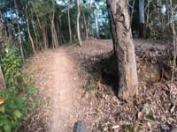
Rocky Dingo is an old school single track that has a descent from the top of Paguna Ridge to finish at the Panguna ridge road junction with Jacobs ladder/Centipede. It is a very challenging track that will test even the most skilled riders with loose technical rock gardens and tight flat corners, Finishing with Crocs-Teeth Rockgarden into a steep rockslab descent nicknamed Crocslide.

Access Info

Climb up the fireroad above the watertank until the top of the hill where there is a short switch back climb to the start.

Local Trail Association
Traditionally Indigenous Territory

Recent Activity on Trail

Past Week
  • 0 rides
  •  
6 Months
  • 4 rides
  • 18.9 km avg distance
All
  • 127 rides
  • Last: Jun 18, 2026
c1c2c3c4
January
February
March
April
May
June
July
August
September
October
November
December
update trails status or condition

Rocky Dingo Trail Reports

statusdatedescription
May 12, 2026 @ 1:25pm (Australia/Brisbane)
May 11, 2026
Two trees down on concrete section of climb
Dec 31, 2025 @ 8:51am (Australia/Brisbane)
Dec 30, 2025
reporter
Apr 5, 2025 @ 3:46pm
Apr 5, 2025
two trees down across track
Feb 24, 2025 @ 4:59pm
Feb 24, 2025
Just got rebuilt by trail workers
Feb 2, 2025 @ 4:02am
Feb 2, 2025
reporter Small tree across descent -growth of small vegetation over trail in multiple parts corridor needs clearing
more »
Status:
on May 12, 2026
Avg: 4.21 (4 votes)
Your vote: 0

view (2,090)
close
3D
Trail Conditions
  • Unknown
  • Snow Groomed
  • Snow Packed
  • Snow Covered
  • Snow Cover Partial
  • Freeze/thaw Cycle
  • Icy
  • Prevalent Mud
  • Wet
  • Variable
  • Ideal
  • Dry
  • Very Dry
Trail Flow (Ridden Direction)
Trailforks scans users ridelogs to determine the most popular direction each trail is ridden. A good flowing trail network will have most trails flowing in a single direction according to their intension.
The colour categories are based on what percentage of riders are riding a trail in its intended direction.
  • > 96%
  • > 90%
  • > 80%
  • > 70%
  • > 50%
  • < 50%
  • bi-directional trail
  • no data
Trail Last Ridden
Trailforks scans ridelogs to determine the last time a trail was ridden.
  • < 2 days
  • < 1 week
  • < 2 weeks
  • < 1 month
  • < 6 months
  • > 6 months
Trail Ridden Direction
The intended direction a trail should be ridden.
  • Downhill Only
  • Downhill Primary
  • Both Directions
  • Uphill Primary
  • Uphill Only
  • One Direction
Contribute Details
Colors indicate trail is missing specified detail.
  • Description
  • Photos
  • Description & Photos
  • Videos
Trail Popularity ?
Trailforks scans ridelogs to determine which trails are ridden the most in the last 9 months. Trails are compared with nearby trails in the same city region with a possible 25 colour shades. Think of this as a heatmap, more rides = more kinetic energy = warmer colors.
  • most popular
  • popular
  • less popular
  • not popular
ATV/ORV/OHV Filter
Max Vehicle Width
inches
US Cell Coverage
Legend
cell carrier legend

Radar Time
Activity Recordings
Trailforks uses anonymized public activity data. ?
Activity Recordings
Trailforks uses anonymized public activity data. ?
Personal Heatmap
Activity Types
all / none
Options
2
Date range month
Winter Trails
Warning A routing network for winter maps does not exist. Selecting trails using the winter trails layer has been disabled.
Missing Trails
Most Popular
Least Popular
Trails are colored based on popularity. The more popular a trail is, the more red. Less popular trails trend towards green.
Jump Magnitude Heatmap
Heatmap of where riders jump on trails. Zoom in to see individual jumps, click circles to view jump details.
BC Backroad Status

Service Road Atlas is a free to use, community-driven service for viewing and creating reports on the numerous back-country service roads around B.C. and Alberta.

map legend
Slope Aspect
Direction the slope faces
Flat N NE E SE S SW W NW
Trails Deemphasized
Trails are shown in grey.
disable
Only show trails with no bike usage.
Enable
Suggested Layers
Based on selected activity type

    Save the current map location and zoom level as your default home location whenever this page is loaded.

    Save
        Directions to rocky-dingo trailhead (-16.805060, 145.683280)

        Photos

        7 more »
        69 |
        Dec 30, 2022 @ 3:58pm
        Dec 30, 2022
        59 |
        Dec 30, 2022 @ 3:57pm
        Dec 30, 2022
        57 |
        Dec 30, 2022 @ 3:49pm
        Dec 30, 2022
        70 |
        Dec 30, 2022 @ 3:49pm
        Dec 30, 2022

        Videos

        1 more »
        SMITHFIELD - ROCKY DINGO
        3:59 | 1121 | Jul 13, 2019 , Cairns

        Routes with this trail

        6 miles 1,327 ft 4 Out & Back Race
        Interschool 4 stage Enduro Stage 1 Stage 2 Lower Stage 3 Centepiede Stage 4 - Can be done in any order

        1 Review & Comments


        We hope you've been enjoying Trailforks!

        Create a FREE account to view trail comments and much more.

        Frequently Asked Questions About Rocky Dingo

        Where is Rocky Dingo located?
        Rocky Dingo is located in Smithfield, Cairns, Australia. It is part of the Smithfield trail network. The trailhead is located at coordinates -16.80506, 145.68328.
        How hard is Rocky Dingo?
        Rocky Dingo is rated as Black Diamond difficulty. The physical rating is Moderate. The average grade is 7.2%. The climb difficulty is rated Blue.
        What is the elevation gain for Rocky Dingo?
        Rocky Dingo has 11 m of elevation gain. The trail has 119 m of elevation descent. The elevation ranges from 96 m to 211 m.
        How long is Rocky Dingo?
        Rocky Dingo is 1.5 km long. The trail type is singletrack.

        Hit the Trail

        Open in App

        Get this trail on your phone instantly.
        open trail in app

        Download Trail

        Save to wishlist, Garmin & download.
        save the trail

        Find Related Routes

        Find routes and users activities that include this trail.
        find routes for this trail

        You must enter a description before submitting.