more stats
4.0 miles
Distance
95 ft
Climb
-2,193 ft
Descent
00:30:26
Avg time
-2,096 ft
Altitude change
1,112 ft
Altitude min
3,214 ft
Altitude max
3,214 ft
Altitude start
1,119 ft
Altitude end
-9.9%
Grade
-51.4%
Grade max
16.1%
Grade min
2,051 ft
Distance climb
3 miles
Distance down
1,325 ft
Distance flat
00:30:26
Avg time

Roller Coaster Details

  • Activities
    • Mountain Bike
    • E-Bike
  • Riding Area
    Finale Outdoor Region
    Finale Ligure
  • Ref Number
    #171
  • AKA
    Rollercoaster
  • Difficulty Rating
  • Voted Difficulty
    Blue (24 votes)
  • Local Popularity
    100 in Mountain Biking [+]
    • 100 in E-Biking
  • Global Ranking
    #1 in Mountain Biking [+]
    • #2 in E-Biking
  • Trail Type
    Singletrack
  • Bike Type
    AM, XC
  • Climb Difficulty
    Green
  • Physical Rating
    Moderate
  • Trail Visibility
    Always easy to follow
  • Season
    All-year round
  • Dogs Allowed
    Yes
  • eBike Allowed
    Yes up to Class 1
  • TTFs on Trail
    Berm
  • Land Owner
    Finale Outdoor Region

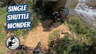
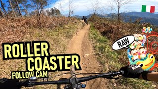
Maybe the most iconic and known trail in Finale. Every rider that spends time in Finale must ride this. In its 7km length, you’ll find an experience packed with fun, speed, gnar, views for a great all-round experience.
Used as stage 1 of the first Trophy of Nations in 2019, remains one of the best experiences in the area.

Access Info

Din Area is reachable from the E80 highway accessing Finale Ligure, then drive north on the SP490 until the openings at the crossroad towards Osiglia.

Disclaimer

At around the middle of the trail there is a compulsory double-track crossing where paying attention is key. Given its nature, the trail can change after weather happenings and season changes. Always pay attention.

Trail Supporters
Local Trail Association

Recent Activity on Trail

Past Week
  • 21 rides
  • 32.5 km average
6 Months
  • 983 rides
  • 37.0 km avg distance
All
  • 4,595 rides
  • Last: Jun 19, 2026
c1c2c3c4
January
February
March
April
May
June
July
August
September
October
November
December
Status:
on Jun 18, 2026
Dry
Avg: 4.5 (269 votes)
Your vote: 0

view (25,426)
close
3D
Trail Conditions
  • Unknown
  • Snow Groomed
  • Snow Packed
  • Snow Covered
  • Snow Cover Partial
  • Freeze/thaw Cycle
  • Icy
  • Prevalent Mud
  • Wet
  • Variable
  • Ideal
  • Dry
  • Very Dry
Trail Flow (Ridden Direction)
Trailforks scans users ridelogs to determine the most popular direction each trail is ridden. A good flowing trail network will have most trails flowing in a single direction according to their intension.
The colour categories are based on what percentage of riders are riding a trail in its intended direction.
  • > 96%
  • > 90%
  • > 80%
  • > 70%
  • > 50%
  • < 50%
  • bi-directional trail
  • no data
Trail Last Ridden
Trailforks scans ridelogs to determine the last time a trail was ridden.
  • < 2 days
  • < 1 week
  • < 2 weeks
  • < 1 month
  • < 6 months
  • > 6 months
Trail Ridden Direction
The intended direction a trail should be ridden.
  • Downhill Only
  • Downhill Primary
  • Both Directions
  • Uphill Primary
  • Uphill Only
  • One Direction
Contribute Details
Colors indicate trail is missing specified detail.
  • Description
  • Photos
  • Description & Photos
  • Videos
Trail Popularity ?
Trailforks scans ridelogs to determine which trails are ridden the most in the last 9 months. Trails are compared with nearby trails in the same city region with a possible 25 colour shades. Think of this as a heatmap, more rides = more kinetic energy = warmer colors.
  • most popular
  • popular
  • less popular
  • not popular
ATV/ORV/OHV Filter
Max Vehicle Width
inches
US Cell Coverage
Legend
cell carrier legend

Radar Time
Activity Recordings
Trailforks uses anonymized public activity data. ?
Activity Recordings
Trailforks uses anonymized public activity data. ?
Personal Heatmap
Activity Types
all / none
Options
2
Date range month
Winter Trails
Warning A routing network for winter maps does not exist. Selecting trails using the winter trails layer has been disabled.
Missing Trails
Most Popular
Least Popular
Trails are colored based on popularity. The more popular a trail is, the more red. Less popular trails trend towards green.
Jump Magnitude Heatmap
Heatmap of where riders jump on trails. Zoom in to see individual jumps, click circles to view jump details.
BC Backroad Status

Service Road Atlas is a free to use, community-driven service for viewing and creating reports on the numerous back-country service roads around B.C. and Alberta.

map legend
Slope Aspect
Direction the slope faces
Flat N NE E SE S SW W NW
Trails Deemphasized
Trails are shown in grey.
disable
Only show trails with no bike usage.
Enable
Suggested Layers
Based on selected activity type

    Save the current map location and zoom level as your default home location whenever this page is loaded.

    Save
        Directions to roller-coaster-54111 trailhead (44.225330, 8.222520)

        Photos

        114 more »
        43 |
        Apr 29, 2026 @ 12:56am
        Apr 29, 2026
        72 |
        Apr 2, 2026 @ 8:16am
        Apr 2, 2026
        69 |
        Apr 2, 2026 @ 8:16am
        Apr 2, 2026
        249 |
        Mar 8, 2025 @ 2:01am
        Mar 8, 2025

        Videos

        52 more »
        youtuber Making the most of a single uplift in Finale
        10:25 | 572 | Apr 22, 2025 , Finale Ligure
        youtuber Finale Ligure  Teil 2 - Auf den Spuren der...
        9:52 | 165 | Feb 17, 2025 , Finale Ligure
        youtuber Finale Ligure | Zjeżdżamy rockgarden...
        24:07 | 737 | Apr 26, 2023 , Finale Ligure
        youtuber FINALE LIGURE RAW Roller Coaster into Martina ...
        11:16 | 1252 | Jun 27, 2023 , Finale Ligure

        Routes with this trail

        4.3 13 miles 2,234 ft 7 Point to Point
        Route connecting Roller Coaster Kill Bill 1 Madonna Della Guardia Pina Morta Pina Morta Lower Neanderthaler
        3.9 15 miles 3,438 ft 16 Loop
        One Roller and half....going up on collarina the second time.
        3.0 20 miles 3,995 ft 8 Loop
        Für den grossen Anstieg empfehle ich einen Shuttle bis zum Start des Rollercoaster. Die Trails im oberen...

        48 Reviews & Comments


        We hope you've been enjoying Trailforks!

        Create a FREE account to view trail comments and much more.

        • By void & contributors
        • #54111 - 78,212 views

        Frequently Asked Questions About Roller Coaster

        Where is Roller Coaster located?
        Roller Coaster is located in Finale Outdoor Region, Finale Ligure, Italy. It is part of the Finale Outdoor Region trail network. The trailhead is located at coordinates 44.22533, 8.22252.
        How hard is Roller Coaster?
        Roller Coaster is rated as Blue difficulty. The physical rating is Moderate. The average grade is 9.9%. The climb difficulty is rated Green.
        What is the elevation gain for Roller Coaster?
        Roller Coaster has 29 m of elevation gain. The trail has 668 m of elevation descent. The elevation ranges from 339 m to 980 m.
        How long is Roller Coaster?
        Roller Coaster is 6.4 km long. The trail type is singletrack.

        Hit the Trail

        Open in App

        Get this trail on your phone instantly.
        open trail in app

        Download Trail

        Save to wishlist, Garmin & download.
        save the trail

        Find Related Routes

        Find routes and users activities that include this trail.
        find routes for this trail

        You must enter a description before submitting.