more stats
1.1 miles
Distance
86 ft
Climb
-632 ft
Descent
00:11:27
Avg time
-547 ft
Altitude change
1,796 ft
Altitude min
2,372 ft
Altitude max
2,343 ft
Altitude start
1,798 ft
Altitude end
-9.1%
Grade
-45.4%
Grade max
21.2%
Grade min
965 ft
Distance climb
4,692 ft
Distance down
331 ft
Distance flat
00:11:27
Avg time

RSVP Details

  • Activities
    • Mountain Bike
    • Hike
    • Trail Running
  • Riding Area
    Rose Valley
    West Kelowna, British Columbia
  • Difficulty Rating
  • Local Popularity
    90 in Mountain Biking [+]
    • 80 in Trail Running
    • 80 in Hiking
  • Global Ranking
    #54800 in Mountain Biking [+]
    • #72391 in Trail Running
    • #72480 in Hiking
  • Trail Type
    Singletrack
  • Bike Type
    AM, XC
  • Physical Rating
    Moderate
  • Trail Visibility
    Always easy to follow
  • Dogs Allowed
    Yes
  • TTFs on Trail
    Berm, Bridge, Jump

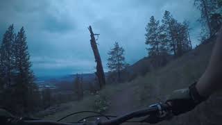
Nice alternative start to Rose Valley Around The Lake, or finish on if you're starting from Reservoir Road.

Access Info

Starts at the Rose Valley Regional upper parking lot and climbs up and over the peak to intersect with the Rose Valley dam road.

Local Trail Association

Recent Activity on Trail

Past Week
  • 3 rides
  • 7 miles average
6 Months
  • 69 rides
  • 7 miles avg distance
All
  • 586 rides
  • Last: Jun 17, 2026
c1c2c3c4
January
February
March
April
May
June
July
August
September
October
November
December
update trails status or condition

RSVP Trail Reports

Status:
on Jun 13, 2026
Dry
Avg: 3.7 (11 votes)
Your vote: 0

view (4,008)
close
3D
Trail Conditions
  • Unknown
  • Snow Groomed
  • Snow Packed
  • Snow Covered
  • Snow Cover Partial
  • Freeze/thaw Cycle
  • Icy
  • Prevalent Mud
  • Wet
  • Variable
  • Ideal
  • Dry
  • Very Dry
Trail Flow (Ridden Direction)
Trailforks scans users ridelogs to determine the most popular direction each trail is ridden. A good flowing trail network will have most trails flowing in a single direction according to their intension.
The colour categories are based on what percentage of riders are riding a trail in its intended direction.
  • > 96%
  • > 90%
  • > 80%
  • > 70%
  • > 50%
  • < 50%
  • bi-directional trail
  • no data
Trail Last Ridden
Trailforks scans ridelogs to determine the last time a trail was ridden.
  • < 2 days
  • < 1 week
  • < 2 weeks
  • < 1 month
  • < 6 months
  • > 6 months
Trail Ridden Direction
The intended direction a trail should be ridden.
  • Downhill Only
  • Downhill Primary
  • Both Directions
  • Uphill Primary
  • Uphill Only
  • One Direction
Contribute Details
Colors indicate trail is missing specified detail.
  • Description
  • Photos
  • Description & Photos
  • Videos
Trail Popularity ?
Trailforks scans ridelogs to determine which trails are ridden the most in the last 9 months. Trails are compared with nearby trails in the same city region with a possible 25 colour shades. Think of this as a heatmap, more rides = more kinetic energy = warmer colors.
  • most popular
  • popular
  • less popular
  • not popular
ATV/ORV/OHV Filter
Max Vehicle Width
inches
US Cell Coverage
Legend
cell carrier legend

Radar Time
Activity Recordings
Trailforks uses anonymized public activity data. ?
Activity Recordings
Trailforks uses anonymized public activity data. ?
Personal Heatmap
Activity Types
all / none
Options
2
Date range month
Winter Trails
Warning A routing network for winter maps does not exist. Selecting trails using the winter trails layer has been disabled.
Missing Trails
Most Popular
Least Popular
Trails are colored based on popularity. The more popular a trail is, the more red. Less popular trails trend towards green.
Jump Magnitude Heatmap
Heatmap of where riders jump on trails. Zoom in to see individual jumps, click circles to view jump details.
BC Backroad Status

Service Road Atlas is a free to use, community-driven service for viewing and creating reports on the numerous back-country service roads around B.C. and Alberta.

map legend
Slope Aspect
Direction the slope faces
Flat N NE E SE S SW W NW
Trails Deemphasized
Trails are shown in grey.
disable
Only show trails with no bike usage.
Enable
Suggested Layers
Based on selected activity type

    Save the current map location and zoom level as your default home location whenever this page is loaded.

    Save
        Directions to rsvp trailhead (49.889850, -119.568460)

        Photos

        10 more »
        171 |
        Jul 24, 2020 @ 6:32pm
        Jul 24, 2020
        181 |
        Jul 24, 2020 @ 10:29am
        Jul 24, 2020
        177 |
        Jul 24, 2020 @ 10:29am
        Jul 24, 2020
        145 |
        Jul 24, 2020 @ 10:29am
        Jul 24, 2020

        Videos

        2 more »
        Mountain Biking RSVP at Rose Valley in West...
        4:54 | 311 | Mar 27, 2023 , West Kelowna
        BCBIKECAM- Rose Valley- RSVP
        6:35 | 161 | Jun 2, 2022 , West Kelowna

        Routes with this trail

        4.0 8 miles 1,664 ft 6 Loop
        For this Sovereign Grouper we've got something for everyone - punchy climbs, loose switchbacks, tech rock...
        4.0 5 miles 1,136 ft 14 Loop
        For SVRN Grouper Rose.BearBones we will be riding up Slick50 connecting into ending at the top of Redrock,...
        11 miles 2,951 ft 10
        Okanagan SW Rose Valley Reservoir Classic Okanagan South West Relive Your Rides For other ride suggestions...

        4 Reviews & Comments


        We hope you've been enjoying Trailforks!

        Create a FREE account to view trail comments and much more.

        • By Angus-DunlopTF Pro & contributors
        • #27742 - 4,586 views

        Frequently Asked Questions About RSVP

        Where is RSVP located?
        RSVP is located in Rose Valley, West Kelowna, British Columbia, Canada. It is part of the Rose Valley trail network. The trailhead is located at coordinates 49.88985, -119.56846.
        How hard is RSVP?
        RSVP is rated as Black Diamond difficulty. The physical rating is Moderate. The average grade is 9.1%.
        What is the elevation gain for RSVP?
        RSVP has 26 m of elevation gain. The trail has 193 m of elevation descent. The elevation ranges from 548 m to 723 m.
        How long is RSVP?
        RSVP is 1.8 km long. The trail type is singletrack.

        Hit the Trail

        Open in App

        Get this trail on your phone instantly.
        open trail in app

        Download Trail

        Save to wishlist, Garmin & download.
        save the trail

        Find Related Routes

        Find routes and users activities that include this trail.
        find routes for this trail

        You must enter a description before submitting.