more stats
1,060 ft
Distance
-140 ft
Descent
00:04:04
Avg time
-141 ft
Altitude change
2,851 ft
Altitude min
2,992 ft
Altitude max
2,992 ft
Altitude start
2,851 ft
Altitude end
-13.3%
Grade
-36.9%
Grade max
951 ft
Distance down
00:04:04
Avg time

Rubber Down Details

  • Activities
    • Mountain Bike
    • E-Bike
  • Riding Area
    Gillard
    Kelowna, British Columbia
  • Difficulty Rating
  • Voted Difficulty
    Black Diamond (1 vote)
  • Local Popularity
    90 in Mountain Biking [+]
    • 90 in E-Biking
  • Global Ranking
    #36464 in Mountain Biking [+]
    • #16761 in E-Biking
  • Trail Type
    Singletrack
  • Bike Type
    DH, AM, DJ
  • Direction
    Downhill Only
    Popular Direction Shown
  • Dogs Allowed
    Yes
  • eBike Allowed
  • TTFs on Trail
    Berm, Drop, Gap Jump
  • Year Opened
    2005
  • Land Owner
    Rec Sites and Trail BC

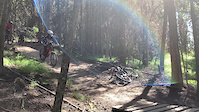
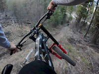
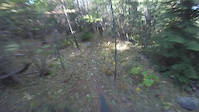
Trail is sweet but short. Rock drop at the start into a few gaps and some berms and continues into a faster section with some bigger jumps and then ends off with a few big jumps before spitting you out at the road across from wobbly pops

Access Info

Trailhead is at the 5.5 km party spot

Local Trail Association
Traditionally Indigenous Territory

Recent Activity on Trail

Past Week
  • 7 rides
  • 13.5 km average
6 Months
  • 56 rides
  • 13.8 km avg distance
All
  • 328 rides
  • Last: Jun 19, 2026
c1c2c3c4
January
February
March
April
May
June
July
August
September
October
November
December
update trails status or condition

Rubber Down Trail Reports

statusdatedescription
Jun 7, 2026 @ 7:33pm (America/Vancouver)
Jun 7, 2026
Mar 30, 2026 @ 8:10pm (America/Vancouver)
Mar 30, 2026
A bit of powdery snow, good dirt underneath it. Good fun
Oct 4, 2024 @ 11:36am
Oct 4, 2024
Jul 28, 2024 @ 1:24pm
Jul 28, 2024
Wood support for first gap has come apart
Jul 20, 2024 @ 11:27am
Jul 20, 2024
brought a hand saw and removed the fallen trees, all clear now.
more »
Status:
on Jun 7, 2026
Ideal
Avg: 4.6 (14 votes)
Your vote: 0

view (2,091)
close
3D
Trail Conditions
  • Unknown
  • Snow Groomed
  • Snow Packed
  • Snow Covered
  • Snow Cover Partial
  • Freeze/thaw Cycle
  • Icy
  • Prevalent Mud
  • Wet
  • Variable
  • Ideal
  • Dry
  • Very Dry
Trail Flow (Ridden Direction)
Trailforks scans users ridelogs to determine the most popular direction each trail is ridden. A good flowing trail network will have most trails flowing in a single direction according to their intension.
The colour categories are based on what percentage of riders are riding a trail in its intended direction.
  • > 96%
  • > 90%
  • > 80%
  • > 70%
  • > 50%
  • < 50%
  • bi-directional trail
  • no data
Trail Last Ridden
Trailforks scans ridelogs to determine the last time a trail was ridden.
  • < 2 days
  • < 1 week
  • < 2 weeks
  • < 1 month
  • < 6 months
  • > 6 months
Trail Ridden Direction
The intended direction a trail should be ridden.
  • Downhill Only
  • Downhill Primary
  • Both Directions
  • Uphill Primary
  • Uphill Only
  • One Direction
Contribute Details
Colors indicate trail is missing specified detail.
  • Description
  • Photos
  • Description & Photos
  • Videos
Trail Popularity ?
Trailforks scans ridelogs to determine which trails are ridden the most in the last 9 months. Trails are compared with nearby trails in the same city region with a possible 25 colour shades. Think of this as a heatmap, more rides = more kinetic energy = warmer colors.
  • most popular
  • popular
  • less popular
  • not popular
ATV/ORV/OHV Filter
Max Vehicle Width
inches
US Cell Coverage
Legend
cell carrier legend

Radar Time
Activity Recordings
Trailforks uses anonymized public activity data. ?
Activity Recordings
Trailforks uses anonymized public activity data. ?
Personal Heatmap
Activity Types
all / none
Options
2
Date range month
Winter Trails
Warning A routing network for winter maps does not exist. Selecting trails using the winter trails layer has been disabled.
Missing Trails
Most Popular
Least Popular
Trails are colored based on popularity. The more popular a trail is, the more red. Less popular trails trend towards green.
Jump Magnitude Heatmap
Heatmap of where riders jump on trails. Zoom in to see individual jumps, click circles to view jump details.
BC Backroad Status

Service Road Atlas is a free to use, community-driven service for viewing and creating reports on the numerous back-country service roads around B.C. and Alberta.

map legend
Slope Aspect
Direction the slope faces
Flat N NE E SE S SW W NW
Trails Deemphasized
Trails are shown in grey.
disable
Only show trails with no bike usage.
Enable
Suggested Layers
Based on selected activity type

    Save the current map location and zoom level as your default home location whenever this page is loaded.

    Save
        Directions to rubber-down trailhead (49.777890, -119.455570)

        Photos

        40 more »
        78 |
        Nov 17, 2025 @ 11:13pm
        Nov 17, 2025
        331 |
        Sep 28, 2022 @ 11:16am
        Sep 28, 2022
        247 |
        Nov 7, 2020 @ 9:57am
        Nov 7, 2020
        233 |
        May 10, 2020 @ 7:45am
        May 10, 2020

        Videos

        4 more »
        0:09 | 234 | Oct 24, 2021 , Kelowna
        Gillard GoPro POV - Rubber Down Trail Preview
        0:48 | 440 | May 10, 2021 , Kelowna
        Gillard GoPro POV - First Laps 2019
        0:52 | 797 | Apr 22, 2019 , Kelowna
        Gillard
        2:24 | 194 | Sep 16, 2017 , Kelowna

        Routes with this trail

        29 miles 4,465 ft 35
        Devilville Downhill - Climb Crawford trails to the KVR. Commute the KVR to the Gillard DH area, continue...
        22 miles 3,898 ft 43
        This route is a loop from to Gillard via Sloam. Bit of an epic with plenty of climbing to satisfy the hard...
        2 miles 3 ft 15 Shuttled
        Moose Knucle to Boss hogg will give you a good variety of trail with a mix of rock, roots and stunts!

        Reviews / Comments

        No reviews yet, be the first to write a review or ask a question.
        Use trail reports to comment on trail conditions.


        We hope you've been enjoying Trailforks!

        Create a FREE account to view trail comments and much more.

        • By smokeTF Pro Simpcw & contributors
        • #19188 - 3,933 views

        Frequently Asked Questions About Rubber Down

        Where is Rubber Down located?
        Rubber Down is located in Gillard, Kelowna, British Columbia, Canada. It is part of the Gillard trail network. The trailhead is located at coordinates 49.77789, -119.45557.
        How hard is Rubber Down?
        Rubber Down is rated as Double Black Diamond difficulty. The average grade is 13.3%.
        What is the elevation gain for Rubber Down?
        The trail has 140 ft of elevation descent. The elevation ranges from 2,851 ft to 2,992 ft.
        Is Rubber Down a point to point trail?
        Yes, Rubber Down is a point to point trail. The direction is Downhill Only. The trail type is singletrack.

        Hit the Trail

        Open in App

        Get this trail on your phone instantly.
        open trail in app

        Download Trail

        Save to wishlist, Garmin & download.
        save the trail

        Find Related Routes

        Find routes and users activities that include this trail.
        find routes for this trail

        You must enter a description before submitting.