more stats
2,205 ft
Distance
26 ft
Climb
-152 ft
Descent
00:03:02
Avg time
-127 ft
Altitude change
5,714 ft
Altitude min
5,842 ft
Altitude max
5,842 ft
Altitude start
5,715 ft
Altitude end
-5.8%
Grade
-30.9%
Grade max
13.5%
Grade min
302 ft
Distance climb
1,493 ft
Distance down
407 ft
Distance flat
00:03:02
Avg time

Rush Flow Details

  • Activities
    • Mountain Bike
    • E-Bike
    • Adaptive Bike
  • Riding Area
    Corner Canyon
    Draper, Utah
  • Difficulty Rating
  • Voted Difficulty
    Blue (4 votes)
  • Local Popularity
    100 in Mountain Biking [+]
    • 100 in E-Biking
  • Global Ranking
    #29251 in Mountain Biking [+]
    • #2914 in E-Biking
  • Trail Type
    Singletrack
  • Bike Type
    DH, AM, XC, Adaptive MTB
  • Direction
    Downhill Only
    Popular Direction Shown
  • Trail Visibility
    Always easy to follow
  • eBike Allowed
    Yes up to Class 1

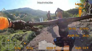
Flow trail is a bit tight at the top, but gets really fast as you transition to the lower Rush. Plenty of kick ups, jumps, drops, and huge berms. This is a favorite downhill trail for beginners and XC riders. The turns are frequent, it is difficult to get a lot of speed at the top, but it is great practice. A few little technical sections usually due to water damage or some skidding making brake bumps.

This is just the top where the full Rush Flow trail starts.

Adaptive Bike Info
aMTB Blue Rating: Intermediate features and steeper terrain.

Super fun for adaptive bikes

Local Trail Association
Traditionally Indigenous Territory

Recent Activity on Trail

Past Week
  • 94 rides
  • 13 miles average
6 Months
  • 1,115 rides
  • 12 miles avg distance
All
  • 8,075 rides
  • Last: Jun 17, 2026
c1c2c3c4
January
February
March
April
May
June
July
August
September
October
November
December
Status:
on Jun 11, 2026
Dry
Avg: 4.26 (29 votes)
Your vote: 0

view (60,437)
close
3D
Trail Conditions
  • Unknown
  • Snow Groomed
  • Snow Packed
  • Snow Covered
  • Snow Cover Partial
  • Freeze/thaw Cycle
  • Icy
  • Prevalent Mud
  • Wet
  • Variable
  • Ideal
  • Dry
  • Very Dry
Trail Flow (Ridden Direction)
Trailforks scans users ridelogs to determine the most popular direction each trail is ridden. A good flowing trail network will have most trails flowing in a single direction according to their intension.
The colour categories are based on what percentage of riders are riding a trail in its intended direction.
  • > 96%
  • > 90%
  • > 80%
  • > 70%
  • > 50%
  • < 50%
  • bi-directional trail
  • no data
Trail Last Ridden
Trailforks scans ridelogs to determine the last time a trail was ridden.
  • < 2 days
  • < 1 week
  • < 2 weeks
  • < 1 month
  • < 6 months
  • > 6 months
Trail Ridden Direction
The intended direction a trail should be ridden.
  • Downhill Only
  • Downhill Primary
  • Both Directions
  • Uphill Primary
  • Uphill Only
  • One Direction
Contribute Details
Colors indicate trail is missing specified detail.
  • Description
  • Photos
  • Description & Photos
  • Videos
Trail Popularity ?
Trailforks scans ridelogs to determine which trails are ridden the most in the last 9 months. Trails are compared with nearby trails in the same city region with a possible 25 colour shades. Think of this as a heatmap, more rides = more kinetic energy = warmer colors.
  • most popular
  • popular
  • less popular
  • not popular
ATV/ORV/OHV Filter
Max Vehicle Width
inches
US Cell Coverage
Legend
cell carrier legend

Radar Time
Activity Recordings
Trailforks uses anonymized public activity data. ?
Activity Recordings
Trailforks uses anonymized public activity data. ?
Personal Heatmap
Activity Types
all / none
Options
2
Date range month
Winter Trails
Warning A routing network for winter maps does not exist. Selecting trails using the winter trails layer has been disabled.
Missing Trails
Most Popular
Least Popular
Trails are colored based on popularity. The more popular a trail is, the more red. Less popular trails trend towards green.
Jump Magnitude Heatmap
Heatmap of where riders jump on trails. Zoom in to see individual jumps, click circles to view jump details.
BC Backroad Status

Service Road Atlas is a free to use, community-driven service for viewing and creating reports on the numerous back-country service roads around B.C. and Alberta.

map legend
Slope Aspect
Direction the slope faces
Flat N NE E SE S SW W NW
Trails Deemphasized
Trails are shown in grey.
disable
Only show trails with no bike usage.
Enable
Suggested Layers
Based on selected activity type

    Save the current map location and zoom level as your default home location whenever this page is loaded.

    Save
        Directions to rush-flow-182207 trailhead (40.488220, -111.820700)

        Photos

        22 more »
        43 |
        Aug 31, 2025 @ 11:15am
        Aug 31, 2025
        73 |
        Jun 29, 2023 @ 4:37pm
        Jun 29, 2023
        138 |
        Nov 10, 2021 @ 7:18pm
        Nov 10, 2021
        160 |
        Nov 10, 2021 @ 7:18pm
        Nov 10, 2021

        Videos

        8 more »
        youtuber We're Moving To Utah? (Salt Lake City Van Life)
        15:18 | 336 | Nov 19, 2023 , Draper
        youtuber MTB Riding Rush Flow, Draper, Utah, September...
        11:35 | 311 | Sep 29, 2023 , Draper
        Rush 06/09/2023
        9:59 | 152 | Apr 16, 2024 , Draper
        The Bored Life - Epic Rush while MTB the Rush...
        18:05 | 314 | Jul 18, 2022 , Draper

        Routes with this trail

        4.3 7 miles 1,278 ft 22 Loop
        This is a really popular option for folks to park at the skills park and make their way up to Rush. and...
        5.0 11 miles 2,040 ft 13 Loop
        Fun loop up to Jacob's Ladder then back over to come down Rush. Take up to the top, then to get to Jacob's...
        5.0 4 miles 869 ft 12 Loop
        Corner Canyon, Clarks to Rush loop. Clarks is one-way uphill for mountain bikes, Rush is downhill only, no...

        6 Reviews & Comments


        We hope you've been enjoying Trailforks!

        Create a FREE account to view trail comments and much more.

        • By toddTF Pro Trailforks & contributors
        • #182207 - 14,593 views

        Frequently Asked Questions About Rush Flow

        Where is Rush Flow located?
        Rush Flow is located in Corner Canyon, Draper, Utah, United States. It is part of the Corner Canyon trail network. The trailhead is located at coordinates 40.48822, -111.8207.
        How hard is Rush Flow?
        Rush Flow is rated as Blue difficulty. The average grade is 5.8%.
        What is the elevation gain for Rush Flow?
        Rush Flow has 26 ft of elevation gain. The trail has 152 ft of elevation descent. The elevation ranges from 5,714 ft to 5,842 ft.
        Is Rush Flow a point to point trail?
        Yes, Rush Flow is a point to point trail. The direction is Downhill Only. The trail type is singletrack.

        Hit the Trail

        Open in App

        Get this trail on your phone instantly.
        open trail in app

        Download Trail

        Save to wishlist, Garmin & download.
        save the trail

        Find Related Routes

        Find routes and users activities that include this trail.
        find routes for this trail

        You must enter a description before submitting.