



Open in App
Get this trail on your phone instantly.

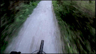
The north-most third of this trail is a wide, gravel path perfect for walking, bikes, strollers, bikes with trailers, etc. There's a lot of traffic on this part by the local community, including older folks, kids, dog walkers etc. It's good to get some fresh air and good access to the rest of the trail, but please watch for other trail users.
The middle third of this trail is wide singletrack through mixed deciduous and cedar forest. There is slightly less traffic on this part, after you get off the gravel.
There's a view of the bay in this area now that the trees are gone.
The southern-most third of the trail is single-track which starts in the clearcut and goes south through some woods and a grassy clearing before exiting on Governor street.
There are multiple smaller, neighborhood access trails and some forks and turns on this route. It's not clearly marked and you're likely to get "lost" once or twice before you find the right route, north to south (of vice versa). Things are changing and re-routing since 2018 and 2019 logging. It's a great place to explore and have a casual ride. Do not expect Galbraith-like flow, elevation change or technical features. Think "I'm riding my bike in the woods" and you'll have a great time.

| c1 | c2 | c3 | c4 |
|---|---|---|---|
January | February | March | April |
May | June | July | August |
September | October | November | December |


Service Road Atlas is a free to use, community-driven service for viewing and creating reports on the numerous back-country service roads around B.C. and Alberta.
Save the current map location and zoom level as your default home location whenever this page is loaded.
Save
No reviews yet, be the first to write a review or ask a question.
Use trail reports to comment on trail conditions.
We hope you've been enjoying Trailforks!
Create a FREE account to view trail comments and much more.
 & contributors
You must enter a description before submitting.

