more stats
4,367 ft
Distance
-525 ft
Descent
00:05:20
Avg time
-525 ft
Altitude change
3,594 ft
Altitude min
4,118 ft
Altitude max
4,118 ft
Altitude start
3,593 ft
Altitude end
-12%
Grade
-105.1%
Grade max
1.9%
Grade min
118 ft
Distance climb
4,055 ft
Distance down
194 ft
Distance flat
00:05:20
Avg time

SANDOKAN Details

  • Activities
    • Mountain Bike
  • Riding Area
    Calheta
    Funchal
  • AKA
    prazeres
  • Difficulty Rating
  • Local Popularity
    90 in Mountain Biking
  • Global Ranking
    #37470 in Mountain Biking
  • Trail Type
    Singletrack
  • Bike Type
    DH, AM, XC
  • Direction
    Downhill Primary
    Popular Direction Shown
  • Climb Difficulty
    Green
  • Physical Rating
    Easy
  • Season
    All year
  • Dogs Allowed
    Yes
  • Year Opened
    2013

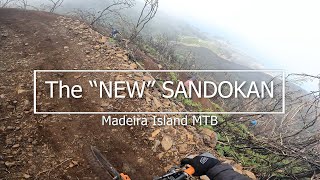
Pista pequena e rapida, pouca enclinação, vale muito a pena pelo cenario e o proprio trilho, tecnica em algumas zonas de pedra.

Access Info

Após o entroncamento de quem vem dos Prazeres para o Paul da Serra uns 300 metros á direita.

Local Trail Association

Recent Activity on Trail

Past Week
  • 1 rides
  • 37 miles average
6 Months
  • 40 rides
  • 25 miles avg distance
All
  • 127 rides
  • Last: Jun 10, 2026
c1c2c3c4
January
February
March
April
May
June
July
August
September
October
November
December
Status:
on Apr 14, 2026
Wet
Avg: 4.44 (5 votes)
Your vote: 0

view (801)
close
3D
Trail Conditions
  • Unknown
  • Snow Groomed
  • Snow Packed
  • Snow Covered
  • Snow Cover Partial
  • Freeze/thaw Cycle
  • Icy
  • Prevalent Mud
  • Wet
  • Variable
  • Ideal
  • Dry
  • Very Dry
Trail Flow (Ridden Direction)
Trailforks scans users ridelogs to determine the most popular direction each trail is ridden. A good flowing trail network will have most trails flowing in a single direction according to their intension.
The colour categories are based on what percentage of riders are riding a trail in its intended direction.
  • > 96%
  • > 90%
  • > 80%
  • > 70%
  • > 50%
  • < 50%
  • bi-directional trail
  • no data
Trail Last Ridden
Trailforks scans ridelogs to determine the last time a trail was ridden.
  • < 2 days
  • < 1 week
  • < 2 weeks
  • < 1 month
  • < 6 months
  • > 6 months
Trail Ridden Direction
The intended direction a trail should be ridden.
  • Downhill Only
  • Downhill Primary
  • Both Directions
  • Uphill Primary
  • Uphill Only
  • One Direction
Contribute Details
Colors indicate trail is missing specified detail.
  • Description
  • Photos
  • Description & Photos
  • Videos
Trail Popularity ?
Trailforks scans ridelogs to determine which trails are ridden the most in the last 9 months. Trails are compared with nearby trails in the same city region with a possible 25 colour shades. Think of this as a heatmap, more rides = more kinetic energy = warmer colors.
  • most popular
  • popular
  • less popular
  • not popular
ATV/ORV/OHV Filter
Max Vehicle Width
inches
US Cell Coverage
Legend
cell carrier legend

Radar Time
Activity Recordings
Trailforks uses anonymized public activity data. ?
Activity Recordings
Trailforks uses anonymized public activity data. ?
Personal Heatmap
Activity Types
all / none
Options
2
Date range month
Winter Trails
Warning A routing network for winter maps does not exist. Selecting trails using the winter trails layer has been disabled.
Missing Trails
Most Popular
Least Popular
Trails are colored based on popularity. The more popular a trail is, the more red. Less popular trails trend towards green.
Jump Magnitude Heatmap
Heatmap of where riders jump on trails. Zoom in to see individual jumps, click circles to view jump details.
BC Backroad Status

Service Road Atlas is a free to use, community-driven service for viewing and creating reports on the numerous back-country service roads around B.C. and Alberta.

map legend
Slope Aspect
Direction the slope faces
Flat N NE E SE S SW W NW
Trails Deemphasized
Trails are shown in grey.
disable
Only show trails with no bike usage.
Enable
Suggested Layers
Based on selected activity type

    Save the current map location and zoom level as your default home location whenever this page is loaded.

    Save
        Directions to sandokan trailhead (32.784390, -17.182290)

        Photos

        27 more »
        76 |
        Sep 13, 2023 @ 2:21pm
        Sep 13, 2023
        67 |
        Apr 22, 2023 @ 3:11pm
        Apr 22, 2023
        64 |
        Apr 22, 2023 @ 3:11pm
        Apr 22, 2023
        52 |
        Mar 27, 2023 @ 4:09pm
        Mar 27, 2023

        Videos

        7 more »
        youtuber Madeira Island MTB 'SANDOKAN'
        5:33 | 279 | Jan 5, 2023 , Funchal
        youtuber They've rebuild the whole trail from the...
        5:45 | 162 | Apr 29, 2024 , Funchal
        Madeira 2018: Sandokan
        5:48 | 317 | May 17, 2020 , Funchal
        MTB - Madeira 2k18
        5:39 | 256 | May 7, 2019 , Funchal

        Routes with this trail

        5.0 28 miles 6,351 ft 8 Point to Point Race
        Itinerary of the Sandokan Enduro 2015
        14 miles 2,634 ft 7 Point to Point
        CARQUEJA ENDURO SERIES PEC 1 SANDOKAN PEC 2 NEGRAS PEC 3 PARGOS PEC 4 CATRIPO PEC 5 POMBOS PEC 6 CORUJEIRA...
        sandokan 2019 Archived
        25 miles 4,595 ft 5 Race
        VII Madeira Island Sandokan Enduro. Mountainbike Race event. The magic sunset trails!!!

        Reviews / Comments

        No reviews yet, be the first to write a review or ask a question.
        Use trail reports to comment on trail conditions.


        We hope you've been enjoying Trailforks!

        Create a FREE account to view trail comments and much more.

        • By cliogtt & contributors
        • #24641 - 4,863 views

        Frequently Asked Questions About SANDOKAN

        Where is SANDOKAN located?
        SANDOKAN is located in Calheta, Funchal, Portugal. It is part of the Calheta trail network. The trailhead is located at coordinates 32.78439, -17.18229.
        How hard is SANDOKAN?
        SANDOKAN is rated as Blue difficulty. The physical rating is Easy. The average grade is 12%. The climb difficulty is rated Green.
        What is the elevation gain for SANDOKAN?
        The trail has 160 m of elevation descent. The elevation ranges from 1,095 m to 1,255 m.
        Is SANDOKAN a point to point trail?
        SANDOKAN is not a point to point trail. The direction is Downhill Primary. The trail type is singletrack.

        Hit the Trail

        Open in App

        Get this trail on your phone instantly.
        open trail in app

        Download Trail

        Save to wishlist, Garmin & download.
        save the trail

        Find Related Routes

        Find routes and users activities that include this trail.
        find routes for this trail

        You must enter a description before submitting.