more stats
2.4 miles
Distance
6 ft
Climb
-186 ft
Descent
00:10:39
Avg time
-180 ft
Altitude change
368 ft
Altitude min
549 ft
Altitude max
549 ft
Altitude start
367 ft
Altitude end
-1.4%
Grade
-9%
Grade max
4.7%
Grade min
512 ft
Distance climb
2 miles
Distance down
3,901 ft
Distance flat
00:10:39
Avg time

Sawmill Valley Details

  • Activities
    • Mountain Bike
    • E-Bike
    • Gravel Bike
    • Hike
    • Trail Running
  • Riding Area
    Sawmill Creek
    Mississauga, Ontario
  • AKA
    Sawmill Trail
  • Difficulty Rating
  • Local Popularity
    5 in Mountain Biking [+]
    • 5 in E-Biking
    • 5 in Trail Running
    • 5 in Hiking
  • Global Ranking
    #126081 in Mountain Biking [+]
    • #218598 in Trail Running
    • #233055 in Hiking
  • Trail Type
    Gravel Path
  • Bike Type
    XC, CX, Gravel
  • Direction
    Both Directions
    Popular Direction Shown
  • Climb Difficulty
    Green
  • Physical Rating
    Easy
  • Trail Visibility
    Always easy to follow
  • Family Friendly
    Yes
  • Dogs Allowed
    Yes
  • eBike Allowed
    Yes up to Class 1
  • Ride in Rain
    Yes
  • Land Owner

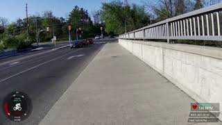
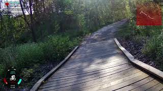
This trail follows the Credit River Valley from access point at Burnamthorpe Road at Walnut Grvoe Rd. and traverses through to the Junction of MIssissauga and the South Millway.

The beautiful trees, quiet river and the sounds of birds can be heard throughout this pleasant valley trip. This is one of many trails in and around Mississauga that allow for the use of bicylces on and off roads, through natural and urban settings.

Local Trail Association

Recent Activity on Trail

Past Week
  • 0 rides
  •  
6 Months
  • 0 rides
  •  
All
  • 15 rides
  • Last: Apr 20, 2025
c1c2c3c4
January
February
March
April
May
June
July
August
September
October
November
December
update trails status or condition

Sawmill Valley Trail Reports

statusdatedescription
Apr 15, 2026 @ 10:54am (America/Toronto)
Apr 15, 2026
the trail is closed west of Erin Mills Parkway at Rogers Road Trail. Cannot travel north due to construction.
Nov 15, 2025 @ 6:12pm (America/Toronto)
Nov 15, 2025
Major erosion (major ruts or slumping, large boulders and roots exposed due to erosion)
Oct 18, 2024 @ 12:00pm
Oct 18, 2024
'Major water erosion damage. Boardwalk is wobbly and marked closed by the city.' No repairs or work as of 20241018. Boardwalks still washed out...
Aug 29, 2024 @ 8:19am
Aug 29, 2024
Major water erosion damage. Boardwalk is wobbly and marked closed by the city.
Sep 24, 2020 @ 11:15am
Sep 24, 2020
more »
Status:
on Apr 15, 2026
Avg: 4.13 (1 votes)
Your vote: 0

view (178)
close
3D
Trail Conditions
  • Unknown
  • Snow Groomed
  • Snow Packed
  • Snow Covered
  • Snow Cover Partial
  • Freeze/thaw Cycle
  • Icy
  • Prevalent Mud
  • Wet
  • Variable
  • Ideal
  • Dry
  • Very Dry
Trail Flow (Ridden Direction)
Trailforks scans users ridelogs to determine the most popular direction each trail is ridden. A good flowing trail network will have most trails flowing in a single direction according to their intension.
The colour categories are based on what percentage of riders are riding a trail in its intended direction.
  • > 96%
  • > 90%
  • > 80%
  • > 70%
  • > 50%
  • < 50%
  • bi-directional trail
  • no data
Trail Last Ridden
Trailforks scans ridelogs to determine the last time a trail was ridden.
  • < 2 days
  • < 1 week
  • < 2 weeks
  • < 1 month
  • < 6 months
  • > 6 months
Trail Ridden Direction
The intended direction a trail should be ridden.
  • Downhill Only
  • Downhill Primary
  • Both Directions
  • Uphill Primary
  • Uphill Only
  • One Direction
Contribute Details
Colors indicate trail is missing specified detail.
  • Description
  • Photos
  • Description & Photos
  • Videos
Trail Popularity ?
Trailforks scans ridelogs to determine which trails are ridden the most in the last 9 months. Trails are compared with nearby trails in the same city region with a possible 25 colour shades. Think of this as a heatmap, more rides = more kinetic energy = warmer colors.
  • most popular
  • popular
  • less popular
  • not popular
ATV/ORV/OHV Filter
Max Vehicle Width
inches
US Cell Coverage
Legend
cell carrier legend

Radar Time
Activity Recordings
Trailforks uses anonymized public activity data. ?
Activity Recordings
Trailforks uses anonymized public activity data. ?
Personal Heatmap
Activity Types
all / none
Options
2
Date range month
Winter Trails
Warning A routing network for winter maps does not exist. Selecting trails using the winter trails layer has been disabled.
Missing Trails
Most Popular
Least Popular
Trails are colored based on popularity. The more popular a trail is, the more red. Less popular trails trend towards green.
Jump Magnitude Heatmap
Heatmap of where riders jump on trails. Zoom in to see individual jumps, click circles to view jump details.
BC Backroad Status

Service Road Atlas is a free to use, community-driven service for viewing and creating reports on the numerous back-country service roads around B.C. and Alberta.

map legend
Slope Aspect
Direction the slope faces
Flat N NE E SE S SW W NW
Trails Deemphasized
Trails are shown in grey.
disable
Only show trails with no bike usage.
Enable
Suggested Layers
Based on selected activity type

    Save the current map location and zoom level as your default home location whenever this page is loaded.

    Save
        Directions to sawmill-valley trailhead (43.548070, -79.701180)

        Photos

        3 more »
        116 |
        May 9, 2020 @ 6:40pm
        May 9, 2020
        116 |
        May 9, 2020 @ 6:40pm
        May 9, 2020
        329 |
        Jan 6, 2013 @ 5:40am
        Jan 6, 2013

        Videos

        2 more »
        1st Sunday Ride - Part 2
        0:45 | 215 | May 17, 2021 , Mississauga
        1st Sunday Ride - Part 3
        2:51 | 216 | May 17, 2021 , Mississauga

        2 Reviews & Comments


        We hope you've been enjoying Trailforks!

        Create a FREE account to view trail comments and much more.

        • By gnarcissistTF Pro & contributors
        • #213685 - 4,613 views

        Frequently Asked Questions About Sawmill Valley

        Where is Sawmill Valley located?
        Sawmill Valley is located in Sawmill Creek, Mississauga, Ontario, Canada. It is part of the Sawmill Creek trail network. The trailhead is located at coordinates 43.54807, -79.70118.
        How hard is Sawmill Valley?
        Sawmill Valley is rated as Green difficulty. The physical rating is Easy. The average grade is 1.4%. The climb difficulty is rated Green.
        What is the elevation gain for Sawmill Valley?
        Sawmill Valley has 2 m of elevation gain. The trail has 57 m of elevation descent. The elevation ranges from 112 m to 167 m.
        Is Sawmill Valley a point to point trail?
        Sawmill Valley is not a point to point trail. The direction is Both Directions. The trail type is gravel path.

        Hit the Trail

        Open in App

        Get this trail on your phone instantly.
        open trail in app

        Download Trail

        Save to wishlist, Garmin & download.
        save the trail

        Find Related Routes

        Find routes and users activities that include this trail.
        find routes for this trail

        You must enter a description before submitting.