more stats
1.3 miles
Distance
-350 ft
Descent
00:08:02
Avg time
-350 ft
Altitude change
7,726 ft
Altitude min
8,076 ft
Altitude max
8,076 ft
Altitude start
7,726 ft
Altitude end
-4.9%
Grade
-19.1%
Grade max
3.3%
Grade min
141 ft
Distance climb
1 mile
Distance down
404 ft
Distance flat
00:08:02
Avg time

Schultz Creek Details

  • Activities
    • Mountain Bike
    • Horse
    • Hike
    • Trail Running
  • Riding Area
    MEDL (Mount Elden Dry Lakes)
    Flagstaff, Arizona
  • Ref Number
    152
  • Difficulty Rating
  • Voted Difficulty
    Blue (9 votes)
  • Local Popularity
    100 in Mountain Biking [+]
    • 80 in Trail Running
    • 85 in Hiking
    • 100 in Horseback
  • Global Ranking
    #1005 in Mountain Biking [+]
    • #1526 in Trail Running
    • #1561 in Hiking
  • Hiking SAC Scale
    T1 Hiking
  • Trail Type
    Singletrack
  • Bike Type
    AM, XC
  • Direction
    Both Directions
    Popular Direction Shown
  • Climb Difficulty
    Blue
  • Physical Rating
    Easy
  • Trail Visibility
    Always easy to follow
  • Dogs Allowed
    Yes
  • eBike Allowed
  • TTFs on Trail
    Rock Garden

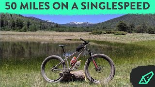
One of the most enjoyable green circle trails I've ridden. While you won't get technical, rocks or big jumps, you will get a long, flowy fast trail. A good climb and an enjoyable decent. Multi-use trail so be courteous to other trail users. Remember to yield to uphill riders. In the Spring the creek flows so you will probably get wet.

Trail Supporters

  • USFS
    Land Manager
Local Trail Association

Recent Activity on Trail

Past Week
  • 27 rides
  • 14 miles average
6 Months
  • 203 rides
  • 17 miles avg distance
All
  • 1,796 rides
  • Last: Jun 20, 2026
c1c2c3c4
January
February
March
April
May
June
July
August
September
October
November
December
Status:
on Jun 3, 2026
Very Dry
Avg: 4.2 (43 votes)
Your vote: 0

view (9,918)
close
3D
Trail Conditions
  • Unknown
  • Snow Groomed
  • Snow Packed
  • Snow Covered
  • Snow Cover Partial
  • Freeze/thaw Cycle
  • Icy
  • Prevalent Mud
  • Wet
  • Variable
  • Ideal
  • Dry
  • Very Dry
Trail Flow (Ridden Direction)
Trailforks scans users ridelogs to determine the most popular direction each trail is ridden. A good flowing trail network will have most trails flowing in a single direction according to their intension.
The colour categories are based on what percentage of riders are riding a trail in its intended direction.
  • > 96%
  • > 90%
  • > 80%
  • > 70%
  • > 50%
  • < 50%
  • bi-directional trail
  • no data
Trail Last Ridden
Trailforks scans ridelogs to determine the last time a trail was ridden.
  • < 2 days
  • < 1 week
  • < 2 weeks
  • < 1 month
  • < 6 months
  • > 6 months
Trail Ridden Direction
The intended direction a trail should be ridden.
  • Downhill Only
  • Downhill Primary
  • Both Directions
  • Uphill Primary
  • Uphill Only
  • One Direction
Contribute Details
Colors indicate trail is missing specified detail.
  • Description
  • Photos
  • Description & Photos
  • Videos
Trail Popularity ?
Trailforks scans ridelogs to determine which trails are ridden the most in the last 9 months. Trails are compared with nearby trails in the same city region with a possible 25 colour shades. Think of this as a heatmap, more rides = more kinetic energy = warmer colors.
  • most popular
  • popular
  • less popular
  • not popular
ATV/ORV/OHV Filter
Max Vehicle Width
inches
US Cell Coverage
Legend
cell carrier legend

Radar Time
Activity Recordings
Trailforks uses anonymized public activity data. ?
Activity Recordings
Trailforks uses anonymized public activity data. ?
Personal Heatmap
Activity Types
all / none
Options
2
Date range month
Winter Trails
Warning A routing network for winter maps does not exist. Selecting trails using the winter trails layer has been disabled.
Missing Trails
Most Popular
Least Popular
Trails are colored based on popularity. The more popular a trail is, the more red. Less popular trails trend towards green.
Jump Magnitude Heatmap
Heatmap of where riders jump on trails. Zoom in to see individual jumps, click circles to view jump details.
BC Backroad Status

Service Road Atlas is a free to use, community-driven service for viewing and creating reports on the numerous back-country service roads around B.C. and Alberta.

map legend
Slope Aspect
Direction the slope faces
Flat N NE E SE S SW W NW
Trails Deemphasized
Trails are shown in grey.
disable
Only show trails with no bike usage.
Enable
Suggested Layers
Based on selected activity type

    Save the current map location and zoom level as your default home location whenever this page is loaded.

    Save
        Directions to schultz-creek trailhead (35.284660, -111.631860)

        Photos

        30 more »
        263 |
        Aug 16, 2021 @ 5:54am
        Aug 16, 2021
        232 |
        Oct 6, 2020 @ 10:14pm
        Oct 6, 2020
        212 |
        Oct 6, 2020 @ 10:13pm
        Oct 6, 2020
        261 |
        Aug 8, 2020 @ 6:18pm
        Aug 8, 2020

        Videos

        18 more »
        youtuber My Hardest Day Yet: 50 Miles (80km) on a...
        26:05 | 549 | Jul 30, 2020 , Flagstaff
        youtuber A Hidden Gem | Flagstaff, Arizona.
        10:07 | 1025 | Nov 27, 2019 , Flagstaff
        youtuber Schultz Creek Trail in Flagstaff Arizona (Top...
        21:39 | 1220 | Oct 1, 2019 , Flagstaff
        youtuber 9k Feet & 7 Miles of DH: This Is Flagstaff, AZ
        9:02 | 313 | Dec 6, 2021 , Flagstaff

        Routes with this trail

        4.4 48 miles 4,910 ft 9 Loop
        This route encircles Humphrey's Peak - the highest point in Arizona at 12,635'. This is a high alpine ride...
        4.0 184 miles 10,428 ft 7
        This 185-mile loop follows quiet dirt roads and two-tracks through woodlands and grasslands among 800+...
        23 miles 3,005 ft 8 Loop
        Sunset, and Shultz from Absolute Bikes. Bike routes and paths are used to get to and from the trail.

        16 Reviews & Comments


        We hope you've been enjoying Trailforks!

        Create a FREE account to view trail comments and much more.

        • By toddTF Pro Trailforks & contributors
        • #16331 - 19,164 views

        Frequently Asked Questions About Schultz Creek

        Where is Schultz Creek located?
        Schultz Creek is located in MEDL (Mount Elden Dry Lakes), Flagstaff, Arizona, United States. It is part of the MEDL (Mount Elden Dry Lakes) trail network. The trailhead is located at coordinates 35.28466, -111.63186.
        How hard is Schultz Creek?
        Schultz Creek is rated as Green difficulty. The physical rating is Easy. The average grade is 4.9%. The climb difficulty is rated Blue.
        What is the elevation gain for Schultz Creek?
        The trail has 350 ft of elevation descent. The elevation ranges from 7,726 ft to 8,076 ft.
        Is Schultz Creek a point to point trail?
        Schultz Creek is not a point to point trail. The direction is Both Directions. The trail type is singletrack.

        Hit the Trail

        Open in App

        Get this trail on your phone instantly.
        open trail in app

        Download Trail

        Save to wishlist, Garmin & download.
        save the trail

        Find Related Routes

        Find routes and users activities that include this trail.
        find routes for this trail

        You must enter a description before submitting.