more stats
1.2 miles
Distance
52 ft
Climb
-292 ft
Descent
00:07:48
Avg time
-240 ft
Altitude change
745 ft
Altitude min
987 ft
Altitude max
984 ft
Altitude start
745 ft
Altitude end
-3.8%
Grade
-35.6%
Grade max
9.9%
Grade min
1,306 ft
Distance climb
3,068 ft
Distance down
1,913 ft
Distance flat
00:07:48
Avg time

Scorpion Details

  • Activities
    • Mountain Bike
    • E-Bike
  • Riding Area
  • Difficulty Rating
  • Voted Difficulty
    Blue (1 vote)
  • Local Popularity
    100 in Mountain Biking [+]
    • 100 in E-Biking
  • Global Ranking
    #681 in Mountain Biking [+]
    • #2127 in E-Biking
  • Trail Type
    Singletrack
  • Bike Type
    AM, XC
  • Direction
    Downhill Only[+]
    Popular Direction Shown
    • Downhill Only for E-Biking
  • Physical Rating
    Moderate
  • Season
    all seasons
  • eBike Allowed
    Yes up to Class 1
  • TTFs on Trail
    Berm, Bridge, Log Ride
  • Ride in Rain
    Yes

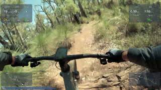
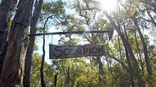
Scorpion is a moderate downhill trail, with lots of wooden berms. There are a few large tree trunk bridges for those who are game - though B-lines are always available.

Trail Supporters
  • Hillary's Boat and Tackle
    Sponsor
Local Trail Association
Traditionally Indigenous Territory

Recent Activity on Trail

Past Week
  • 9 rides
  • 19 miles average
6 Months
  • 227 rides
  • 13 miles avg distance
All
  • 2,734 rides
  • Last: Jun 28, 2026
c1c2c3c4
January
February
March
April
May
June
July
August
September
October
November
December
Status:
on Jun 21, 2026
Ideal
Avg: 4.43 (15 votes)
Your vote: 0

view (15,489)
close
3D
Trail Conditions
  • Unknown
  • Snow Groomed
  • Snow Packed
  • Snow Covered
  • Snow Cover Partial
  • Freeze/thaw Cycle
  • Icy
  • Prevalent Mud
  • Wet
  • Variable
  • Ideal
  • Dry
  • Very Dry
Trail Flow (Ridden Direction)
Trailforks scans users ridelogs to determine the most popular direction each trail is ridden. A good flowing trail network will have most trails flowing in a single direction according to their intension.
The colour categories are based on what percentage of riders are riding a trail in its intended direction.
  • > 96%
  • > 90%
  • > 80%
  • > 70%
  • > 50%
  • < 50%
  • bi-directional trail
  • no data
Trail Last Ridden
Trailforks scans ridelogs to determine the last time a trail was ridden.
  • < 2 days
  • < 1 week
  • < 2 weeks
  • < 1 month
  • < 6 months
  • > 6 months
Trail Ridden Direction
The intended direction a trail should be ridden.
  • Downhill Only
  • Downhill Primary
  • Both Directions
  • Uphill Primary
  • Uphill Only
  • One Direction
Contribute Details
Colors indicate trail is missing specified detail.
  • Description
  • Photos
  • Description & Photos
  • Videos
Trail Popularity ?
Trailforks scans ridelogs to determine which trails are ridden the most in the last 9 months. Trails are compared with nearby trails in the same city region with a possible 25 colour shades. Think of this as a heatmap, more rides = more kinetic energy = warmer colors.
  • most popular
  • popular
  • less popular
  • not popular
ATV/ORV/OHV Filter
Max Vehicle Width
inches
US Cell Coverage
Legend
cell carrier legend

Radar Time
Activity Recordings
Trailforks uses anonymized public activity data. ?
Activity Recordings
Trailforks uses anonymized public activity data. ?
Personal Heatmap
Activity Types
all / none
Options
2
Date range month
Winter Trails
Warning A routing network for winter maps does not exist. Selecting trails using the winter trails layer has been disabled.
Missing Trails
Most Popular
Least Popular
Trails are colored based on popularity. The more popular a trail is, the more red. Less popular trails trend towards green.
Jump Magnitude Heatmap
Heatmap of where riders jump on trails. Zoom in to see individual jumps, click circles to view jump details.
BC Backroad Status

Service Road Atlas is a free to use, community-driven service for viewing and creating reports on the numerous back-country service roads around B.C. and Alberta.

map legend
Slope Aspect
Direction the slope faces
Flat N NE E SE S SW W NW
Trails Deemphasized
Trails are shown in grey.
disable
Only show trails with no bike usage.
Enable
Suggested Layers
Based on selected activity type

    Save the current map location and zoom level as your default home location whenever this page is loaded.

    Save
        Directions to scorpion-17843 trailhead (-31.973470, 116.148970)

        Photos

        19 more »
        55 |
        Jul 25, 2025 @ 7:45pm
        Jul 25, 2025
        99 |
        Aug 1, 2021 @ 5:50am
        Aug 1, 2021
        80 |
        Apr 17, 2021 @ 8:51pm
        Apr 17, 2021
        89 |
        Apr 17, 2021 @ 8:43pm
        Apr 17, 2021

        Videos

        8 more »
        Scorpion  28 February 2026
        5:38 | 36 | Mar 16, 2026 , Kalamunda
        Scorpion Trail - Kalamunda MTB | Scott Spark...
        2:38 | 323 | Oct 14, 2023 , Kalamunda
        Kalamunda Scorpion Downhill
        5:55 | 609 | Nov 24, 2021 , Kalamunda
        One Trail Wonder: Scorpion
        1005 | Oct 17, 2017 , Kalamunda

        Trail Lists

        Routes with this trail

        4.0 9 miles 1,108 ft 32 Out & Back
        A great chance to get several great descents into one ride. It is also easy to add repeats of anyone of...
        4.0 17 miles 1,667 ft 50 Loop
        Camel Farm Loop with a bit of a challenge
        2.5 32 miles 3,534 ft 35 Loop
        Kalamunda 50 is a yearly event held in and around the Kalamunda trails

        1 Review & Comments


        We hope you've been enjoying Trailforks!

        Create a FREE account to view trail comments and much more.

        • By BELLMACHER & contributors
        • #17843 - 6,590 views

        Frequently Asked Questions About Scorpion

        Where is Scorpion located?
        Scorpion is located in Kalamunda Trail Network, Kalamunda, Australia. It is part of the Kalamunda Trail Network trail network. The trailhead is located at coordinates -31.97347, 116.14897.
        How hard is Scorpion?
        Scorpion is rated as Blue difficulty. The physical rating is Moderate. The average grade is 3.8%.
        What is the elevation gain for Scorpion?
        Scorpion has 16 m of elevation gain. The trail has 89 m of elevation descent. The elevation ranges from 227 m to 301 m.
        Is Scorpion a point to point trail?
        Yes, Scorpion is a point to point trail. The direction is Downhill Only. The trail type is singletrack.

        Hit the Trail

        Open in App

        Get this trail on your phone instantly.
        open trail in app

        Download Trail

        Save to wishlist, Garmin & download.
        save the trail

        Find Related Routes

        Find routes and users activities that include this trail.
        find routes for this trail

        You must enter a description before submitting.