more stats
1.4 miles
Distance
280 ft
Climb
-454 ft
Descent
00:18:56
Avg time
-174 ft
Altitude change
2,173 ft
Altitude min
2,592 ft
Altitude max
2,347 ft
Altitude start
2,172 ft
Altitude end
-2.4%
Grade
-36.7%
Grade max
30.5%
Grade min
2,635 ft
Distance climb
4,137 ft
Distance down
587 ft
Distance flat
00:18:56
Avg time

Section 102 Details

  • Activities
    • Mountain Bike
    • E-Bike
    • Hike
    • Trail Running
  • Riding Area
    No Flow Zone
    Whistler, British Columbia
  • Difficulty Rating
  • Local Popularity
    20 in Mountain Biking [+]
    • 15 in E-Biking
    • 20 in Trail Running
    • 20 in Hiking
  • Global Ranking
    #138055 in Mountain Biking [+]
    • #144859 in E-Biking
    • #128533 in Trail Running
    • #121703 in Hiking
  • Hiking SAC Scale
    T2 Mountain Hiking
  • Trail Type
    Singletrack
  • Bike Type
    AM, XC
  • Direction
    One Direction
    Popular Direction Shown
  • Climb Difficulty
    Black Diamond
  • Physical Rating
    Hard
  • Dogs Allowed
    Yes
  • eBike Allowed
    Yes up to Class 1
  • TTFs on Trail
    Rock Face, Rock Garden, Teeter Totter
  • Ride in Rain
    Yes

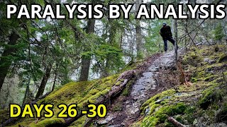
Section 102 is another old-school classic that winds its way from Emerald to the Cougar Mountain road. It is often linked with Kill Me Thrill Me but is substantially more difficult to clean so prepare for some hike-a-bike unless you are a very strong technical climber. As is the case with the other Emerald trails, the terrain is rocky so make sure so have a spare tube. Beware of the teeter-totter at the very end of the trail - it has claimed many victims over the years

Access Info

The trail is access from the top of Emerald via the same road as Shit Happens. Bear right as the access road switches back to the water tank and continue taking the right trail past a couple more forks. After a slight descent you reach a small lake....Section 102 starts on the right-hand side. After a few metres, switch-back to the right and start climbing

Local Trail Association

Recent Activity on Trail

Past Week
  • 0 rides
  •  
6 Months
  • 0 rides
  •  
All
  • 48 rides
  • Last: May 24, 2026
c1c2c3c4
January
February
March
April
May
June
July
August
September
October
November
December
update trails status or condition

Section 102 Trail Reports

statusdatedescription
Apr 22, 2026 @ 8:01pm (America/Vancouver)
Apr 22, 2026
cleared and good to ride from the Azrael junction.
Aug 18, 2025 @ 3:03pm
Aug 18, 2025
reporter Tree cleared.
Aug 17, 2025 @ 9:21am
Aug 17, 2025
Big tree across trail, closer to Cougar mountain end
Aug 1, 2025 @ 12:40pm
Aug 1, 2025
reporter Tree cleared. GTG
Jul 25, 2025 @ 10:40am
Jul 25, 2025
Tree across trail on the descent to cougar. To big for one person to move by hand. Should be easy enough with a hand saw
more »
Status:
on Apr 22, 2026
Ideal
Avg: 3.43 (10 votes)
Your vote: 0

view (267)
close
3D
Trail Conditions
  • Unknown
  • Snow Groomed
  • Snow Packed
  • Snow Covered
  • Snow Cover Partial
  • Freeze/thaw Cycle
  • Icy
  • Prevalent Mud
  • Wet
  • Variable
  • Ideal
  • Dry
  • Very Dry
Trail Flow (Ridden Direction)
Trailforks scans users ridelogs to determine the most popular direction each trail is ridden. A good flowing trail network will have most trails flowing in a single direction according to their intension.
The colour categories are based on what percentage of riders are riding a trail in its intended direction.
  • > 96%
  • > 90%
  • > 80%
  • > 70%
  • > 50%
  • < 50%
  • bi-directional trail
  • no data
Trail Last Ridden
Trailforks scans ridelogs to determine the last time a trail was ridden.
  • < 2 days
  • < 1 week
  • < 2 weeks
  • < 1 month
  • < 6 months
  • > 6 months
Trail Ridden Direction
The intended direction a trail should be ridden.
  • Downhill Only
  • Downhill Primary
  • Both Directions
  • Uphill Primary
  • Uphill Only
  • One Direction
Contribute Details
Colors indicate trail is missing specified detail.
  • Description
  • Photos
  • Description & Photos
  • Videos
Trail Popularity ?
Trailforks scans ridelogs to determine which trails are ridden the most in the last 9 months. Trails are compared with nearby trails in the same city region with a possible 25 colour shades. Think of this as a heatmap, more rides = more kinetic energy = warmer colors.
  • most popular
  • popular
  • less popular
  • not popular
ATV/ORV/OHV Filter
Max Vehicle Width
inches
US Cell Coverage
Legend
cell carrier legend

Radar Time
Activity Recordings
Trailforks uses anonymized public activity data. ?
Activity Recordings
Trailforks uses anonymized public activity data. ?
Personal Heatmap
Activity Types
all / none
Options
2
Date range month
Winter Trails
Warning A routing network for winter maps does not exist. Selecting trails using the winter trails layer has been disabled.
Missing Trails
Most Popular
Least Popular
Trails are colored based on popularity. The more popular a trail is, the more red. Less popular trails trend towards green.
Jump Magnitude Heatmap
Heatmap of where riders jump on trails. Zoom in to see individual jumps, click circles to view jump details.
BC Backroad Status

Service Road Atlas is a free to use, community-driven service for viewing and creating reports on the numerous back-country service roads around B.C. and Alberta.

map legend
Slope Aspect
Direction the slope faces
Flat N NE E SE S SW W NW
Trails Deemphasized
Trails are shown in grey.
disable
Only show trails with no bike usage.
Enable
Suggested Layers
Based on selected activity type

    Save the current map location and zoom level as your default home location whenever this page is loaded.

    Save
        Directions to section-102 trailhead (50.163610, -122.933820)

        Photos

        19 more »
        117 |
        Oct 10, 2020 @ 4:58pm
        Oct 10, 2020
        181 |
        Jun 9, 2020 @ 5:54pm
        Jun 9, 2020
        178 |
        May 17, 2018 @ 11:50pm
        May 17, 2018
        209 |
        Aug 19, 2017 @ 11:33pm
        Aug 19, 2017

        Videos

        1 more »
        youtuber Could I Actually Ride 30 Different MTB Trails...
        14:42 | 135 | May 1, 2024 , Whistler

        Trail Lists

        Routes with this trail

        23 miles 5,361 ft 33
        This is the Thrill Course for WORCA Dirty 30. Registration link:...
        6 miles 2,098 ft 7 Loop
        Gargamel is one of Whistler's iconic gnarly, technical trails that is still very much worth riding. Expect...
        5.0 41 miles 9,388 ft 52 Point to Point Race
        WORCA’S EPIC ADVENTURE OF WHISTLER’S INCREDIBLE SINGLE TRACK! Mark you calendar...July 10th...This...

        Trail Products

        3 Reviews & Comments


        We hope you've been enjoying Trailforks!

        Create a FREE account to view trail comments and much more.

        • By canadakaTF Pro Trailforks & contributors
        • #4824 - 4,287 views

        Frequently Asked Questions About Section 102

        Where is Section 102 located?
        Section 102 is located in No Flow Zone, Whistler, British Columbia, Canada. It is part of the No Flow Zone trail network. The trailhead is located at coordinates 50.16361, -122.93382.
        How hard is Section 102?
        Section 102 is rated as Black Diamond difficulty. The physical rating is Hard. The average grade is 2.4%. The climb difficulty is rated Black Diamond.
        What is the elevation gain for Section 102?
        Section 102 has 85 m of elevation gain. The trail has 138 m of elevation descent. The elevation ranges from 662 m to 790 m.
        Is Section 102 a point to point trail?
        Yes, Section 102 is a point to point trail. The direction is One Direction. The trail type is singletrack.

        Hit the Trail

        Open in App

        Get this trail on your phone instantly.
        open trail in app

        Download Trail

        Save to wishlist, Garmin & download.
        save the trail

        Find Related Routes

        Find routes and users activities that include this trail.
        find routes for this trail

        You must enter a description before submitting.