more stats
4,360 ft
Distance
288 ft
Climb
-82 ft
Descent
00:13:15
Avg time
208 ft
Altitude change
645 ft
Altitude min
936 ft
Altitude max
728 ft
Altitude start
935 ft
Altitude end
4.8%
Grade
-16.4%
Grade max
26.2%
Grade min
3,094 ft
Distance climb
1,266 ft
Distance down
00:13:15
Avg time

Serpentine Trail Details

  • Activities
    • Mountain Bike
    • E-Bike
    • Hike
    • Trail Running
  • Riding Area
    Tamarancho
    Fairfax, California
  • Difficulty Rating
  • Voted Difficulty
    Black Diamond (10 votes)
  • Local Popularity
    95 in Mountain Biking [+]
    • 85 in E-Biking
    • 70 in Trail Running
    • 60 in Hiking
  • Global Ranking
    #35531 in Mountain Biking [+]
    • #24663 in E-Biking
    • #62113 in Trail Running
    • #73080 in Hiking
  • Trail Type
    Singletrack
  • Bike Type
    AM, XC
  • Direction
    Both Directions
    Popular Direction Shown
  • Climb Difficulty
    Blue
  • Physical Rating
    Moderate
  • Dogs Allowed
    Yes
  • eBike Allowed
  • TTFs on Trail
    Rock Garden
  • Land Owner
    Boy Scouts of America

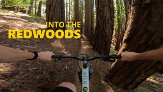
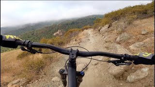
Serpentine trail is probably the most difficult climb on the Tamarancho loop, especially on a hot day. It starts out in the open, and descends through some meadows. There is a small rock drop marked with a double black sign, although it does not really deserve that rating, there is a blue sign next to a rocky ride around. It enters some trees, with very challenging and rocky climb marked with a red sign, or an easier climb marked with a blue sign. The climb seems to keep going and going, and you can really work up a sweat on a hot day.

Local Trail Association
Traditionally Indigenous Territory

Recent Activity on Trail

Past Week
  • 13 rides
  • 18 miles average
6 Months
  • 257 rides
  • 15 miles avg distance
All
  • 1,928 rides
  • Last: Jun 20, 2026
c1c2c3c4
January
February
March
April
May
June
July
August
September
October
November
December
Status:
on Apr 15, 2026
Variable
Avg: 4.19 (20 votes)
Your vote: 0

view (17,181)
close
3D
Trail Conditions
  • Unknown
  • Snow Groomed
  • Snow Packed
  • Snow Covered
  • Snow Cover Partial
  • Freeze/thaw Cycle
  • Icy
  • Prevalent Mud
  • Wet
  • Variable
  • Ideal
  • Dry
  • Very Dry
Trail Flow (Ridden Direction)
Trailforks scans users ridelogs to determine the most popular direction each trail is ridden. A good flowing trail network will have most trails flowing in a single direction according to their intension.
The colour categories are based on what percentage of riders are riding a trail in its intended direction.
  • > 96%
  • > 90%
  • > 80%
  • > 70%
  • > 50%
  • < 50%
  • bi-directional trail
  • no data
Trail Last Ridden
Trailforks scans ridelogs to determine the last time a trail was ridden.
  • < 2 days
  • < 1 week
  • < 2 weeks
  • < 1 month
  • < 6 months
  • > 6 months
Trail Ridden Direction
The intended direction a trail should be ridden.
  • Downhill Only
  • Downhill Primary
  • Both Directions
  • Uphill Primary
  • Uphill Only
  • One Direction
Contribute Details
Colors indicate trail is missing specified detail.
  • Description
  • Photos
  • Description & Photos
  • Videos
Trail Popularity ?
Trailforks scans ridelogs to determine which trails are ridden the most in the last 9 months. Trails are compared with nearby trails in the same city region with a possible 25 colour shades. Think of this as a heatmap, more rides = more kinetic energy = warmer colors.
  • most popular
  • popular
  • less popular
  • not popular
ATV/ORV/OHV Filter
Max Vehicle Width
inches
US Cell Coverage
Legend
cell carrier legend

Radar Time
Activity Recordings
Trailforks uses anonymized public activity data. ?
Activity Recordings
Trailforks uses anonymized public activity data. ?
Personal Heatmap
Activity Types
all / none
Options
2
Date range month
Winter Trails
Warning A routing network for winter maps does not exist. Selecting trails using the winter trails layer has been disabled.
Missing Trails
Most Popular
Least Popular
Trails are colored based on popularity. The more popular a trail is, the more red. Less popular trails trend towards green.
Jump Magnitude Heatmap
Heatmap of where riders jump on trails. Zoom in to see individual jumps, click circles to view jump details.
BC Backroad Status

Service Road Atlas is a free to use, community-driven service for viewing and creating reports on the numerous back-country service roads around B.C. and Alberta.

map legend
Slope Aspect
Direction the slope faces
Flat N NE E SE S SW W NW
Trails Deemphasized
Trails are shown in grey.
disable
Only show trails with no bike usage.
Enable
Suggested Layers
Based on selected activity type

    Save the current map location and zoom level as your default home location whenever this page is loaded.

    Save
        Directions to serpentine-trail trailhead (37.989290, -122.606700)

        Photos

        12 more »
        84 |
        Jun 22, 2024 @ 1:35pm
        Jun 22, 2024
        127 |
        Nov 17, 2021 @ 9:33am
        Nov 17, 2021
        151 |
        Nov 17, 2021 @ 9:33am
        Nov 17, 2021
        236 |
        Jan 18, 2021 @ 9:20pm
        Jan 18, 2021

        Videos

        8 more »
        youtuber Tamarancho Flow - Camp Tamarancho - Fairfax,...
        14:43 | 1021 | May 9, 2017 , Fairfax
        youtuber Marinduro 2026! - Stage 4: Serpentine
        27:03 | 35 | May 10, 2026 , Fairfax
        Camp Tamarancho Loop, Fairfax, California
        6:00 | 95 | May 30, 2024 , Fairfax
        Visiting the Birthplace of MTB | Mountain...
        16:39 | 198 | Sep 25, 2021 , Fairfax

        Routes with this trail

        3.5 7 miles 1,254 ft 10 Loop
        Great loop around Tamarancho Trail system!
        3.5 19 miles 2,965 ft 11 Loop
        Begin the Tamarancho loop via Alchemists Trail then take Dead Heifer Fire Road at the bottom of the Endor...
        8 miles 1,532 ft 9 Loop
        Hit all the goods at Tamarancho and hit them a couple times. This hits the main loop as well as the and .

        Trail Products

        1 Review & Comments


        We hope you've been enjoying Trailforks!

        Create a FREE account to view trail comments and much more.

        • By TheBikeNerdTF Pro NWTA & contributors
        • #20432 - 4,935 views

        Frequently Asked Questions About Serpentine Trail

        Where is Serpentine Trail located?
        Serpentine Trail is located in Tamarancho, Fairfax, California, United States. It is part of the Tamarancho trail network. The trailhead is located at coordinates 37.98929, -122.6067.
        How hard is Serpentine Trail?
        Serpentine Trail is rated as Blue difficulty. The physical rating is Moderate. The average grade is 4.8%. The climb difficulty is rated Blue.
        What is the elevation gain for Serpentine Trail?
        Serpentine Trail has 288 ft of elevation gain. The trail has 82 ft of elevation descent. The elevation ranges from 645 ft to 936 ft.
        Is Serpentine Trail a point to point trail?
        Serpentine Trail is not a point to point trail. The direction is Both Directions. The trail type is singletrack.

        Hit the Trail

        Open in App

        Get this trail on your phone instantly.
        open trail in app

        Download Trail

        Save to wishlist, Garmin & download.
        save the trail

        Find Related Routes

        Find routes and users activities that include this trail.
        find routes for this trail

        You must enter a description before submitting.