more stats
3,169 ft
Distance
8 ft
Climb
-356 ft
Descent
00:04:21
Avg time
-348 ft
Altitude change
363 ft
Altitude min
721 ft
Altitude max
711 ft
Altitude start
364 ft
Altitude end
-11%
Grade
-35%
Grade max
9.4%
Grade min
272 ft
Distance climb
2,687 ft
Distance down
167 ft
Distance flat
00:04:21
Avg time

Sheep Skull Details

  • Activities
    • Mountain Bike
    • E-Bike
    • Adaptive Bike
    • Winter Fat Bike
  • Riding Area
    Forest of Dean
    Gloucester
  • Difficulty Rating
  • Local Popularity
    80 in Mountain Biking [+]
    • 75 in E-Biking
  • Global Ranking
    #9626 in Mountain Biking [+]
    • #7367 in E-Biking
  • Trail Type
    Singletrack
  • Bike Type
    DH, AM, XC, DJ, RD, Fat, Adaptive MTB
  • Direction
    Downhill Only
    Popular Direction Shown
  • Physical Rating
    Moderate
  • Dogs Allowed
    Yes
  • eBike Allowed
    Yes up to Class 1
  • Ride in Rain
    Yes
  • Land Owner
    Forestry England

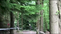
Super fast all the way. Through the top ‘bus stop’, then jumping into and out of a bombhole, over some roots onto the middle fire road. Flying on down from there, loads of challenging roots tempt you into braking, then anchors off into the final fast ‘motorway’ section. Sections, berms and jumps are in season here. Super fun and fast too, and a great one to session.

Local Trail Association

Recent Activity on Trail

Past Week
  • 1 rides
  • 38 miles average
6 Months
  • 44 rides
  • 17 miles avg distance
All
  • 417 rides
  • Last: Jun 14, 2026
c1c2c3c4
January
February
March
April
May
June
July
August
September
October
November
December
Status:
on Mar 1, 2026
Variable
Avg: 4.45 (16 votes)
Your vote: 0

view (7,696)
close
3D
Trail Conditions
  • Unknown
  • Snow Groomed
  • Snow Packed
  • Snow Covered
  • Snow Cover Partial
  • Freeze/thaw Cycle
  • Icy
  • Prevalent Mud
  • Wet
  • Variable
  • Ideal
  • Dry
  • Very Dry
Trail Flow (Ridden Direction)
Trailforks scans users ridelogs to determine the most popular direction each trail is ridden. A good flowing trail network will have most trails flowing in a single direction according to their intension.
The colour categories are based on what percentage of riders are riding a trail in its intended direction.
  • > 96%
  • > 90%
  • > 80%
  • > 70%
  • > 50%
  • < 50%
  • bi-directional trail
  • no data
Trail Last Ridden
Trailforks scans ridelogs to determine the last time a trail was ridden.
  • < 2 days
  • < 1 week
  • < 2 weeks
  • < 1 month
  • < 6 months
  • > 6 months
Trail Ridden Direction
The intended direction a trail should be ridden.
  • Downhill Only
  • Downhill Primary
  • Both Directions
  • Uphill Primary
  • Uphill Only
  • One Direction
Contribute Details
Colors indicate trail is missing specified detail.
  • Description
  • Photos
  • Description & Photos
  • Videos
Trail Popularity ?
Trailforks scans ridelogs to determine which trails are ridden the most in the last 9 months. Trails are compared with nearby trails in the same city region with a possible 25 colour shades. Think of this as a heatmap, more rides = more kinetic energy = warmer colors.
  • most popular
  • popular
  • less popular
  • not popular
ATV/ORV/OHV Filter
Max Vehicle Width
inches
US Cell Coverage
Legend
cell carrier legend

Radar Time
Activity Recordings
Trailforks uses anonymized public activity data. ?
Activity Recordings
Trailforks uses anonymized public activity data. ?
Personal Heatmap
Activity Types
all / none
Options
2
Date range month
Winter Trails
Warning A routing network for winter maps does not exist. Selecting trails using the winter trails layer has been disabled.
Missing Trails
Most Popular
Least Popular
Trails are colored based on popularity. The more popular a trail is, the more red. Less popular trails trend towards green.
Jump Magnitude Heatmap
Heatmap of where riders jump on trails. Zoom in to see individual jumps, click circles to view jump details.
BC Backroad Status

Service Road Atlas is a free to use, community-driven service for viewing and creating reports on the numerous back-country service roads around B.C. and Alberta.

map legend
Slope Aspect
Direction the slope faces
Flat N NE E SE S SW W NW
Trails Deemphasized
Trails are shown in grey.
disable
Only show trails with no bike usage.
Enable
Suggested Layers
Based on selected activity type

    Save the current map location and zoom level as your default home location whenever this page is loaded.

    Save
        Directions to sheep-skull trailhead (51.809920, -2.584500)

        Photos

        153 more »
        413 |
        Feb 22, 2014 @ 11:35pm
        Feb 22, 2014
        561 |
        Feb 22, 2014 @ 11:37pm
        Feb 22, 2014
        309 |
        Feb 19, 2019 @ 3:33am
        Feb 19, 2019
        209 |
        Feb 19, 2019 @ 3:35am
        Feb 19, 2019

        Videos

        38 more »
        Sheepskull | Downhill Mountain Biking in the...
        3:49 | 948 | Sep 15, 2019 , Gloucester
        FoD MTB / Forest of Dean - Sheepskull - Red - 2018
        3:00 | 564 | Sep 13, 2018 , Gloucester
        Darkside at FOD
        2:43 | 305 | Jun 27, 2017 , Gloucester
        FOD sheepskull WITH CRASH
        3:51 | 121 | Feb 16, 2017 , Gloucester

        2 Reviews & Comments


        We hope you've been enjoying Trailforks!

        Create a FREE account to view trail comments and much more.

        • By STIGZ18 & contributors
        • #20977 - 10,577 views

        Frequently Asked Questions About Sheep Skull

        Where is Sheep Skull located?
        Sheep Skull is located in Forest of Dean, Gloucester, United Kingdom. It is part of the Forest of Dean trail network. The trailhead is located at coordinates 51.80992, -2.5845.
        How hard is Sheep Skull?
        Sheep Skull is rated as Black difficulty. The physical rating is Moderate. The average grade is 11%.
        What is the elevation gain for Sheep Skull?
        Sheep Skull has 8 ft of elevation gain. The trail has 356 ft of elevation descent. The elevation ranges from 363 ft to 721 ft.
        Is Sheep Skull a point to point trail?
        Yes, Sheep Skull is a point to point trail. The direction is Downhill Only. The trail type is singletrack.

        Hit the Trail

        Open in App

        Get this trail on your phone instantly.
        open trail in app

        Download Trail

        Save to wishlist, Garmin & download.
        save the trail

        Find Related Routes

        Find routes and users activities that include this trail.
        find routes for this trail

        You must enter a description before submitting.