more stats
3.0 miles
Distance
610 ft
Climb
-649 ft
Descent
00:35:42
Avg time
-39 ft
Altitude change
1,634 ft
Altitude min
2,269 ft
Altitude max
1,673 ft
Altitude start
1,634 ft
Altitude end
-0.3%
Grade
-22.5%
Grade max
23.6%
Grade min
1 mile
Distance climb
1 mile
Distance down
1,975 ft
Distance flat
00:35:42
Avg time

Sherburner Details

  • Activities
    • Mountain Bike
    • Hike
    • Trail Running
  • Riding Area
    Sherburne Trails
    Killington, Vermont
  • Difficulty Rating
  • Voted Difficulty
    Blue (2 votes)
  • Local Popularity
    100 in Mountain Biking [+]
    • 80 in Trail Running
    • 45 in Hiking
  • Global Ranking
    #220 in Mountain Biking [+]
    • #34589 in Trail Running
    • #81344 in Hiking
  • Trail Type
    Singletrack
  • Bike Type
    AM, XC
  • Climb Difficulty
    Blue
  • Physical Rating
    Moderate
  • Trail Visibility
    Always easy to follow
  • Season
    Sping-Fall
  • Dogs Allowed
    Yes
  • eBike Allowed
  • TTFs on Trail
    Berm, Bridge, Jump
  • Year Opened
    2022
  • Land Owner

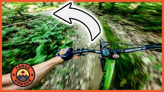
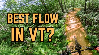
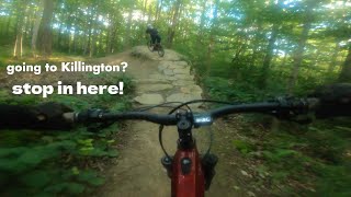
New trail for 2023 built by L&D Trail Works with a steady climb up the west side of RT 100 in the beautiful Green Mountain National Forest followed by a fast, flowy, feature filled decent back into Gifford State Park. This is a directional trail so please DO NOT climb up the downhill.

If you like what you are riding please donate to the Killington Mountain Bike Club so we can continue into the 3rd phase of this network.

Access Info

Park either at Base Camp or the pull off on Rt 100. DO NOT park in the Gifford Woods State Park unless you want to pay the day fee which does gain you access to showers and bathrooms. Also DO NOT park at the Kent Pond Boat launch as this is for water access only.

Disclaimer

Directional Trail. DO NOT climb up the downhill

Trail Supporters
Local Trail Association
Traditionally Indigenous Territory

Recent Activity on Trail

Past Week
  • 13 rides
  • 7 miles average
6 Months
  • 71 rides
  • 9 miles avg distance
All
  • 1,068 rides
  • Last: Jun 17, 2026
c1c2c3c4
January
February
March
April
May
June
July
August
September
October
November
December
Status:
on Jun 13, 2026
Variable
Avg: 4.81 (26 votes)
Your vote: 0

view (4,172)
close
3D
Trail Conditions
  • Unknown
  • Snow Groomed
  • Snow Packed
  • Snow Covered
  • Snow Cover Partial
  • Freeze/thaw Cycle
  • Icy
  • Prevalent Mud
  • Wet
  • Variable
  • Ideal
  • Dry
  • Very Dry
Trail Flow (Ridden Direction)
Trailforks scans users ridelogs to determine the most popular direction each trail is ridden. A good flowing trail network will have most trails flowing in a single direction according to their intension.
The colour categories are based on what percentage of riders are riding a trail in its intended direction.
  • > 96%
  • > 90%
  • > 80%
  • > 70%
  • > 50%
  • < 50%
  • bi-directional trail
  • no data
Trail Last Ridden
Trailforks scans ridelogs to determine the last time a trail was ridden.
  • < 2 days
  • < 1 week
  • < 2 weeks
  • < 1 month
  • < 6 months
  • > 6 months
Trail Ridden Direction
The intended direction a trail should be ridden.
  • Downhill Only
  • Downhill Primary
  • Both Directions
  • Uphill Primary
  • Uphill Only
  • One Direction
Contribute Details
Colors indicate trail is missing specified detail.
  • Description
  • Photos
  • Description & Photos
  • Videos
Trail Popularity ?
Trailforks scans ridelogs to determine which trails are ridden the most in the last 9 months. Trails are compared with nearby trails in the same city region with a possible 25 colour shades. Think of this as a heatmap, more rides = more kinetic energy = warmer colors.
  • most popular
  • popular
  • less popular
  • not popular
ATV/ORV/OHV Filter
Max Vehicle Width
inches
US Cell Coverage
Legend
cell carrier legend

Radar Time
Activity Recordings
Trailforks uses anonymized public activity data. ?
Activity Recordings
Trailforks uses anonymized public activity data. ?
Personal Heatmap
Activity Types
all / none
Options
2
Date range month
Winter Trails
Warning A routing network for winter maps does not exist. Selecting trails using the winter trails layer has been disabled.
Missing Trails
Most Popular
Least Popular
Trails are colored based on popularity. The more popular a trail is, the more red. Less popular trails trend towards green.
Jump Magnitude Heatmap
Heatmap of where riders jump on trails. Zoom in to see individual jumps, click circles to view jump details.
BC Backroad Status

Service Road Atlas is a free to use, community-driven service for viewing and creating reports on the numerous back-country service roads around B.C. and Alberta.

map legend
Slope Aspect
Direction the slope faces
Flat N NE E SE S SW W NW
Trails Deemphasized
Trails are shown in grey.
disable
Only show trails with no bike usage.
Enable
Suggested Layers
Based on selected activity type

    Save the current map location and zoom level as your default home location whenever this page is loaded.

    Save
        Directions to sherburner trailhead (43.684130, -72.819390)

        Photos

        17 more »
        63 |
        Oct 14, 2025 @ 7:07pm
        Oct 14, 2025
        74 |
        Oct 14, 2025 @ 7:07pm
        Oct 14, 2025
        61 |
        Oct 14, 2025 @ 7:07pm
        Oct 14, 2025
        68 |
        Oct 14, 2025 @ 7:06pm
        Oct 14, 2025

        Videos

        4 more »
        youtuber SHERBURNER Trail in Killington Vermont!  Super...
        11:08 | 334 | Sep 12, 2024 , Killington
        This Vermont MTB Spot Deserves Way More Love
        20:26 | 108 | Aug 17, 2025 , Killington
        Sherburner a legit FLOW trail
        5:17 | 327 | Jul 22, 2024 , Killington
        Sherburned
        6:10 | 264 | Oct 8, 2023 , Killington

        Routes with this trail

        4.0 13 miles 1,869 ft 4
        A little bit of everything

        16 Reviews & Comments


        We hope you've been enjoying Trailforks!

        Create a FREE account to view trail comments and much more.

        • By BcolonaTF Pro KMBC & contributors
        • #642370 - 4,679 views

        Frequently Asked Questions About Sherburner

        Where is Sherburner located?
        Sherburner is located in Sherburne Trails, Killington, Vermont, United States. It is part of the Sherburne Trails trail network. The trailhead is located at coordinates 43.68413, -72.81939.
        How hard is Sherburner?
        Sherburner is rated as Blue difficulty. The physical rating is Moderate. The average grade is 0.3%. The climb difficulty is rated Blue.
        What is the elevation gain for Sherburner?
        Sherburner has 610 ft of elevation gain. The trail has 649 ft of elevation descent. The elevation ranges from 1,634 ft to 2,269 ft.
        How long is Sherburner?
        Sherburner is 3.0 miles long. The trail type is singletrack.

        Hit the Trail

        Open in App

        Get this trail on your phone instantly.
        open trail in app

        Download Trail

        Save to wishlist, Garmin & download.
        save the trail

        Find Related Routes

        Find routes and users activities that include this trail.
        find routes for this trail

        You must enter a description before submitting.