more stats
3,350 ft
Distance
-578 ft
Descent
00:06:34
Avg time
-578 ft
Altitude change
1,824 ft
Altitude min
2,402 ft
Altitude max
2,402 ft
Altitude start
1,824 ft
Altitude end
-17.3%
Grade
-55.9%
Grade max
-2.1%
Grade min
3,337 ft
Distance down
13 ft
Distance flat
00:06:34
Avg time

Shining Details

  • Activities
    • Mountain Bike
    • E-Bike
  • Riding Area
    The Bluff Recreation Area
    Smithers, British Columbia
  • Difficulty Rating
  • Local Popularity
    75 in Mountain Biking [+]
    • 60 in E-Biking
  • Global Ranking
    #92814 in Mountain Biking [+]
    • #72969 in E-Biking
  • Trail Type
    Singletrack
  • Bike Type
    DH, AM
  • Direction
    Downhill Only
    Popular Direction Shown
  • Dogs Allowed
    Yes
  • eBike Allowed
    Yes up to Class 1
  • TTFs on Trail
    Berm, Bridge, Drop, Jump, Ladder Bridge, Log Ride, Skinny

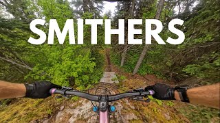
The Shinning has lots of optional lines with large wooden drops, jumps, and ramps. This trail is super fun and is really drifty with a mix of loam and loose soil. Technical bits here and there and great flow in other sections. Very fun and connects to lots of other great trails.

Local Trail Association
Traditionally Indigenous Territory

Recent Activity on Trail

Past Week
  • 1 rides
  • 14 miles average
6 Months
  • 6 rides
  • 7 miles avg distance
All
  • 112 rides
  • Last: Jun 26, 2026
c1c2c3c4
January
February
March
April
May
June
July
August
September
October
November
December
update trails status or condition

Shining Trail Reports

statusdatedescription
Jun 7, 2026 @ 4:50pm (America/Vancouver)
Jun 7, 2026
Large tree across trail
May 5, 2026 @ 8:28pm (America/Vancouver)
May 5, 2026
reporter The Bluff trails are mostly open. There are some sections closed, please obey closure signs to help preserve the trails.
Apr 25, 2026 @ 6:11am (America/Vancouver)
Apr 25, 2026
reporter The Bluff trails are open (mostly)! Please obey closed trail signs.
Dec 2, 2025 @ 8:02pm (America/Vancouver)
Dec 2, 2025
reporter Snow season is here.
Apr 14, 2025 @ 9:49pm
Apr 14, 2025
reporter
more »
Status:
on Jun 7, 2026
Dry
Avg: 3.65 (5 votes)
Your vote: 0

view (756)
close
3D
Trail Conditions
  • Unknown
  • Snow Groomed
  • Snow Packed
  • Snow Covered
  • Snow Cover Partial
  • Freeze/thaw Cycle
  • Icy
  • Prevalent Mud
  • Wet
  • Variable
  • Ideal
  • Dry
  • Very Dry
Trail Flow (Ridden Direction)
Trailforks scans users ridelogs to determine the most popular direction each trail is ridden. A good flowing trail network will have most trails flowing in a single direction according to their intension.
The colour categories are based on what percentage of riders are riding a trail in its intended direction.
  • > 96%
  • > 90%
  • > 80%
  • > 70%
  • > 50%
  • < 50%
  • bi-directional trail
  • no data
Trail Last Ridden
Trailforks scans ridelogs to determine the last time a trail was ridden.
  • < 2 days
  • < 1 week
  • < 2 weeks
  • < 1 month
  • < 6 months
  • > 6 months
Trail Ridden Direction
The intended direction a trail should be ridden.
  • Downhill Only
  • Downhill Primary
  • Both Directions
  • Uphill Primary
  • Uphill Only
  • One Direction
Contribute Details
Colors indicate trail is missing specified detail.
  • Description
  • Photos
  • Description & Photos
  • Videos
Trail Popularity ?
Trailforks scans ridelogs to determine which trails are ridden the most in the last 9 months. Trails are compared with nearby trails in the same city region with a possible 25 colour shades. Think of this as a heatmap, more rides = more kinetic energy = warmer colors.
  • most popular
  • popular
  • less popular
  • not popular
ATV/ORV/OHV Filter
Max Vehicle Width
inches
US Cell Coverage
Legend
cell carrier legend

Radar Time
Activity Recordings
Trailforks uses anonymized public activity data. ?
Activity Recordings
Trailforks uses anonymized public activity data. ?
Personal Heatmap
Activity Types
all / none
Options
2
Date range month
Winter Trails
Warning A routing network for winter maps does not exist. Selecting trails using the winter trails layer has been disabled.
Missing Trails
Most Popular
Least Popular
Trails are colored based on popularity. The more popular a trail is, the more red. Less popular trails trend towards green.
Jump Magnitude Heatmap
Heatmap of where riders jump on trails. Zoom in to see individual jumps, click circles to view jump details.
BC Backroad Status

Service Road Atlas is a free to use, community-driven service for viewing and creating reports on the numerous back-country service roads around B.C. and Alberta.

map legend
Slope Aspect
Direction the slope faces
Flat N NE E SE S SW W NW
Trails Deemphasized
Trails are shown in grey.
disable
Only show trails with no bike usage.
Enable
Suggested Layers
Based on selected activity type

    Save the current map location and zoom level as your default home location whenever this page is loaded.

    Save
        Directions to shining trailhead (54.772560, -127.187970)

        Photos

        14 more »
        105 |
        Aug 18, 2020 @ 9:21am
        Aug 18, 2020
        177 |
        Aug 14, 2019 @ 9:54am
        Aug 14, 2019
        4,200 |
        Oct 1, 2018 @ 8:19pm
        Oct 1, 2018
        200 |
        May 23, 2018 @ 7:52am
        May 23, 2018

        Videos

        3 more »
        You have to put Smithers on your list of...
        7:40 | 151 | Oct 26, 2024 , Smithers
        Shinning, AntiFlo, Apocalypse
        5:12 | 586 | Jun 13, 2020 , Smithers
        lower Mystery DH - Cypress Mountain
        0:14 | 323 | Dec 17, 2013 , Smithers

        Routes with this trail

        4.0 9 miles 1,679 ft 29 Loop
        This is a perimeter loop of the entire Bluff trail system, come for a challenge. Climb up Meanstreak and...
        5.0 23 miles 6,337 ft 32 Loop
        Looking for an epic ride? Try this gigantic route which samples nearly every bluff trail in one ride.

        Reviews / Comments

        No reviews yet, be the first to write a review or ask a question.
        Use trail reports to comment on trail conditions.


        We hope you've been enjoying Trailforks!

        Create a FREE account to view trail comments and much more.

        • By SMBAAdmin SMBA & contributors
        • #97937 - 2,135 views

        Frequently Asked Questions About Shining

        Where is Shining located?
        Shining is located in The Bluff Recreation Area, Smithers, British Columbia, Canada. It is part of the The Bluff Recreation Area trail network. The trailhead is located at coordinates 54.77256, -127.18797.
        How hard is Shining?
        Shining is rated as Black Diamond difficulty. The average grade is 17.3%.
        What is the elevation gain for Shining?
        The trail has 176 m of elevation descent. The elevation ranges from 556 m to 732 m.
        Is Shining a point to point trail?
        Yes, Shining is a point to point trail. The direction is Downhill Only. The trail type is singletrack.

        Hit the Trail

        Open in App

        Get this trail on your phone instantly.
        open trail in app

        Download Trail

        Save to wishlist, Garmin & download.
        save the trail

        Find Related Routes

        Find routes and users activities that include this trail.
        find routes for this trail

        You must enter a description before submitting.