more stats
3,658 ft
Distance
284 ft
Climb
00:09:13
Avg time
284 ft
Altitude change
103 ft
Altitude min
389 ft
Altitude max
105 ft
Altitude start
390 ft
Altitude end
7.8%
Grade
-1.6%
Grade max
23.9%
Grade min
3,169 ft
Distance climb
174 ft
Distance down
318 ft
Distance flat
00:09:13
Avg time

Side Hill Details

  • Activities
    • Mountain Bike
    • E-Bike
    • Adaptive Bike
    • Winter Fat Bike
    • Hike
    • Trail Running
  • Riding Area
    Los Peñasquitos Canyon
    San Diego, California
  • Difficulty Rating
  • Voted Difficulty
    Blue (2 votes)
  • Local Popularity
    85 in Mountain Biking [+]
    • 80 in E-Biking
    • 65 in Trail Running
    • 90 in Hiking
  • Global Ranking
    #59789 in Mountain Biking [+]
    • #36302 in E-Biking
    • #94573 in Trail Running
    • #15394 in Hiking
  • Trail Type
    Mixed
  • Bike Type
    DH, AM, XC, Fat, Adaptive MTB
  • Direction
    Both Directions
    Popular Direction Shown
  • Climb Difficulty
    Blue
  • Physical Rating
    Moderate
  • Trail Visibility
    Always easy to follow
  • Family Friendly
    Yes
  • Dogs Allowed
    Yes
  • eBike Allowed
    Yes up to Class 1
  • Land Owner
    City of San Diego

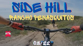
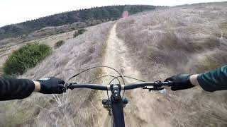
Steep climb/descent followed by a pretty smooth singletrack. Turns into fireroad at the top.

Adaptive Bike Info
aMTB Green Rating: Beginner features and moderate terrain.

Due to recent trail work this trail is downgraded from aMTB2 to aMTB1. Still slight potential for drama but most adaptive riders are good to go! Thank you SDMBA!

Local Trail Association
Traditionally Indigenous Territory

Recent Activity on Trail

Past Week
  • 4 rides
  • 22.5 km average
6 Months
  • 84 rides
  • 28.1 km avg distance
All
  • 669 rides
  • Last: Jun 27, 2026
c1c2c3c4
January
February
March
April
May
June
July
August
September
October
November
December
update trails status or condition

Side Hill Trail Reports

statusdatedescription
Jun 27, 2025 @ 5:09pm
Jun 27, 2025
Mar 29, 2025 @ 10:23am
Mar 29, 2025
Mar 20, 2025 @ 4:05pm
Mar 20, 2025
Always fun. Dirt is great right now. Could use a few fun jumps.
Jun 23, 2024 @ 12:08pm
Jun 23, 2024
New Cafe near top of sidehill at Carmel Cntry & Carmel Mtn Rd. Open 7am til 3. Good juices, coffees, food
Sep 23, 2023 @ 7:56am
Sep 23, 2023
more »
Status:
on Jun 27, 2025
Dry
Avg: 3.8 (15 votes)
Your vote: 0

view (3,766)
close
3D
Trail Conditions
  • Unknown
  • Snow Groomed
  • Snow Packed
  • Snow Covered
  • Snow Cover Partial
  • Freeze/thaw Cycle
  • Icy
  • Prevalent Mud
  • Wet
  • Variable
  • Ideal
  • Dry
  • Very Dry
Trail Flow (Ridden Direction)
Trailforks scans users ridelogs to determine the most popular direction each trail is ridden. A good flowing trail network will have most trails flowing in a single direction according to their intension.
The colour categories are based on what percentage of riders are riding a trail in its intended direction.
  • > 96%
  • > 90%
  • > 80%
  • > 70%
  • > 50%
  • < 50%
  • bi-directional trail
  • no data
Trail Last Ridden
Trailforks scans ridelogs to determine the last time a trail was ridden.
  • < 2 days
  • < 1 week
  • < 2 weeks
  • < 1 month
  • < 6 months
  • > 6 months
Trail Ridden Direction
The intended direction a trail should be ridden.
  • Downhill Only
  • Downhill Primary
  • Both Directions
  • Uphill Primary
  • Uphill Only
  • One Direction
Contribute Details
Colors indicate trail is missing specified detail.
  • Description
  • Photos
  • Description & Photos
  • Videos
Trail Popularity ?
Trailforks scans ridelogs to determine which trails are ridden the most in the last 9 months. Trails are compared with nearby trails in the same city region with a possible 25 colour shades. Think of this as a heatmap, more rides = more kinetic energy = warmer colors.
  • most popular
  • popular
  • less popular
  • not popular
ATV/ORV/OHV Filter
Max Vehicle Width
inches
US Cell Coverage
Legend
cell carrier legend

Radar Time
Activity Recordings
Trailforks uses anonymized public activity data. ?
Activity Recordings
Trailforks uses anonymized public activity data. ?
Personal Heatmap
Activity Types
all / none
Options
2
Date range month
Winter Trails
Warning A routing network for winter maps does not exist. Selecting trails using the winter trails layer has been disabled.
Missing Trails
Most Popular
Least Popular
Trails are colored based on popularity. The more popular a trail is, the more red. Less popular trails trend towards green.
Jump Magnitude Heatmap
Heatmap of where riders jump on trails. Zoom in to see individual jumps, click circles to view jump details.
BC Backroad Status

Service Road Atlas is a free to use, community-driven service for viewing and creating reports on the numerous back-country service roads around B.C. and Alberta.

map legend
Slope Aspect
Direction the slope faces
Flat N NE E SE S SW W NW
Trails Deemphasized
Trails are shown in grey.
disable
Only show trails with no bike usage.
Enable
Suggested Layers
Based on selected activity type

    Save the current map location and zoom level as your default home location whenever this page is loaded.

    Save
        Directions to side-hill trailhead (32.919140, -117.193630)

        Photos

        4 more »
        43 |
        Nov 8, 2024 @ 11:35am
        Nov 8, 2024
        44 |
        Nov 8, 2024 @ 11:35am
        Nov 8, 2024
        37 |
        Nov 8, 2024 @ 11:35am
        Nov 8, 2024
        80 |
        Feb 18, 2022 @ 3:10pm
        Feb 18, 2022

        Videos

        3 more »
        youtuber Side Hill Rancho Penasquitos MTB Trail
        3:30 | 498 | Apr 21, 2022 , San Diego
        PQ “SIDEHILL”
        2:42 | 330 | Jan 12, 2021 , San Diego
        Eminent Cycles Haste Demo/'Side Hill' PQ...
        0:24 | 761 | Feb 28, 2018 , San Diego

        Routes with this trail

        3.7 45 miles 4,490 ft 31 Point to Point
        Get ready for something NEW! An east to west, 45 mile adventure starting at /Goodan Ranch down Beeler...
        3.5 23 miles 1,957 ft 61 Loop
        This route through Los Penasquitos Canyon and Del Mar Mesa hits some of the most popular trails in the...
        5.0 24 miles 2,166 ft 26 Point to Point
        This is the 2024 Half Archipelago Ridge put on by SDMBA . Check out https://archride.sdmba.com/ for more...

        10 Reviews & Comments


        We hope you've been enjoying Trailforks!

        Create a FREE account to view trail comments and much more.

        • By The-dirt-farmerTF Pro & contributors
        • #48288 - 4,298 views

        Frequently Asked Questions About Side Hill

        Where is Side Hill located?
        Side Hill is located in Los Peñasquitos Canyon, San Diego, California, United States. It is part of the Los Peñasquitos Canyon trail network. The trailhead is located at coordinates 32.91914, -117.19363.
        How hard is Side Hill?
        Side Hill is rated as Blue difficulty. The physical rating is Moderate. The average grade is 7.8%. The climb difficulty is rated Blue.
        What is the elevation gain for Side Hill?
        Side Hill has 284 ft of elevation gain. The elevation ranges from 103 ft to 389 ft.
        Is Side Hill a point to point trail?
        Side Hill is not a point to point trail. The direction is Both Directions. The trail type is mixed.

        Hit the Trail

        Open in App

        Get this trail on your phone instantly.
        open trail in app

        Download Trail

        Save to wishlist, Garmin & download.
        save the trail

        Find Related Routes

        Find routes and users activities that include this trail.
        find routes for this trail

        You must enter a description before submitting.