more stats
2,365 ft
Distance
281 ft
Climb
-11 ft
Descent
00:11:54
Avg time
269 ft
Altitude change
2,110 ft
Altitude min
2,390 ft
Altitude max
2,121 ft
Altitude start
2,392 ft
Altitude end
11.4%
Grade
-3.3%
Grade max
37.3%
Grade min
1,969 ft
Distance climb
397 ft
Distance down
00:11:54
Avg time

Simi Peak Details

  • Activities
    • Mountain Bike
    • E-Bike
    • Hike
    • Trail Running
  • Riding Area
    Wood Ranch/Lang Ranch
    Simi Valley, California
  • Difficulty Rating
  • Local Popularity
    40 in Mountain Biking [+]
    • 55 in E-Biking
    • 70 in Trail Running
    • 55 in Hiking
  • Global Ranking
    #108368 in Mountain Biking [+]
    • #77777 in Trail Running
    • #103540 in Hiking
  • Trail Type
    Singletrack
  • Direction
    Both Directions
  • Climb Difficulty
    Blue
  • Physical Rating
    Moderate
  • Dogs Allowed
    Yes
  • eBike Allowed

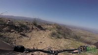
Maybe this is just an out-n-back to the peak, or maybe it is the path to some super secret double diamond DH run. You'll have to see for yourself.

Traditionally Indigenous Territory

Recent Activity on Trail

Past Week
  • 0 rides
  •  
6 Months
  • 1 rides
  • 7 miles avg distance
All
  • 49 rides
  • Last: Feb 1, 2026
c1c2c3c4
January
February
March
April
May
June
July
August
September
October
November
December
update trails status or condition

Simi Peak Trail Reports

statusdatedescription
Nov 24, 2024 @ 5:07pm
Nov 24, 2024
Very rutted and overgrown.
Apr 20, 2023 @ 7:57am
Apr 20, 2023
Rutted & overgrown
Jul 7, 2022 @ 11:27am
Jul 7, 2022
overgrown vegetarian makes it extremely difficult to navigate
Mar 22, 2022 @ 3:01pm
Mar 22, 2022
May 8, 2021 @ 10:25am
May 8, 2021
more »
Status:
on Nov 24, 2024
Variable
Avg: 3.99 (4 votes)
Your vote: 0

view (515)
close
3D
Trail Conditions
  • Unknown
  • Snow Groomed
  • Snow Packed
  • Snow Covered
  • Snow Cover Partial
  • Freeze/thaw Cycle
  • Icy
  • Prevalent Mud
  • Wet
  • Variable
  • Ideal
  • Dry
  • Very Dry
Trail Flow (Ridden Direction)
Trailforks scans users ridelogs to determine the most popular direction each trail is ridden. A good flowing trail network will have most trails flowing in a single direction according to their intension.
The colour categories are based on what percentage of riders are riding a trail in its intended direction.
  • > 96%
  • > 90%
  • > 80%
  • > 70%
  • > 50%
  • < 50%
  • bi-directional trail
  • no data
Trail Last Ridden
Trailforks scans ridelogs to determine the last time a trail was ridden.
  • < 2 days
  • < 1 week
  • < 2 weeks
  • < 1 month
  • < 6 months
  • > 6 months
Trail Ridden Direction
The intended direction a trail should be ridden.
  • Downhill Only
  • Downhill Primary
  • Both Directions
  • Uphill Primary
  • Uphill Only
  • One Direction
Contribute Details
Colors indicate trail is missing specified detail.
  • Description
  • Photos
  • Description & Photos
  • Videos
Trail Popularity ?
Trailforks scans ridelogs to determine which trails are ridden the most in the last 9 months. Trails are compared with nearby trails in the same city region with a possible 25 colour shades. Think of this as a heatmap, more rides = more kinetic energy = warmer colors.
  • most popular
  • popular
  • less popular
  • not popular
ATV/ORV/OHV Filter
Max Vehicle Width
inches
US Cell Coverage
Legend
cell carrier legend

Radar Time
Activity Recordings
Trailforks uses anonymized public activity data. ?
Activity Recordings
Trailforks uses anonymized public activity data. ?
Personal Heatmap
Activity Types
all / none
Options
2
Date range month
Winter Trails
Warning A routing network for winter maps does not exist. Selecting trails using the winter trails layer has been disabled.
Missing Trails
Most Popular
Least Popular
Trails are colored based on popularity. The more popular a trail is, the more red. Less popular trails trend towards green.
Jump Magnitude Heatmap
Heatmap of where riders jump on trails. Zoom in to see individual jumps, click circles to view jump details.
BC Backroad Status

Service Road Atlas is a free to use, community-driven service for viewing and creating reports on the numerous back-country service roads around B.C. and Alberta.

map legend
Slope Aspect
Direction the slope faces
Flat N NE E SE S SW W NW
Trails Deemphasized
Trails are shown in grey.
disable
Only show trails with no bike usage.
Enable
Suggested Layers
Based on selected activity type

    Save the current map location and zoom level as your default home location whenever this page is loaded.

    Save
        Directions to simi-peak trailhead (34.206320, -118.776280)

        Photos

        18 more »
        76 |
        May 9, 2021 @ 9:37am
        May 9, 2021
        46 |
        May 9, 2021 @ 9:37am
        May 9, 2021
        39 |
        May 9, 2021 @ 9:37am
        May 9, 2021
        46 |
        May 9, 2021 @ 9:37am
        May 9, 2021

        Videos

        3 more »
        youtuber Simi Peak to China Flats - Mountain Biking -...
        4:05 | 409 | May 9, 2021 , Simi Valley
        Simi MTB - Simi Peak
        0:56 | 63 | Jun 9, 2024 , Simi Valley
        Start of Simi Peak
        0:27 | 76 | Feb 20, 2020 , Simi Valley

        1 Review & Comments


        We hope you've been enjoying Trailforks!

        Create a FREE account to view trail comments and much more.

        • By toddTF Pro Trailforks & contributors
        • #93346 - 1,887 views

        Frequently Asked Questions About Simi Peak

        Where is Simi Peak located?
        Simi Peak is located in Wood Ranch/Lang Ranch, Simi Valley, California, United States. It is part of the Wood Ranch/Lang Ranch trail network. The trailhead is located at coordinates 34.20632, -118.77628.
        How hard is Simi Peak?
        Simi Peak is rated as Blue difficulty. The physical rating is Moderate. The average grade is 11.4%. The climb difficulty is rated Blue.
        What is the elevation gain for Simi Peak?
        Simi Peak has 281 ft of elevation gain. The trail has 11 ft of elevation descent. The elevation ranges from 2,110 ft to 2,390 ft.
        Is Simi Peak a point to point trail?
        Simi Peak is not a point to point trail. The direction is Both Directions. The trail type is singletrack.

        Hit the Trail

        Open in App

        Get this trail on your phone instantly.
        open trail in app

        Download Trail

        Save to wishlist, Garmin & download.
        save the trail

        Find Related Routes

        Find routes and users activities that include this trail.
        find routes for this trail

        You must enter a description before submitting.