more stats
1,965 ft
Distance
-281 ft
Descent
00:01:28
Avg time
-282 ft
Altitude change
364 ft
Altitude min
646 ft
Altitude max
646 ft
Altitude start
364 ft
Altitude end
-14.4%
Grade
-71%
Grade max
-2%
Grade min
13 ft
Distance climb
1,900 ft
Distance down
49 ft
Distance flat
00:01:28
Avg time

Ski Run Details

  • Activities
    • Mountain Bike
    • E-Bike
  • Riding Area
    Forest of Dean
    Gloucester
  • Difficulty Rating
  • Local Popularity
    65 in Mountain Biking [+]
    • 70 in E-Biking
  • Global Ranking
    #18749 in Mountain Biking [+]
    • #23937 in E-Biking
  • Trail Type
    Singletrack
  • Bike Type
    DH, AM
  • Physical Rating
    Moderate
  • eBike Allowed
    Yes up to Class 1
  • Ride in Rain
    Yes
  • Land Owner
    Forestry England

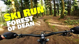
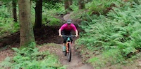
The original downhill trail at the Forest of Dean and rideable in all weathers, the Ski Run drops in through big rocky and rooted sections with fade drops. Into a fast set of turns, a hip jump, the popular tabletop, berms and road gap.

Local Trail Association

Recent Activity on Trail

Past Week
  • 1 rides
  • 8 miles average
6 Months
  • 33 rides
  • 14 miles avg distance
All
  • 276 rides
  • Last: Jun 5, 2026
c1c2c3c4
January
February
March
April
May
June
July
August
September
October
November
December
update trails status or condition

Ski Run Trail Reports

Status:
on Mar 11, 2023
Wet
Avg: 4.5 (12 votes)
Your vote: 0

view (6,198)
close
3D
Trail Conditions
  • Unknown
  • Snow Groomed
  • Snow Packed
  • Snow Covered
  • Snow Cover Partial
  • Freeze/thaw Cycle
  • Icy
  • Prevalent Mud
  • Wet
  • Variable
  • Ideal
  • Dry
  • Very Dry
Trail Flow (Ridden Direction)
Trailforks scans users ridelogs to determine the most popular direction each trail is ridden. A good flowing trail network will have most trails flowing in a single direction according to their intension.
The colour categories are based on what percentage of riders are riding a trail in its intended direction.
  • > 96%
  • > 90%
  • > 80%
  • > 70%
  • > 50%
  • < 50%
  • bi-directional trail
  • no data
Trail Last Ridden
Trailforks scans ridelogs to determine the last time a trail was ridden.
  • < 2 days
  • < 1 week
  • < 2 weeks
  • < 1 month
  • < 6 months
  • > 6 months
Trail Ridden Direction
The intended direction a trail should be ridden.
  • Downhill Only
  • Downhill Primary
  • Both Directions
  • Uphill Primary
  • Uphill Only
  • One Direction
Contribute Details
Colors indicate trail is missing specified detail.
  • Description
  • Photos
  • Description & Photos
  • Videos
Trail Popularity ?
Trailforks scans ridelogs to determine which trails are ridden the most in the last 9 months. Trails are compared with nearby trails in the same city region with a possible 25 colour shades. Think of this as a heatmap, more rides = more kinetic energy = warmer colors.
  • most popular
  • popular
  • less popular
  • not popular
ATV/ORV/OHV Filter
Max Vehicle Width
inches
US Cell Coverage
Legend
cell carrier legend

Radar Time
Activity Recordings
Trailforks uses anonymized public activity data. ?
Activity Recordings
Trailforks uses anonymized public activity data. ?
Personal Heatmap
Activity Types
all / none
Options
2
Date range month
Winter Trails
Warning A routing network for winter maps does not exist. Selecting trails using the winter trails layer has been disabled.
Missing Trails
Most Popular
Least Popular
Trails are colored based on popularity. The more popular a trail is, the more red. Less popular trails trend towards green.
Jump Magnitude Heatmap
Heatmap of where riders jump on trails. Zoom in to see individual jumps, click circles to view jump details.
BC Backroad Status

Service Road Atlas is a free to use, community-driven service for viewing and creating reports on the numerous back-country service roads around B.C. and Alberta.

map legend
Slope Aspect
Direction the slope faces
Flat N NE E SE S SW W NW
Trails Deemphasized
Trails are shown in grey.
disable
Only show trails with no bike usage.
Enable
Suggested Layers
Based on selected activity type

    Save the current map location and zoom level as your default home location whenever this page is loaded.

    Save
        Directions to ski-run-20974 trailhead (51.809390, -2.579610)

        Photos

        1,017 more »
        1,002 |
        Dec 4, 2016 @ 4:00pm
        Dec 4, 2016
        728 |
        Mar 12, 2011 @ 7:45am
        Mar 12, 2011
        129 |
        Feb 26, 2019 @ 6:06am
        Feb 26, 2019
        63 |
        Dec 9, 2018 @ 11:49am
        Dec 9, 2018

        Videos

        14 more »
        A full run down Ski Run! | Forest of Dean...
        3:09 | 240 | Jun 27, 2022 , Gloucester
        RAW - F.O.D. MINI DH RD4
        2:52 | 330 | Feb 5, 2020 , Gloucester
        100% Mini Downhill, Round 4 2019
        4:12 | 843 | Dec 5, 2019 , Gloucester
        More than just another ride | Tracy Moseley's...
        0:59 | 134 | Oct 1, 2019 , Gloucester

        1 Review & Comments


        We hope you've been enjoying Trailforks!

        Create a FREE account to view trail comments and much more.

        • By STIGZ18 & contributors
        • #20974 - 6,597 views

        Frequently Asked Questions About Ski Run

        Where is Ski Run located?
        Ski Run is located in Forest of Dean, Gloucester, United Kingdom. It is part of the Forest of Dean trail network. The trailhead is located at coordinates 51.80939, -2.57961.
        How hard is Ski Run?
        Ski Run is rated as Black difficulty. The physical rating is Moderate. The average grade is 14.4%.
        What is the elevation gain for Ski Run?
        The trail has 281 ft of elevation descent. The elevation ranges from 364 ft to 646 ft.
        How long is Ski Run?
        Ski Run is 1,965 ft long. The trail type is singletrack.

        Hit the Trail

        Open in App

        Get this trail on your phone instantly.
        open trail in app

        Download Trail

        Save to wishlist, Garmin & download.
        save the trail

        Find Related Routes

        Find routes and users activities that include this trail.
        find routes for this trail

        You must enter a description before submitting.