more stats
2,005 ft
Distance
3 ft
Climb
-124 ft
Descent
00:03:19
Avg time
-122 ft
Altitude change
976 ft
Altitude min
1,097 ft
Altitude max
1,097 ft
Altitude start
974 ft
Altitude end
-6.1%
Grade
-43%
Grade max
6.7%
Grade min
180 ft
Distance climb
1,558 ft
Distance down
266 ft
Distance flat
00:03:19
Avg time

Skin & Bones Details

  • Activities
    • Mountain Bike
    • E-Bike
    • Hike
    • Trail Running
    • Snowshoe
  • Riding Area
    Dagmar North Trails
    Uxbridge, Ontario
  • Difficulty Rating
  • Voted Difficulty
    Black Diamond (4 votes)
  • Local Popularity
    90 in Mountain Biking [+]
    • 90 in E-Biking
  • Global Ranking
    #7896 in Mountain Biking [+]
    • #4047 in E-Biking
  • Trail Type
    Singletrack
  • Bike Type
    AM, XC
  • Direction
    Downhill Only
    Popular Direction Shown
  • Physical Rating
    Moderate
  • Trail Visibility
    Always easy to follow
  • Season
    April-November
  • eBike Allowed
    Yes up to Class 1
  • TTFs on Trail
    Berm, Drop, Jump, Rock Garden, Roller Coaster
  • Year Opened
    2020
  • Land Owner
    Toronto Region Conservation Authority

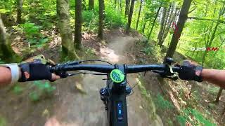
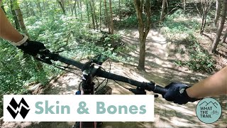
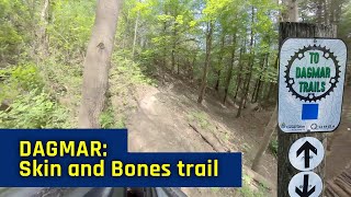
Trail opened - July 18th 2020 - Please use this downhill with caution, as this trail was built for experienced riders only. DO NOT ride around or walk over the entrance filter (the large rock). If you cannot ride over the boulder then this trail is more technical than you should attempt. Ride Biopace instead. Ride Down Hill ONLY. Consider walking it the 1st time.

source: DMBA
Disclaimer

This trail is for experienced mountain bikers. DO NOT ride around or walk over the entrance filter. If you cannot ride over the boulder then this trail is more technical than you should attempt. Ride Biopace instead.

Local Trail Association

Recent Activity on Trail

Past Week
  • 17 rides
  • 12 miles average
6 Months
  • 127 rides
  • 11 miles avg distance
All
  • 2,751 rides
  • Last: Jun 24, 2026
c1c2c3c4
January
February
March
April
May
June
July
August
September
October
November
December
update trails status or condition

Skin & Bones Trail Reports

Status:
on Jun 13, 2026
Ideal
Avg: 4.43 (15 votes)
Your vote: 0

view (5,692)
close
3D
Trail Conditions
  • Unknown
  • Snow Groomed
  • Snow Packed
  • Snow Covered
  • Snow Cover Partial
  • Freeze/thaw Cycle
  • Icy
  • Prevalent Mud
  • Wet
  • Variable
  • Ideal
  • Dry
  • Very Dry
Trail Flow (Ridden Direction)
Trailforks scans users ridelogs to determine the most popular direction each trail is ridden. A good flowing trail network will have most trails flowing in a single direction according to their intension.
The colour categories are based on what percentage of riders are riding a trail in its intended direction.
  • > 96%
  • > 90%
  • > 80%
  • > 70%
  • > 50%
  • < 50%
  • bi-directional trail
  • no data
Trail Last Ridden
Trailforks scans ridelogs to determine the last time a trail was ridden.
  • < 2 days
  • < 1 week
  • < 2 weeks
  • < 1 month
  • < 6 months
  • > 6 months
Trail Ridden Direction
The intended direction a trail should be ridden.
  • Downhill Only
  • Downhill Primary
  • Both Directions
  • Uphill Primary
  • Uphill Only
  • One Direction
Contribute Details
Colors indicate trail is missing specified detail.
  • Description
  • Photos
  • Description & Photos
  • Videos
Trail Popularity ?
Trailforks scans ridelogs to determine which trails are ridden the most in the last 9 months. Trails are compared with nearby trails in the same city region with a possible 25 colour shades. Think of this as a heatmap, more rides = more kinetic energy = warmer colors.
  • most popular
  • popular
  • less popular
  • not popular
ATV/ORV/OHV Filter
Max Vehicle Width
inches
US Cell Coverage
Legend
cell carrier legend

Radar Time
Activity Recordings
Trailforks uses anonymized public activity data. ?
Activity Recordings
Trailforks uses anonymized public activity data. ?
Personal Heatmap
Activity Types
all / none
Options
2
Date range month
Winter Trails
Warning A routing network for winter maps does not exist. Selecting trails using the winter trails layer has been disabled.
Missing Trails
Most Popular
Least Popular
Trails are colored based on popularity. The more popular a trail is, the more red. Less popular trails trend towards green.
Jump Magnitude Heatmap
Heatmap of where riders jump on trails. Zoom in to see individual jumps, click circles to view jump details.
BC Backroad Status

Service Road Atlas is a free to use, community-driven service for viewing and creating reports on the numerous back-country service roads around B.C. and Alberta.

map legend
Slope Aspect
Direction the slope faces
Flat N NE E SE S SW W NW
Trails Deemphasized
Trails are shown in grey.
disable
Only show trails with no bike usage.
Enable
Suggested Layers
Based on selected activity type

    Save the current map location and zoom level as your default home location whenever this page is loaded.

    Save
        Directions to skin--bones trailhead (44.018440, -79.064720)

        Photos

        24 more »
        72 |
        Jun 15, 2025 @ 2:19pm
        Jun 15, 2025
        84 |
        Jun 15, 2025 @ 2:10pm
        Jun 15, 2025
        62 |
        Jun 15, 2025 @ 2:01pm
        Jun 15, 2025
        70 |
        Jun 15, 2025 @ 2:00pm
        Jun 15, 2025

        Videos

        8 more »
        Skin and bone July 27 2024
        3:46 | 472 | Sep 10, 2024 , Uxbridge
        Skin and Bones - Dagmar North MTB
        3:56 | 647 | Sep 6, 2022 , Uxbridge
        Dagmar North Trail - Granite Planet and Skin...
        7:22 | 905 | Jul 27, 2021 , Uxbridge
        Dagmar - Skin and Bones trail - June 2021
        2:55 | 558 | Jun 24, 2021 , Uxbridge

        Routes with this trail

        5.0 9 miles 882 ft 8 Loop
        As most of the trails now are one way, this route completes the entire single track routes with minimum...
        4.4 16 miles 1,397 ft 27
        26km of the best trails between Durham over to Dagmar and back
        2.0 16 miles 1,373 ft 43 Loop
        Durham and Dagmar loop from the east gate, around some trail closures.

        21 Reviews & Comments


        We hope you've been enjoying Trailforks!

        Create a FREE account to view trail comments and much more.

        • By bruce-macTF Pro DMBA & contributors
        • #239269 - 7,151 views

        Frequently Asked Questions About Skin & Bones

        Where is Skin & Bones located?
        Skin & Bones is located in Dagmar North Trails, Uxbridge, Ontario, Canada. It is part of the Dagmar North Trails trail network. The trailhead is located at coordinates 44.01844, -79.06472.
        How hard is Skin & Bones?
        Skin & Bones is rated as Double Black Diamond difficulty. The physical rating is Moderate. The average grade is 6.1%.
        What is the elevation gain for Skin & Bones?
        Skin & Bones has 3 ft of elevation gain. The trail has 124 ft of elevation descent. The elevation ranges from 976 ft to 1,097 ft.
        Is Skin & Bones a point to point trail?
        Yes, Skin & Bones is a point to point trail. The direction is Downhill Only. The trail type is singletrack.

        Hit the Trail

        Open in App

        Get this trail on your phone instantly.
        open trail in app

        Download Trail

        Save to wishlist, Garmin & download.
        save the trail

        Find Related Routes

        Find routes and users activities that include this trail.
        find routes for this trail

        You must enter a description before submitting.