
Open in App
Get this trail on your phone instantly.

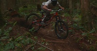
Fast & flowy trail that is fairly straight. Cutting right across the mountain from the bottom of Upper PowerSmart to the access road or an optional bridge gap route that connects to the bottom portion of Grin and Holler.
| c1 | c2 | c3 | c4 |
|---|---|---|---|
January | February | March | April |
May | June | July | August |
September | October | November | December |

Service Road Atlas is a free to use, community-driven service for viewing and creating reports on the numerous back-country service roads around B.C. and Alberta.
Save the current map location and zoom level as your default home location whenever this page is loaded.
SaveWe hope you've been enjoying Trailforks!
Create a FREE account to view trail comments and much more.
You must enter a description before submitting.

