more stats
4,357 ft
Distance
108 ft
Climb
-69 ft
Descent
00:14:30
Avg time
38 ft
Altitude change
808 ft
Altitude min
905 ft
Altitude max
808 ft
Altitude start
846 ft
Altitude end
0.9%
Grade
-17.8%
Grade max
14.3%
Grade min
1,742 ft
Distance climb
1,033 ft
Distance down
1,581 ft
Distance flat
00:14:30
Avg time

Skylands Details

  • Activities
    • Mountain Bike
    • Hike
    • Trail Running
  • Riding Area
    Ringwood State Park
    Ringwood, New Jersey
  • Difficulty Rating
  • Voted Difficulty
    Black Diamond (2 votes)
  • Local Popularity
    90 in Mountain Biking [+]
    • 65 in Trail Running
    • 90 in Hiking
  • Global Ranking
    #36001 in Mountain Biking [+]
    • #34980 in Trail Running
    • #24499 in Hiking
  • Blaze Color
  • Trail Type
    Singletrack
  • Bike Type
    DH, AM, XC, Fat
  • Direction
    Both Directions
  • Climb Difficulty
    Blue
  • Physical Rating
    Hard
  • Trail Visibility
    Sometimes hard to follow
  • Dogs Allowed
    Yes
  • eBike Allowed
  • TTFs on Trail
    Rock Face, Rock Garden
  • Ride in Rain
    Yes
  • Year Opened
    2008

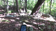
This advanced trail designed to ride equally well in both directions, be warned it's chock full of rock features. It may be found by starting at the intersection of Ringwood-Ramapo Trail and Crossover Trail (Warm Puppy Rock) and continuing north on the Ringwood-Ramapo (red), Or from the top of the race course switch backs near the gas pipeline. Be safe and Enjoy

Local Trail Association
Traditionally Indigenous Territory

Recent Activity on Trail

Past Week
  • 6 rides
  • 13 miles average
6 Months
  • 56 rides
  • 11 miles avg distance
All
  • 707 rides
  • Last: Jun 20, 2026
c1c2c3c4
January
February
March
April
May
June
July
August
September
October
November
December
update trails status or condition

Skylands Trail Reports

statusdatedescription
Jun 20, 2026 @ 2:08pm (America/New_York)
11 hours
Jun 8, 2026 @ 2:36pm (America/New_York)
Jun 8, 2026
Apr 3, 2026 @ 4:18pm (America/New_York)
Apr 3, 2026
I am an intermediate / anvanced rider, and I almost didn't do this trail because of the scary reviews. It was great! Chalanging and so much fun!...
Jan 10, 2026 @ 10:51am (America/New_York)
Jan 10, 2026
Aug 31, 2025 @ 10:05am
Aug 31, 2025
more »
Status:
on Jun 20, 2026
Avg: 4.14 (8 votes)
Your vote: 0

view (3,785)
close
3D
Trail Conditions
  • Unknown
  • Snow Groomed
  • Snow Packed
  • Snow Covered
  • Snow Cover Partial
  • Freeze/thaw Cycle
  • Icy
  • Prevalent Mud
  • Wet
  • Variable
  • Ideal
  • Dry
  • Very Dry
Trail Flow (Ridden Direction)
Trailforks scans users ridelogs to determine the most popular direction each trail is ridden. A good flowing trail network will have most trails flowing in a single direction according to their intension.
The colour categories are based on what percentage of riders are riding a trail in its intended direction.
  • > 96%
  • > 90%
  • > 80%
  • > 70%
  • > 50%
  • < 50%
  • bi-directional trail
  • no data
Trail Last Ridden
Trailforks scans ridelogs to determine the last time a trail was ridden.
  • < 2 days
  • < 1 week
  • < 2 weeks
  • < 1 month
  • < 6 months
  • > 6 months
Trail Ridden Direction
The intended direction a trail should be ridden.
  • Downhill Only
  • Downhill Primary
  • Both Directions
  • Uphill Primary
  • Uphill Only
  • One Direction
Contribute Details
Colors indicate trail is missing specified detail.
  • Description
  • Photos
  • Description & Photos
  • Videos
Trail Popularity ?
Trailforks scans ridelogs to determine which trails are ridden the most in the last 9 months. Trails are compared with nearby trails in the same city region with a possible 25 colour shades. Think of this as a heatmap, more rides = more kinetic energy = warmer colors.
  • most popular
  • popular
  • less popular
  • not popular
ATV/ORV/OHV Filter
Max Vehicle Width
inches
US Cell Coverage
Legend
cell carrier legend

Radar Time
Activity Recordings
Trailforks uses anonymized public activity data. ?
Activity Recordings
Trailforks uses anonymized public activity data. ?
Personal Heatmap
Activity Types
all / none
Options
2
Date range month
Winter Trails
Warning A routing network for winter maps does not exist. Selecting trails using the winter trails layer has been disabled.
Missing Trails
Most Popular
Least Popular
Trails are colored based on popularity. The more popular a trail is, the more red. Less popular trails trend towards green.
Jump Magnitude Heatmap
Heatmap of where riders jump on trails. Zoom in to see individual jumps, click circles to view jump details.
BC Backroad Status

Service Road Atlas is a free to use, community-driven service for viewing and creating reports on the numerous back-country service roads around B.C. and Alberta.

map legend
Slope Aspect
Direction the slope faces
Flat N NE E SE S SW W NW
Trails Deemphasized
Trails are shown in grey.
disable
Only show trails with no bike usage.
Enable
Suggested Layers
Based on selected activity type

    Save the current map location and zoom level as your default home location whenever this page is loaded.

    Save
        Directions to skylands trailhead (41.126490, -74.225240)

        Photos

        6 more »
        462 |
        Feb 22, 2020 @ 3:45am
        Feb 22, 2020
        721 |
        Apr 6, 2011 @ 5:59pm
        Apr 6, 2011
        584 |
        Apr 6, 2011 @ 5:59pm
        Apr 6, 2011
        5 |
        Jun 8, 2026 @ 11:36am
        Jun 8, 2026

        Videos

        3 more »
        youtuber “It's all rocks all the time” Ringwood...
        15:13 | 480 | Mar 16, 2022 , Ringwood
        Skylands/Ringwood Ramapo Southbound Oct 14, 2021
        22:34 | 253 | Oct 16, 2021 , Ringwood
        Ringwood 9-13-20 - Skylands Trail
        5:11 | 184 | Sep 13, 2020 , Ringwood

        Routes with this trail

        5.0 23 miles 2,621 ft 24 Loop
        A demanding 20 mile loop hitting almost all of the best trails in Ringwood State Park. The shown route...
        5.0 13 miles 1,885 ft 14
        Covering the best of the core single track at Ringwood in the most rewarding directions.
        5 miles 566 ft 3 Loop
        A shorter advanced loop featuring all the glorious gnar of s, just long enough to get you back to the fest...

        5 Reviews & Comments


        We hope you've been enjoying Trailforks!

        Create a FREE account to view trail comments and much more.

        Frequently Asked Questions About Skylands

        Where is Skylands located?
        Skylands is located in Ringwood State Park, Ringwood, New Jersey, United States. It is part of the Ringwood State Park trail network. The trailhead is located at coordinates 41.12649, -74.22524.
        How hard is Skylands?
        Skylands is rated as Black Diamond difficulty. The physical rating is Hard. The average grade is 0.9%. The climb difficulty is rated Blue.
        What is the elevation gain for Skylands?
        Skylands has 108 ft of elevation gain. The trail has 69 ft of elevation descent. The elevation ranges from 808 ft to 905 ft.
        Is Skylands a point to point trail?
        Skylands is not a point to point trail. The direction is Both Directions. The trail type is singletrack.

        Hit the Trail

        Open in App

        Get this trail on your phone instantly.
        open trail in app

        Download Trail

        Save to wishlist, Garmin & download.
        save the trail

        Find Related Routes

        Find routes and users activities that include this trail.
        find routes for this trail

        You must enter a description before submitting.