more stats
5,144 ft
Distance
-457 ft
Descent
00:08:25
Avg time
-457 ft
Altitude change
978 ft
Altitude min
1,436 ft
Altitude max
1,435 ft
Altitude start
978 ft
Altitude end
-8.9%
Grade
-34%
Grade max
0.6%
Grade min
79 ft
Distance climb
4,718 ft
Distance down
344 ft
Distance flat
00:08:25
Avg time

Slalomka Details

  • Activities
    • Mountain Bike
    • Winter Fat Bike
  • Riding Area
    Trail Biely Kríž
    Bratislava
  • Difficulty Rating
  • Voted Difficulty
    Black Diamond (13 votes)
  • Local Popularity
    85 in Mountain Biking
  • Global Ranking
    #25637 in Mountain Biking
  • Trail Type
    Singletrack
  • Bike Type
    DH, AM, Fat
  • Direction
    Downhill Only
    Popular Direction Shown
  • Climb Difficulty
    Green
  • Physical Rating
    Moderate
  • Trail Visibility
    Sometimes hard to follow
  • eBike Allowed
    Yes up to Class 1
  • TTFs on Trail
    Berm, Jump, Gap Jump, Log Ride, Rock Garden
  • Year Opened
    2018

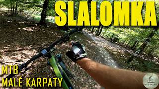
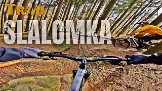
Access to trail Slalomka is located after the uphill section coming off the Červený kríž location. The character of this trail is mainly downhill with few short uphill sections. Slope of the trail is moderate with medium difficulty. The more demanding features and jumps can be found as well, and these features can be bypassed or tackled in lower speeds. Last part of the trail is built as a traverse that is narrow and with a higher difficulty. The trail has an alternative last section that represents the old freeride/downhill trail Slalomka. This section of the trail is steep and more demanding.

Trail with different character consisting of uphill sections, berms, waves, smaller and bigger jumps

Trail Supporters
  • Sponsor
Local Trail Association

Recent Activity on Trail

Past Week
  • 3 rides
  • 31.6 km average
6 Months
  • 26 rides
  • 39.2 km avg distance
All
  • 253 rides
  • Last: Jun 17, 2026
c1c2c3c4
January
February
March
April
May
June
July
August
September
October
November
December
update trails status or condition

Slalomka Trail Reports

Status:
on Jan 19, 2026
Icy
Avg: 4.57 (20 votes)
Your vote: 0

view (3,196)
close
3D
Trail Conditions
  • Unknown
  • Snow Groomed
  • Snow Packed
  • Snow Covered
  • Snow Cover Partial
  • Freeze/thaw Cycle
  • Icy
  • Prevalent Mud
  • Wet
  • Variable
  • Ideal
  • Dry
  • Very Dry
Trail Flow (Ridden Direction)
Trailforks scans users ridelogs to determine the most popular direction each trail is ridden. A good flowing trail network will have most trails flowing in a single direction according to their intension.
The colour categories are based on what percentage of riders are riding a trail in its intended direction.
  • > 96%
  • > 90%
  • > 80%
  • > 70%
  • > 50%
  • < 50%
  • bi-directional trail
  • no data
Trail Last Ridden
Trailforks scans ridelogs to determine the last time a trail was ridden.
  • < 2 days
  • < 1 week
  • < 2 weeks
  • < 1 month
  • < 6 months
  • > 6 months
Trail Ridden Direction
The intended direction a trail should be ridden.
  • Downhill Only
  • Downhill Primary
  • Both Directions
  • Uphill Primary
  • Uphill Only
  • One Direction
Contribute Details
Colors indicate trail is missing specified detail.
  • Description
  • Photos
  • Description & Photos
  • Videos
Trail Popularity ?
Trailforks scans ridelogs to determine which trails are ridden the most in the last 9 months. Trails are compared with nearby trails in the same city region with a possible 25 colour shades. Think of this as a heatmap, more rides = more kinetic energy = warmer colors.
  • most popular
  • popular
  • less popular
  • not popular
ATV/ORV/OHV Filter
Max Vehicle Width
inches
US Cell Coverage
Legend
cell carrier legend

Radar Time
Activity Recordings
Trailforks uses anonymized public activity data. ?
Activity Recordings
Trailforks uses anonymized public activity data. ?
Personal Heatmap
Activity Types
all / none
Options
2
Date range month
Winter Trails
Warning A routing network for winter maps does not exist. Selecting trails using the winter trails layer has been disabled.
Missing Trails
Most Popular
Least Popular
Trails are colored based on popularity. The more popular a trail is, the more red. Less popular trails trend towards green.
Jump Magnitude Heatmap
Heatmap of where riders jump on trails. Zoom in to see individual jumps, click circles to view jump details.
BC Backroad Status

Service Road Atlas is a free to use, community-driven service for viewing and creating reports on the numerous back-country service roads around B.C. and Alberta.

map legend
Slope Aspect
Direction the slope faces
Flat N NE E SE S SW W NW
Trails Deemphasized
Trails are shown in grey.
disable
Only show trails with no bike usage.
Enable
Suggested Layers
Based on selected activity type

    Save the current map location and zoom level as your default home location whenever this page is loaded.

    Save
        Directions to slalomka trailhead (48.229490, 17.131090)

        Photos

        10 more »
        539 |
        Oct 6, 2018 @ 11:49am
        Oct 6, 2018
        551 |
        Oct 6, 2018 @ 11:50am
        Oct 6, 2018
        174 |
        May 3, 2021 @ 11:10am
        May 3, 2021
        140 |
        May 3, 2021 @ 11:10am
        May 3, 2021

        Videos

        10 more »
        Trail Slalomka má novú skvelú a drsnú...
        21:04 | 28 | Jan 6, 2026 , Bratislava
        MTB Biely Kríž - Slalomka
        4:18 | 207 | Apr 18, 2024 , Bratislava
        #1 SlovakTrails - SLALOMKA - RAW edit
        5:23 | 220 | May 13, 2023 , Bratislava
        Chased by mosquitoes
        0:20 | 273 | Aug 1, 2021 , Bratislava

        Routes with this trail

        14 miles 3,158 ft 9 Loop Race
        We invite you to the / informal / continuation of TBK Enduro race 2019. This time in the form of the final...

        Reviews / Comments

        No reviews yet, be the first to write a review or ask a question.
        Use trail reports to comment on trail conditions.


        We hope you've been enjoying Trailforks!

        Create a FREE account to view trail comments and much more.

        • By ZelenaliskaTF Pro TBK & contributors
        • #170441 - 8,438 views

        Frequently Asked Questions About Slalomka

        Where is Slalomka located?
        Slalomka is located in Trail Biely Kríž, Bratislava, Slovakia. It is part of the Trail Biely Kríž trail network. The trailhead is located at coordinates 48.22949, 17.13109.
        How hard is Slalomka?
        Slalomka is rated as Blue difficulty. The physical rating is Moderate. The average grade is 8.9%. The climb difficulty is rated Green.
        What is the elevation gain for Slalomka?
        The trail has 457 ft of elevation descent. The elevation ranges from 978 ft to 1,436 ft.
        Is Slalomka a point to point trail?
        Yes, Slalomka is a point to point trail. The direction is Downhill Only. The trail type is singletrack.

        Hit the Trail

        Open in App

        Get this trail on your phone instantly.
        open trail in app

        Download Trail

        Save to wishlist, Garmin & download.
        save the trail

        Find Related Routes

        Find routes and users activities that include this trail.
        find routes for this trail

        You must enter a description before submitting.