more stats
1,385 ft
Distance
3 ft
Climb
-173 ft
Descent
00:01:45
Avg time
-170 ft
Altitude change
543 ft
Altitude min
717 ft
Altitude max
717 ft
Altitude start
548 ft
Altitude end
-12.3%
Grade
-27.9%
Grade max
5.7%
Grade min
59 ft
Distance climb
1,083 ft
Distance down
233 ft
Distance flat
00:01:45
Avg time

Sofa King Details

  • Activities
    • Mountain Bike
    • E-Bike
  • Riding Area
    Hartland Mountain Bike Park
    Victoria, British Columbia
  • Difficulty Rating
  • Voted Difficulty
    Blue (3 votes)
  • Local Popularity
    100 in Mountain Biking [+]
    • 100 in E-Biking
  • Global Ranking
    #2926 in Mountain Biking [+]
    • #2206 in E-Biking
  • Trail Type
    Singletrack
  • Bike Type
    AM, XC
  • Direction
    Downhill Only
    Popular Direction Shown
  • Physical Rating
    Easy
  • Trail Visibility
    Always easy to follow
  • Dogs Allowed
    Yes
  • eBike Allowed
    Yes up to Class 1
  • TTFs on Trail
    Berm, Drop, Jump, Rock Face
  • Ride in Rain
    Yes
  • Land Owner

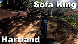
SK used to be an old school trail comprised of gnarly/sketchy stunts and structures with high consequences. All the old stuff is gone save for a couple of natural features that sees little to no action. SIMBS and the trail elves have created a short, flowy, pumpy trail with berms, hits, and table tops at near bike park quality rideable for newbies to pros.
n
Work seems to be flowing from the top down with the latest feature being a hip/table and small step down with a near-endless tranny (Jun 2014). Rock drops and a steep rock up and over were added in 2015-16 providing advanced options off the main intermediate line. Quite fun to session and work up to getting more and more air time.

Lots of thanks to the folks that keep making this a better trail.

Trail Supporters
  • Original: Landon Maclean, Josh Vanderkoven (?), Ed,
    Builder
  • Malcom & Spencer Ranson, Jake Innes, Jacob Van Dam, Max McCullough
    Builder
  • SIMBS
    Maintainer
Local Trail Association

Recent Activity on Trail

Past Week
  • 49 rides
  • 6 miles average
6 Months
  • 1,048 rides
  • 7 miles avg distance
All
  • 7,521 rides
  • Last: Jun 22, 2026
c1c2c3c4
January
February
March
April
May
June
July
August
September
October
November
December
Status:
on Jun 7, 2026
Ideal
Avg: 4.47 (42 votes)
Your vote: 0

view (27,945)
close
3D
Trail Conditions
  • Unknown
  • Snow Groomed
  • Snow Packed
  • Snow Covered
  • Snow Cover Partial
  • Freeze/thaw Cycle
  • Icy
  • Prevalent Mud
  • Wet
  • Variable
  • Ideal
  • Dry
  • Very Dry
Trail Flow (Ridden Direction)
Trailforks scans users ridelogs to determine the most popular direction each trail is ridden. A good flowing trail network will have most trails flowing in a single direction according to their intension.
The colour categories are based on what percentage of riders are riding a trail in its intended direction.
  • > 96%
  • > 90%
  • > 80%
  • > 70%
  • > 50%
  • < 50%
  • bi-directional trail
  • no data
Trail Last Ridden
Trailforks scans ridelogs to determine the last time a trail was ridden.
  • < 2 days
  • < 1 week
  • < 2 weeks
  • < 1 month
  • < 6 months
  • > 6 months
Trail Ridden Direction
The intended direction a trail should be ridden.
  • Downhill Only
  • Downhill Primary
  • Both Directions
  • Uphill Primary
  • Uphill Only
  • One Direction
Contribute Details
Colors indicate trail is missing specified detail.
  • Description
  • Photos
  • Description & Photos
  • Videos
Trail Popularity ?
Trailforks scans ridelogs to determine which trails are ridden the most in the last 9 months. Trails are compared with nearby trails in the same city region with a possible 25 colour shades. Think of this as a heatmap, more rides = more kinetic energy = warmer colors.
  • most popular
  • popular
  • less popular
  • not popular
ATV/ORV/OHV Filter
Max Vehicle Width
inches
US Cell Coverage
Legend
cell carrier legend

Radar Time
Activity Recordings
Trailforks uses anonymized public activity data. ?
Activity Recordings
Trailforks uses anonymized public activity data. ?
Personal Heatmap
Activity Types
all / none
Options
2
Date range month
Winter Trails
Warning A routing network for winter maps does not exist. Selecting trails using the winter trails layer has been disabled.
Missing Trails
Most Popular
Least Popular
Trails are colored based on popularity. The more popular a trail is, the more red. Less popular trails trend towards green.
Jump Magnitude Heatmap
Heatmap of where riders jump on trails. Zoom in to see individual jumps, click circles to view jump details.
BC Backroad Status

Service Road Atlas is a free to use, community-driven service for viewing and creating reports on the numerous back-country service roads around B.C. and Alberta.

map legend
Slope Aspect
Direction the slope faces
Flat N NE E SE S SW W NW
Trails Deemphasized
Trails are shown in grey.
disable
Only show trails with no bike usage.
Enable
Suggested Layers
Based on selected activity type

    Save the current map location and zoom level as your default home location whenever this page is loaded.

    Save
        Directions to sofa-king trailhead (48.522150, -123.465760)

        Photos

        27 more »
        87 |
        Jul 11, 2023 @ 11:01am
        Jul 11, 2023
        95 |
        Jun 5, 2023 @ 11:23pm
        Jun 5, 2023
        139 |
        Jan 12, 2023 @ 2:04pm
        Jan 12, 2023
        200 |
        Jan 24, 2022 @ 10:45pm
        Jan 24, 2022

        Videos

        67 more »
        Feb 9th, 2025 Snow
        2:52 | 98 | Feb 9, 2025 , Victoria
        youtuber December Mountain Biking in Victoria, BC
        4:44 | 175 | Dec 20, 2024 , Victoria
        Sofa King - Hartland 2024
        0:20 | 130 | Oct 1, 2024 , Victoria
        youtuber Sofa King - Hartland Mountain Bike Park
        0:11 | 523 | Dec 15, 2022 , Victoria

        Routes with this trail

        5.0 6 miles 1,087 ft 13
        This loop suggestion is part of our Community Routes—a group of routes created by the community, for the...
        4.8 5 miles 981 ft 26 Loop
        Pretty fantastic route around Hartland. Easily sub Snakes for Torpedo and/or for Sofa if you want to up...
        5 miles 952 ft 11
        Join us for a women's and non-binary community enduro race at Hartland Bike Park! Low barrier, high vibes,...

        3 Reviews & Comments


        We hope you've been enjoying Trailforks!

        Create a FREE account to view trail comments and much more.

        • By highrocker1298TF Pro & contributors
        • #6957 - 14,364 views

        Frequently Asked Questions About Sofa King

        Where is Sofa King located?
        Sofa King is located in Hartland Mountain Bike Park, Victoria, British Columbia, Canada. It is part of the Hartland Mountain Bike Park trail network. The trailhead is located at coordinates 48.52215, -123.46576.
        How hard is Sofa King?
        Sofa King is rated as Blue difficulty. The physical rating is Easy. The average grade is 12.3%.
        What is the elevation gain for Sofa King?
        Sofa King has 1 m of elevation gain. The trail has 53 m of elevation descent. The elevation ranges from 166 m to 219 m.
        Is Sofa King a point to point trail?
        Yes, Sofa King is a point to point trail. The direction is Downhill Only. The trail type is singletrack.

        Hit the Trail

        Open in App

        Get this trail on your phone instantly.
        open trail in app

        Download Trail

        Save to wishlist, Garmin & download.
        save the trail

        Find Related Routes

        Find routes and users activities that include this trail.
        find routes for this trail

        You must enter a description before submitting.