more stats
2,526 ft
Distance
17 ft
Climb
-151 ft
Descent
00:03:34
Avg time
-135 ft
Altitude change
1,378 ft
Altitude min
1,519 ft
Altitude max
1,515 ft
Altitude start
1,381 ft
Altitude end
-5.4%
Grade
-26.1%
Grade max
10.3%
Grade min
371 ft
Distance climb
1,355 ft
Distance down
801 ft
Distance flat
00:03:34
Avg time

Stefanka Details

  • Activities
    • Mountain Bike
    • E-Bike
  • Riding Area
  • Difficulty Rating
  • Voted Difficulty
    Green (1 vote)
  • Local Popularity
    75 in Mountain Biking [+]
    • 70 in E-Biking
  • Global Ranking
    #51475 in Mountain Biking [+]
    • #49952 in E-Biking
  • Trail Type
    Singletrack
  • Bike Type
    AM, XC
  • Direction
    One Direction
    Popular Direction Shown
  • Trail Visibility
    Always easy to follow
  • Dogs Allowed
    Yes
  • eBike Allowed
    Yes up to Class 1
  • Land Owner
    Enduro Trails Bielsko-Biała

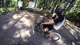
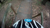
Łagodnie opadająca kręta i pofalowana ścieżka. Zaczyna się niedaleko od centrum, powyżej starego amfiteatru (dojazd z Błoni na start trwa około 5-7 minut) a kończy na Ul. Modrej. Poradzi sobie na niej każdy kolarz górski, trzeba jednak uważać na dosyć ciasne zakręty i niewielką szerokość trasy.

Bike Park

Recent Activity on Trail

Past Week
  • 1 rides
  • 3 miles average
6 Months
  • 20 rides
  • 10 miles avg distance
All
  • 252 rides
  • Last: Jun 30, 2026
c1c2c3c4
January
February
March
April
May
June
July
August
September
October
November
December
Status:
on Sep 30, 2025
Ideal
Avg: 4.11 (11 votes)
Your vote: 0

view (3,628)
close
3D
Trail Conditions
  • Unknown
  • Snow Groomed
  • Snow Packed
  • Snow Covered
  • Snow Cover Partial
  • Freeze/thaw Cycle
  • Icy
  • Prevalent Mud
  • Wet
  • Variable
  • Ideal
  • Dry
  • Very Dry
Trail Flow (Ridden Direction)
Trailforks scans users ridelogs to determine the most popular direction each trail is ridden. A good flowing trail network will have most trails flowing in a single direction according to their intension.
The colour categories are based on what percentage of riders are riding a trail in its intended direction.
  • > 96%
  • > 90%
  • > 80%
  • > 70%
  • > 50%
  • < 50%
  • bi-directional trail
  • no data
Trail Last Ridden
Trailforks scans ridelogs to determine the last time a trail was ridden.
  • < 2 days
  • < 1 week
  • < 2 weeks
  • < 1 month
  • < 6 months
  • > 6 months
Trail Ridden Direction
The intended direction a trail should be ridden.
  • Downhill Only
  • Downhill Primary
  • Both Directions
  • Uphill Primary
  • Uphill Only
  • One Direction
Contribute Details
Colors indicate trail is missing specified detail.
  • Description
  • Photos
  • Description & Photos
  • Videos
Trail Popularity ?
Trailforks scans ridelogs to determine which trails are ridden the most in the last 9 months. Trails are compared with nearby trails in the same city region with a possible 25 colour shades. Think of this as a heatmap, more rides = more kinetic energy = warmer colors.
  • most popular
  • popular
  • less popular
  • not popular
ATV/ORV/OHV Filter
Max Vehicle Width
inches
US Cell Coverage
Legend
cell carrier legend

Radar Time
Activity Recordings
Trailforks uses anonymized public activity data. ?
Activity Recordings
Trailforks uses anonymized public activity data. ?
Personal Heatmap
Activity Types
all / none
Options
2
Date range month
Winter Trails
Warning A routing network for winter maps does not exist. Selecting trails using the winter trails layer has been disabled.
Missing Trails
Most Popular
Least Popular
Trails are colored based on popularity. The more popular a trail is, the more red. Less popular trails trend towards green.
Jump Magnitude Heatmap
Heatmap of where riders jump on trails. Zoom in to see individual jumps, click circles to view jump details.
BC Backroad Status

Service Road Atlas is a free to use, community-driven service for viewing and creating reports on the numerous back-country service roads around B.C. and Alberta.

map legend
Slope Aspect
Direction the slope faces
Flat N NE E SE S SW W NW
Trails Deemphasized
Trails are shown in grey.
disable
Only show trails with no bike usage.
Enable
Suggested Layers
Based on selected activity type

    Save the current map location and zoom level as your default home location whenever this page is loaded.

    Save
        Directions to stefanka trailhead (49.774350, 19.057140)

        Photos

        3 more »
        257 |
        May 17, 2018 @ 8:26am
        May 17, 2018
        237 |
        May 17, 2018 @ 8:26am
        May 17, 2018
        26 |
        Oct 1, 2025 @ 7:40pm
        Oct 1, 2025
        31 |
        Oct 1, 2025 @ 7:39pm
        Oct 1, 2025

        Videos

        3 more »
        Enduro Trails - STEFANKA (Bielsko-Biała -...
        2:00 | 498 | Nov 20, 2020 , Bielsko-Biała
        Kozia Góra - Stefanka // Enduro Trails, Bielsko
        2:14 | 534 | Jul 31, 2019 , Bielsko-Biała
        Stefanka 2018 - Enduro Trails - Cała trasa
        2:01 | 144 | May 12, 2018 , Bielsko-Biała

        1 Review & Comments


        We hope you've been enjoying Trailforks!

        Create a FREE account to view trail comments and much more.

        Frequently Asked Questions About Stefanka

        Where is Stefanka located?
        Stefanka is located in Enduro Trails Bielsko-Biała, Bielsko-Biała, Poland. It is part of the Enduro Trails Bielsko-Biała trail network. The trailhead is located at coordinates 49.77435, 19.05714.
        How hard is Stefanka?
        Stefanka is rated as Green difficulty. The average grade is 5.4%.
        What is the elevation gain for Stefanka?
        Stefanka has 5 m of elevation gain. The trail has 46 m of elevation descent. The elevation ranges from 420 m to 463 m.
        Is Stefanka a point to point trail?
        Yes, Stefanka is a point to point trail. The direction is One Direction. The trail type is singletrack.

        Hit the Trail

        Open in App

        Get this trail on your phone instantly.
        open trail in app

        Download Trail

        Save to wishlist, Garmin & download.
        save the trail

        Find Related Routes

        Find routes and users activities that include this trail.
        find routes for this trail

        You must enter a description before submitting.