

Open in App
Get this trail on your phone instantly.

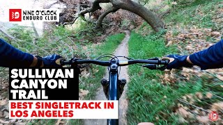
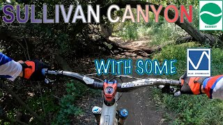
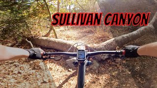
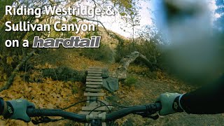
A beautiful downhill run that wends its way under the shade of sycamore trees and crosses running water in the spring. Sullivan Canyon is both a single track and a double wide path that goes from Queensferry Road up to Sullivan Ridge Fire Road, and eventually to dirt Mulholland.
The single track winds back and forth across the wider central trail, which runs up the center of the canyon. Watch for hikers and kids where the single track crosses the path. The single track is a downhill run from north to south. Take the wide path up and the single track back, or ride up Sullivan Ridge and take Sullivan Canyon down. They connect just below dirt Mulholland.
If you take the route down from dirt Mulholland you have three options to get back up. First is simply taking Sullivan Canyon back up, using the wide middle path. Second, there is a switch back on the left a few hundred yards out from the Queensferry parking area called the Squirrel Cage. It climbs up to Sullivan Ridge, and from there to dirt Mulholland. However it is hidden in the undergrowth and difficult to find. The third route is on streets out through Queensferry and eventually up Westridge Road until it turns into the West Mandeville Fire Road, climbing to dirt Mulholland. There is actually a fourth route back to dirt Mulholland if you navigate through the neighborhood to Mandeville Canyon. You can take that up, north, almost to the dead end where you'll find trails on your left and right up the canyon walls that lead to dirt Mulholland and the cold war era Nike Missile Site.
Take Queensferry Road to the dead end and park. The trail starts behind the gate. Optionally start from the top at dirt Mulholland, taking the Sullivan Ridge Fire Road to the Sullivan Canyon trail near the top.
| c1 | c2 | c3 | c4 |
|---|---|---|---|
January | February | March | April |
May | June | July | August |
September | October | November | December |

Service Road Atlas is a free to use, community-driven service for viewing and creating reports on the numerous back-country service roads around B.C. and Alberta.
Save the current map location and zoom level as your default home location whenever this page is loaded.
SaveWe hope you've been enjoying Trailforks!
Create a FREE account to view trail comments and much more.
You must enter a description before submitting.

