more stats
4.3 miles
Distance
442 ft
Climb
-706 ft
Descent
00:32:39
Avg time
-264 ft
Altitude change
5,262 ft
Altitude min
5,681 ft
Altitude max
5,527 ft
Altitude start
5,262 ft
Altitude end
-1.2%
Grade
-22.9%
Grade max
32%
Grade min
2 miles
Distance climb
3 miles
Distance down
781 ft
Distance flat
00:32:39
Avg time

Sundog Trail Details

  • Activities
    • Mountain Bike
    • E-Bike
    • Hike
    • Trail Running
  • Riding Area
    Prescott
    , Arizona
  • Difficulty Rating
  • Voted Difficulty
    Blue (2 votes)
  • Local Popularity
    80 in Mountain Biking [+]
    • 90 in E-Biking
    • 95 in Trail Running
    • 55 in Hiking
  • Global Ranking
    #5153 in Mountain Biking [+]
    • #20786 in Trail Running
    • #96629 in Hiking
  • Trail Type
    Singletrack
  • Bike Type
    XC
  • Direction
    Both Directions
  • Climb Difficulty
    Blue
  • Physical Rating
    Moderate
  • Dogs Allowed
    Yes
  • eBike Allowed
    Yes up to Class 1
  • Land Owner
    City of Prescott

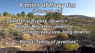
Sundog Ranch Trail is one of the final sections of the Prescott Circle Trail. It can be accessed from the southern end of the Peavine Trail.

To get to the trailhead from Prescott Lakes Parkway, take this road 1.8 miles to the intersection with Sundog Ranch Road. Turn right and take this road 0.1 miles, turning left at the signed trailhead for the Peavine trail. There are restrooms here at the trailhead. Cost to park at the trailhead is $2 (self parking kiosk).

From the Peavine Trail, turn left and follow the trail to the railroad bed. Approximately 3/4 mile south, follow the signage and cross over Sundog Ranch Rd. The trail marker is right across the street.

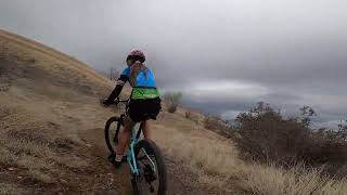
Sundog Ranch Trail begins with a climb to the first summit. This part of the trail is very well maintained and includes one uphill switchback. From this summit, enjoy the bermed turns, then a short descent into the valley. The trail winds through small shrubs and trees and approaches the Juvenile Detention Center. From here, there is the next climb which has a few loose rocks and is stepped nicely. Then another short descent weaving along the hillside to a small creek crossing, then the final climb begins.

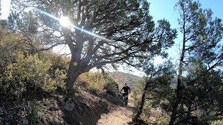
Nothing technical here, just a gentle sustained climb to the summit. As you near the summit you'll have great views of Thumb Butte, Granite Mountain and Prescott to the west. To the east you can see the various car dealerships, the mall and Best Buy. The final descent winds you down the hill with a few tight, loose switchbacks and ends at a tunnel under Highway 69.

Local Trail Association
Traditionally Indigenous Territory

Recent Activity on Trail

Past Week
  • 3 rides
  • 44 miles average
6 Months
  • 52 rides
  • 27 miles avg distance
All
  • 392 rides
  • Last: Jun 21, 2026
c1c2c3c4
January
February
March
April
May
June
July
August
September
October
November
December
update trails status or condition

Sundog Trail Trail Reports

statusdatedescription
Jun 4, 2026 @ 10:26am (America/Phoenix)
Jun 4, 2026
Jan 17, 2026 @ 5:58pm (America/Phoenix)
Jan 17, 2026
Some mud still exists on the northern slopes beneath the green tanks.
Dec 19, 2025 @ 12:13pm (America/Phoenix)
Dec 19, 2025
A few damp spots on Northern slope below the green tank. Some water and mud at the South end of the tunnel.
Nov 6, 2025 @ 8:49am (America/Phoenix)
Nov 6, 2025
Oct 27, 2025 @ 8:56am (America/Phoenix)
Oct 27, 2025
Some shallow mud at South end of the tunnel.
more »
Status:
on Jun 4, 2026
Dry
Avg: 4.47 (14 votes)
Your vote: 0

view (2,710)
close
3D
Trail Conditions
  • Unknown
  • Snow Groomed
  • Snow Packed
  • Snow Covered
  • Snow Cover Partial
  • Freeze/thaw Cycle
  • Icy
  • Prevalent Mud
  • Wet
  • Variable
  • Ideal
  • Dry
  • Very Dry
Trail Flow (Ridden Direction)
Trailforks scans users ridelogs to determine the most popular direction each trail is ridden. A good flowing trail network will have most trails flowing in a single direction according to their intension.
The colour categories are based on what percentage of riders are riding a trail in its intended direction.
  • > 96%
  • > 90%
  • > 80%
  • > 70%
  • > 50%
  • < 50%
  • bi-directional trail
  • no data
Trail Last Ridden
Trailforks scans ridelogs to determine the last time a trail was ridden.
  • < 2 days
  • < 1 week
  • < 2 weeks
  • < 1 month
  • < 6 months
  • > 6 months
Trail Ridden Direction
The intended direction a trail should be ridden.
  • Downhill Only
  • Downhill Primary
  • Both Directions
  • Uphill Primary
  • Uphill Only
  • One Direction
Contribute Details
Colors indicate trail is missing specified detail.
  • Description
  • Photos
  • Description & Photos
  • Videos
Trail Popularity ?
Trailforks scans ridelogs to determine which trails are ridden the most in the last 9 months. Trails are compared with nearby trails in the same city region with a possible 25 colour shades. Think of this as a heatmap, more rides = more kinetic energy = warmer colors.
  • most popular
  • popular
  • less popular
  • not popular
ATV/ORV/OHV Filter
Max Vehicle Width
inches
US Cell Coverage
Legend
cell carrier legend

Radar Time
Activity Recordings
Trailforks uses anonymized public activity data. ?
Activity Recordings
Trailforks uses anonymized public activity data. ?
Personal Heatmap
Activity Types
all / none
Options
2
Date range month
Winter Trails
Warning A routing network for winter maps does not exist. Selecting trails using the winter trails layer has been disabled.
Missing Trails
Most Popular
Least Popular
Trails are colored based on popularity. The more popular a trail is, the more red. Less popular trails trend towards green.
Jump Magnitude Heatmap
Heatmap of where riders jump on trails. Zoom in to see individual jumps, click circles to view jump details.
BC Backroad Status

Service Road Atlas is a free to use, community-driven service for viewing and creating reports on the numerous back-country service roads around B.C. and Alberta.

map legend
Slope Aspect
Direction the slope faces
Flat N NE E SE S SW W NW
Trails Deemphasized
Trails are shown in grey.
disable
Only show trails with no bike usage.
Enable
Suggested Layers
Based on selected activity type

    Save the current map location and zoom level as your default home location whenever this page is loaded.

    Save
        Directions to sundog-trail trailhead (34.552240, -112.416690)

        Photos

        39 more »
        114 |
        Nov 19, 2021 @ 4:22pm
        Nov 19, 2021
        117 |
        Sep 6, 2021 @ 8:39pm
        Sep 6, 2021
        104 |
        Sep 6, 2021 @ 8:39pm
        Sep 6, 2021
        104 |
        Sep 6, 2021 @ 8:39pm
        Sep 6, 2021

        Videos

        6 more »
        Dealership Bypass - Badger Mtn - Sundog +...
        23:27 | 72 | Jul 15, 2025 , Prescott
        Prescott's Sundog Downhill Fun Ride
        22:26 | 153 | May 6, 2024 , Prescott
        Sundog Trail Prescott, AZ Arizona Mountain...
        14:33 | 784 | Nov 6, 2019 , Prescott
        Uber Ride Prescott
        10:24 | 378 | Oct 28, 2019 , Prescott

        Routes with this trail

        5.0 35 miles 2,906 ft 5
        Start at North Peavine trailhead (by hwy 89A), ride South on Peavine to left on Headwaters trail to right...
        2.0 26 miles 1,991 ft 6 Point to Point
        This route includes the lesser technical 26 mile section of the Prescott Circle Trail that can be used for...
        1.0 19 miles 2,127 ft 3 Out & Back
        Starting from the North trailhead ( near hwy. 89A) proceed SOuth to the Headwaters trail. Ride Headwaters...

        3 Reviews & Comments


        We hope you've been enjoying Trailforks!

        Create a FREE account to view trail comments and much more.

        • By schillingsworthTF Pro TRAILFORKS HTA & contributors
        • #33227 - 6,718 views

        Frequently Asked Questions About Sundog Trail

        Where is Sundog Trail located?
        Sundog Trail is located in Prescott, Arizona, United States. It is part of the Prescott trail network. The trailhead is located at coordinates 34.55224, -112.41669.
        How hard is Sundog Trail?
        Sundog Trail is rated as Blue difficulty. The physical rating is Moderate. The average grade is 1.2%. The climb difficulty is rated Blue.
        What is the elevation gain for Sundog Trail?
        Sundog Trail has 442 ft of elevation gain. The trail has 706 ft of elevation descent. The elevation ranges from 5,262 ft to 5,681 ft.
        Is Sundog Trail a point to point trail?
        Sundog Trail is not a point to point trail. The direction is Both Directions. The trail type is singletrack.

        Hit the Trail

        Open in App

        Get this trail on your phone instantly.
        open trail in app

        Download Trail

        Save to wishlist, Garmin & download.
        save the trail

        Find Related Routes

        Find routes and users activities that include this trail.
        find routes for this trail

        You must enter a description before submitting.