more stats
4.3 miles
Distance
1,097 ft
Climb
-934 ft
Descent
00:57:51
Avg time
163 ft
Altitude change
1,784 ft
Altitude min
2,841 ft
Altitude max
1,784 ft
Altitude start
1,946 ft
Altitude end
0.7%
Grade
-59.7%
Grade max
51%
Grade min
3 miles
Distance climb
2 miles
Distance down
456 ft
Distance flat
00:57:51
Avg time

Sunrise Trail Details

  • Activities
    • Mountain Bike
    • Hike
    • Trail Running
  • Riding Area
    McDowell Sonoran Preserve
    Scottsdale, Arizona
  • Difficulty Rating
  • Voted Difficulty
    Black Diamond (1 vote)
  • Local Popularity
    45 in Mountain Biking [+]
    • 70 in Trail Running
    • 85 in Hiking
  • Global Ranking
    #53444 in Mountain Biking [+]
    • #48516 in Trail Running
    • #21727 in Hiking
  • Trail Type
    Singletrack
  • Bike Type
    AM, XC
  • Direction
    Both Directions
  • Climb Difficulty
    Black Diamond
  • Physical Rating
    Extreme
  • Season
    Year round
  • Dogs Allowed
    Yes
  • eBike Allowed
  • Ride in Rain
    Yes
  • Land Owner

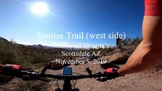
Sunrise is one of the more popular trails in the McDowell range for both hikers and bikers. Great scenery and views are part of the reason, and close access to 2 trailheads are another. The trail is most rideable from west to east, featuring a 45-60 minute rocky climb, followed by a steep and switchback-filled descent (packed with hikers, especially on weekends). Reversing course requires a climb that is too steep for most riders, so some return on Via Linda or alternatively via the Andrews-Kinsey trail. Completing the latter option, however, requires trespassing a neighborhood that has declared itself off limits to bikers.

Access Info

Direct access from Lost Dog Trailhead (preferred for bikes) or Sunrise Trailhead.

Local Trail Association
Traditionally Indigenous Territory

Recent Activity on Trail

Past Week
  • 0 rides
  •  
6 Months
  • 12 rides
  • 18.9 km avg distance
All
  • 130 rides
  • Last: May 23, 2026
c1c2c3c4
January
February
March
April
May
June
July
August
September
October
November
December
update trails status or condition

Sunrise Trail Trail Reports

statusdatedescription
May 2, 2026 @ 9:36am (America/Phoenix)
May 2, 2026
Apr 5, 2024 @ 8:50pm
Apr 5, 2024
In good condition for the Lost Dog to A-K climb (rode as part of big loop, didn't ride down the east half).
Mar 17, 2023 @ 10:59am
Mar 17, 2023
Basically unrideable heading down to the east. More walking than riding. The climb up from the west is good until you get to the hiking parts.....
Jan 18, 2022 @ 3:33pm
Jan 18, 2022
Tons of wash out, lots of hike a bikes.
Sep 9, 2020 @ 8:12pm
Sep 9, 2020
more »
Status:
on May 2, 2026
Dry
Avg: 3.99 (11 votes)
Your vote: 0

view (828)
close
3D
Trail Conditions
  • Unknown
  • Snow Groomed
  • Snow Packed
  • Snow Covered
  • Snow Cover Partial
  • Freeze/thaw Cycle
  • Icy
  • Prevalent Mud
  • Wet
  • Variable
  • Ideal
  • Dry
  • Very Dry
Trail Flow (Ridden Direction)
Trailforks scans users ridelogs to determine the most popular direction each trail is ridden. A good flowing trail network will have most trails flowing in a single direction according to their intension.
The colour categories are based on what percentage of riders are riding a trail in its intended direction.
  • > 96%
  • > 90%
  • > 80%
  • > 70%
  • > 50%
  • < 50%
  • bi-directional trail
  • no data
Trail Last Ridden
Trailforks scans ridelogs to determine the last time a trail was ridden.
  • < 2 days
  • < 1 week
  • < 2 weeks
  • < 1 month
  • < 6 months
  • > 6 months
Trail Ridden Direction
The intended direction a trail should be ridden.
  • Downhill Only
  • Downhill Primary
  • Both Directions
  • Uphill Primary
  • Uphill Only
  • One Direction
Contribute Details
Colors indicate trail is missing specified detail.
  • Description
  • Photos
  • Description & Photos
  • Videos
Trail Popularity ?
Trailforks scans ridelogs to determine which trails are ridden the most in the last 9 months. Trails are compared with nearby trails in the same city region with a possible 25 colour shades. Think of this as a heatmap, more rides = more kinetic energy = warmer colors.
  • most popular
  • popular
  • less popular
  • not popular
ATV/ORV/OHV Filter
Max Vehicle Width
inches
US Cell Coverage
Legend
cell carrier legend

Radar Time
Activity Recordings
Trailforks uses anonymized public activity data. ?
Activity Recordings
Trailforks uses anonymized public activity data. ?
Personal Heatmap
Activity Types
all / none
Options
2
Date range month
Winter Trails
Warning A routing network for winter maps does not exist. Selecting trails using the winter trails layer has been disabled.
Missing Trails
Most Popular
Least Popular
Trails are colored based on popularity. The more popular a trail is, the more red. Less popular trails trend towards green.
Jump Magnitude Heatmap
Heatmap of where riders jump on trails. Zoom in to see individual jumps, click circles to view jump details.
BC Backroad Status

Service Road Atlas is a free to use, community-driven service for viewing and creating reports on the numerous back-country service roads around B.C. and Alberta.

map legend
Slope Aspect
Direction the slope faces
Flat N NE E SE S SW W NW
Trails Deemphasized
Trails are shown in grey.
disable
Only show trails with no bike usage.
Enable
Suggested Layers
Based on selected activity type

    Save the current map location and zoom level as your default home location whenever this page is loaded.

    Save
        Directions to sunrise-trail trailhead (33.602340, -111.809570)

        Photos

        22 more »
        86 |
        Apr 27, 2023 @ 2:32pm
        Apr 27, 2023
        82 |
        Apr 27, 2023 @ 2:32pm
        Apr 27, 2023
        98 |
        Apr 27, 2023 @ 2:32pm
        Apr 27, 2023
        165 |
        Oct 13, 2020 @ 9:25am
        Oct 13, 2020

        Videos

        5 more »
        Sunrise - McDowell Mountains - Scottsdale, Arizona
        12:58 | 251 | Jan 13, 2024 , Scottsdale
        McDowell Mountain | Epic climb, crowded...
        12:43 | 678 | Dec 29, 2019 , Scottsdale
        Sunrise Trail (west side) - Scottsdale AZ
        4:31 | 838 | Dec 10, 2019 , Scottsdale
        Sunrise Trail
        14:17 | 815 | Feb 14, 2018 , Scottsdale

        Routes with this trail

        3.0 63 miles 6,191 ft 32 Loop
        This is the of the AES McDowell Mountains course, at approximately 63 miles. No longer on the AES race...
        1.0 29 miles 5,270 ft 23 Loop
        5-8 hour loop through the mountains. Bring plenty of water and food. You can bail after the doing the...
        2.0 21 miles 3,522 ft 22 Loop
        Great 21 mile loop in the McDowell's for a little bit of everything. Very tough climbs, some fun descents...

        6 Reviews & Comments


        We hope you've been enjoying Trailforks!

        Create a FREE account to view trail comments and much more.

        Frequently Asked Questions About Sunrise Trail

        Where is Sunrise Trail located?
        Sunrise Trail is located in McDowell Sonoran Preserve, Scottsdale, Arizona, United States. It is part of the McDowell Sonoran Preserve trail network. The trailhead is located at coordinates 33.60234, -111.80957.
        How hard is Sunrise Trail?
        Sunrise Trail is rated as Black Diamond difficulty. The physical rating is Extreme. The average grade is 0.7%. The climb difficulty is rated Black Diamond.
        What is the elevation gain for Sunrise Trail?
        Sunrise Trail has 1,097 ft of elevation gain. The trail has 934 ft of elevation descent. The elevation ranges from 1,784 ft to 2,841 ft.
        Is Sunrise Trail a point to point trail?
        Sunrise Trail is not a point to point trail. The direction is Both Directions. The trail type is singletrack.

        Hit the Trail

        Open in App

        Get this trail on your phone instantly.
        open trail in app

        Download Trail

        Save to wishlist, Garmin & download.
        save the trail

        Find Related Routes

        Find routes and users activities that include this trail.
        find routes for this trail

        You must enter a description before submitting.