more stats
3.9 miles
Distance
132 ft
Climb
-2,172 ft
Descent
00:40:45
Avg time
-2,041 ft
Altitude change
877 ft
Altitude min
2,920 ft
Altitude max
2,920 ft
Altitude start
879 ft
Altitude end
-9.9%
Grade
-64.8%
Grade max
21.1%
Grade min
2,264 ft
Distance climb
3 miles
Distance down
860 ft
Distance flat
00:40:45
Avg time

Supergroppo Details

  • Activities
    • Mountain Bike
    • E-Bike
  • Riding Area
    Finale Outdoor Region
    Finale Ligure
  • Ref Number
    #134
  • AKA
    Super Groppo
  • Difficulty Rating
  • Voted Difficulty
    Blue (7 votes)
  • Local Popularity
    60 in Mountain Biking [+]
    • 45 in E-Biking
  • Global Ranking
    #1715 in Mountain Biking [+]
    • #17311 in E-Biking
  • Trail Type
    Singletrack
  • Bike Type
    AM, XC
  • Climb Difficulty
    Green
  • Physical Rating
    Moderate
  • Trail Visibility
    Sometimes hard to follow
  • Season
    All-year round
  • Dogs Allowed
    Yes
  • eBike Allowed
    Yes up to Class 1
  • TTFs on Trail
    Roller Coaster
  • Year Opened
    2015
  • Land Owner
    Finale Outdoor Region

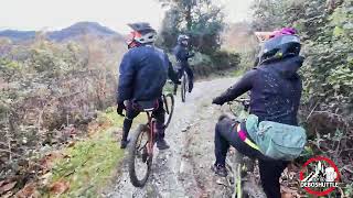
This quite long flowing into the trailway Enduro Trail comprises of a great variety of lines and terrains. While never being extremely technical and maintaining a great flow throughout the whole course, starts from one of the highest peaks close to Nato Base (link) and, after around 7kms, ends in a farm from which it takes its name: Cascina del Groppo.
It was the last stage of the 2013 EWS and is now a great option for a challenging flow ride.

source: ...
Access Info

The trails of the Orco-Vezzi area are best reachable either by bike from Nato Base or from the town of Orco.
Getting to Nato Base: reachable from the E80 highway accessing Orco Feglino, then drive north on the SP23 until the windmills under the Base.

Getting to Orco: reachable from the E80 highway accessing Orco Feglino, then drive south on the SP27 and then on the Via Provinciale Regione Brea.

Disclaimer

Given its nature, the trail can change after weather happenings and season changes. Always pay attention.

Trail Supporters
Local Trail Association

Recent Activity on Trail

Past Week
  • 2 rides
  • 33.5 km average
6 Months
  • 60 rides
  • 33.7 km avg distance
All
  • 250 rides
  • Last: Jun 15, 2026
c1c2c3c4
January
February
March
April
May
June
July
August
September
October
November
December
update trails status or condition

Supergroppo Trail Reports

Status:
on Jun 14, 2026
Dry
Avg: 4.01 (71 votes)
Your vote: 0

view (2,233)
close
3D
Trail Conditions
  • Unknown
  • Snow Groomed
  • Snow Packed
  • Snow Covered
  • Snow Cover Partial
  • Freeze/thaw Cycle
  • Icy
  • Prevalent Mud
  • Wet
  • Variable
  • Ideal
  • Dry
  • Very Dry
Trail Flow (Ridden Direction)
Trailforks scans users ridelogs to determine the most popular direction each trail is ridden. A good flowing trail network will have most trails flowing in a single direction according to their intension.
The colour categories are based on what percentage of riders are riding a trail in its intended direction.
  • > 96%
  • > 90%
  • > 80%
  • > 70%
  • > 50%
  • < 50%
  • bi-directional trail
  • no data
Trail Last Ridden
Trailforks scans ridelogs to determine the last time a trail was ridden.
  • < 2 days
  • < 1 week
  • < 2 weeks
  • < 1 month
  • < 6 months
  • > 6 months
Trail Ridden Direction
The intended direction a trail should be ridden.
  • Downhill Only
  • Downhill Primary
  • Both Directions
  • Uphill Primary
  • Uphill Only
  • One Direction
Contribute Details
Colors indicate trail is missing specified detail.
  • Description
  • Photos
  • Description & Photos
  • Videos
Trail Popularity ?
Trailforks scans ridelogs to determine which trails are ridden the most in the last 9 months. Trails are compared with nearby trails in the same city region with a possible 25 colour shades. Think of this as a heatmap, more rides = more kinetic energy = warmer colors.
  • most popular
  • popular
  • less popular
  • not popular
ATV/ORV/OHV Filter
Max Vehicle Width
inches
US Cell Coverage
Legend
cell carrier legend

Radar Time
Activity Recordings
Trailforks uses anonymized public activity data. ?
Activity Recordings
Trailforks uses anonymized public activity data. ?
Personal Heatmap
Activity Types
all / none
Options
2
Date range month
Winter Trails
Warning A routing network for winter maps does not exist. Selecting trails using the winter trails layer has been disabled.
Missing Trails
Most Popular
Least Popular
Trails are colored based on popularity. The more popular a trail is, the more red. Less popular trails trend towards green.
Jump Magnitude Heatmap
Heatmap of where riders jump on trails. Zoom in to see individual jumps, click circles to view jump details.
BC Backroad Status

Service Road Atlas is a free to use, community-driven service for viewing and creating reports on the numerous back-country service roads around B.C. and Alberta.

map legend
Slope Aspect
Direction the slope faces
Flat N NE E SE S SW W NW
Trails Deemphasized
Trails are shown in grey.
disable
Only show trails with no bike usage.
Enable
Suggested Layers
Based on selected activity type

    Save the current map location and zoom level as your default home location whenever this page is loaded.

    Save
        Directions to supergroppo trailhead (44.262900, 8.317860)

        Photos

        47 more »
        59 |
        Sep 18, 2025 @ 8:56am
        Sep 18, 2025
        174 |
        Apr 27, 2024 @ 6:53am
        Apr 27, 2024
        162 |
        Jul 18, 2023 @ 11:41pm
        Jul 18, 2023
        139 |
        Jul 18, 2023 @ 11:41pm
        Jul 18, 2023

        Videos

        14 more »
        Finale Ligure eMTBing - Trail Supergroppo Pt2
        18:49 | 188 | Jan 25, 2026 , Finale Ligure
        Supergroppo Finale Ligure MTB Trail Guide |...
        21:25 | 121 | Dec 10, 2025 , Finale Ligure
        Finale Ligure eMTBing - Trail Supergroppo Pt 2
        13:08 | 380 | Sep 20, 2024 , Finale Ligure
        Finale Ligure - Supergroppo (RAW)
        13:10 | 363 | Jul 1, 2024 , Finale Ligure

        Routes with this trail

        5.0 13 miles 1,977 ft 3 Point to Point
        A mix of steep technical trails and mellow singletracks, total climb around 600 meters, shuttle to nato...
        4.0 15 miles 1,848 ft 8 Point to Point
        A mix of steep technical trails and mellow singletracks, total climb around 600 meters, shuttle to nato...
        9 miles 820 ft 3
        single lift base nato_Crestino 1_monte alto-Supergroppo

        17 Reviews & Comments


        We hope you've been enjoying Trailforks!

        Create a FREE account to view trail comments and much more.

        • By finaleoutdoorregion FOR & contributors
        • #29135 - 18,080 views

        Frequently Asked Questions About Supergroppo

        Where is Supergroppo located?
        Supergroppo is located in Finale Outdoor Region, Finale Ligure, Italy. It is part of the Finale Outdoor Region trail network. The trailhead is located at coordinates 44.2629, 8.31786.
        How hard is Supergroppo?
        Supergroppo is rated as Blue difficulty. The physical rating is Moderate. The average grade is 9.9%. The climb difficulty is rated Green.
        What is the elevation gain for Supergroppo?
        Supergroppo has 40 m of elevation gain. The trail has 662 m of elevation descent. The elevation ranges from 267 m to 890 m.
        How long is Supergroppo?
        Supergroppo is 6.3 km long. The trail type is singletrack.

        Hit the Trail

        Open in App

        Get this trail on your phone instantly.
        open trail in app

        Download Trail

        Save to wishlist, Garmin & download.
        save the trail

        Find Related Routes

        Find routes and users activities that include this trail.
        find routes for this trail

        You must enter a description before submitting.