more stats
5,108 ft
Distance
71 ft
Climb
-689 ft
Descent
00:08:06
Avg time
-617 ft
Altitude change
1,384 ft
Altitude min
2,001 ft
Altitude max
2,001 ft
Altitude start
1,385 ft
Altitude end
-12.1%
Grade
-78.8%
Grade max
37.9%
Grade min
797 ft
Distance climb
4,088 ft
Distance down
223 ft
Distance flat
00:08:06
Avg time

Tūteata Details

  • Activities
    • Mountain Bike
    • E-Bike
  • Riding Area
  • Difficulty Rating
  • Voted Difficulty
    Black Diamond (3 votes)
  • Local Popularity
    80 in Mountain Biking [+]
    • 85 in E-Biking
  • Global Ranking
    #10986 in Mountain Biking [+]
    • #10991 in E-Biking
  • Trail Type
    Singletrack
  • Bike Type
    AM
  • Direction
    Downhill Only
    Popular Direction Shown
  • Physical Rating
    Moderate
  • Trail Visibility
    Always easy to follow
  • Dogs Allowed
    Yes
  • eBike Allowed
    Yes up to Class 1
  • TTFs on Trail
    Drop, Jump, Gap Jump

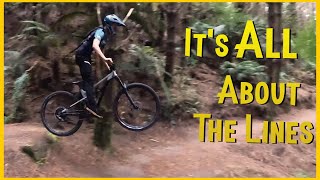
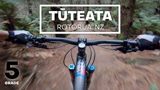
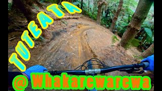
Tūteata is starts fast and open at the top with some drops and jumps and then after you cross the road it continues fast and gets steeper and more technical with off camber traverses, steep corners, and is super fun. Flows really nicely Be prepared for off camber and dropping corners!

Tūteata was built thanks to Maxxis, and all who contributed through purchasing the special edition Taiaha released for Crankworx Rotorua in 2019

Local Trail Association

Recent Activity on Trail

Past Week
  • 6 rides
  • 17 miles average
6 Months
  • 153 rides
  • 18 miles avg distance
All
  • 831 rides
  • Last: Jun 20, 2026
c1c2c3c4
January
February
March
April
May
June
July
August
September
October
November
December
update trails status or condition

Tūteata Trail Reports

statusdatedescription
Jun 13, 2026 @ 2:24pm (Pacific/Auckland)
Jun 12, 2026
Goes good
Jun 7, 2026 @ 4:16pm (Pacific/Auckland)
Jun 6, 2026
reporter Checked the top two sections no trees still across the tracks
Jun 6, 2026 @ 10:43am (Pacific/Auckland)
Jun 5, 2026
Large tree down on top section need chainsaw
Apr 2, 2026 @ 3:30pm (Pacific/Auckland)
Apr 1, 2026
from shuttle down, surface blown
Mar 4, 2026 @ 8:11pm (Pacific/Auckland)
Mar 3, 2026
A drop just past the Apamoana intersection is starting to get a little sketchy. Where the front wheel drops is getting dug out. Needs a bit of...
more »
Status:
on Jun 13, 2026
Ideal
Avg: 4.73 (24 votes)
Your vote: 0

view (7,329)
close
3D
Trail Conditions
  • Unknown
  • Snow Groomed
  • Snow Packed
  • Snow Covered
  • Snow Cover Partial
  • Freeze/thaw Cycle
  • Icy
  • Prevalent Mud
  • Wet
  • Variable
  • Ideal
  • Dry
  • Very Dry
Trail Flow (Ridden Direction)
Trailforks scans users ridelogs to determine the most popular direction each trail is ridden. A good flowing trail network will have most trails flowing in a single direction according to their intension.
The colour categories are based on what percentage of riders are riding a trail in its intended direction.
  • > 96%
  • > 90%
  • > 80%
  • > 70%
  • > 50%
  • < 50%
  • bi-directional trail
  • no data
Trail Last Ridden
Trailforks scans ridelogs to determine the last time a trail was ridden.
  • < 2 days
  • < 1 week
  • < 2 weeks
  • < 1 month
  • < 6 months
  • > 6 months
Trail Ridden Direction
The intended direction a trail should be ridden.
  • Downhill Only
  • Downhill Primary
  • Both Directions
  • Uphill Primary
  • Uphill Only
  • One Direction
Contribute Details
Colors indicate trail is missing specified detail.
  • Description
  • Photos
  • Description & Photos
  • Videos
Trail Popularity ?
Trailforks scans ridelogs to determine which trails are ridden the most in the last 9 months. Trails are compared with nearby trails in the same city region with a possible 25 colour shades. Think of this as a heatmap, more rides = more kinetic energy = warmer colors.
  • most popular
  • popular
  • less popular
  • not popular
ATV/ORV/OHV Filter
Max Vehicle Width
inches
US Cell Coverage
Legend
cell carrier legend

Radar Time
Activity Recordings
Trailforks uses anonymized public activity data. ?
Activity Recordings
Trailforks uses anonymized public activity data. ?
Personal Heatmap
Activity Types
all / none
Options
2
Date range month
Winter Trails
Warning A routing network for winter maps does not exist. Selecting trails using the winter trails layer has been disabled.
Missing Trails
Most Popular
Least Popular
Trails are colored based on popularity. The more popular a trail is, the more red. Less popular trails trend towards green.
Jump Magnitude Heatmap
Heatmap of where riders jump on trails. Zoom in to see individual jumps, click circles to view jump details.
BC Backroad Status

Service Road Atlas is a free to use, community-driven service for viewing and creating reports on the numerous back-country service roads around B.C. and Alberta.

map legend
Slope Aspect
Direction the slope faces
Flat N NE E SE S SW W NW
Trails Deemphasized
Trails are shown in grey.
disable
Only show trails with no bike usage.
Enable
Suggested Layers
Based on selected activity type

    Save the current map location and zoom level as your default home location whenever this page is loaded.

    Save
        Directions to t-teata trailhead (-38.171020, 176.301260)

        Photos

        53 more »
        95 |
        Mar 18, 2025 @ 4:51pm
        Mar 18, 2025
        76 |
        Mar 18, 2025 @ 4:51pm
        Mar 18, 2025
        125 |
        Mar 18, 2025 @ 4:51pm
        Mar 18, 2025
        81 |
        Mar 18, 2025 @ 4:52pm
        Mar 18, 2025

        Videos

        20 more »
        youtuber Uncovering HIDDEN lines for the North Island...
        34:34 | 336 | Apr 1, 2023 , Rotorua
        youtuber Tuteata  ::  Whakarewarewa Forest, Rotorua ...
        6:50 | 795 | Apr 8, 2020 , Rotorua
        youtuber JUMPS, DROPS & TECH - Tūteata Mountain...
        4:01 | 693 | Nov 2, 2020 , Rotorua
        youtuber Tuteata @ Whakarewarewa/Redwoods
        4:59 | 486 | Mar 24, 2020 , Rotorua

        Articles

        Richie Rude Runs Through His Favourite Trails in Whakarewarewa Forest, Rotorua
        Mar 24, 2025 from pinkbike.com
        With more than 200km of purpose-built tracks, Whakarewarewa has played host to both weekend warriors and the world’s best.

        Trail Lists

        Routes with this trail

        7 miles 1,892 ft 9
        Map for Marleen Wholesalers for Crankworx 2019
        65 miles 17,466 ft 39 Loop
        FY 1 Hundred 2021 D2 FY 1 Hundred 2021 D2 FY 1 Hundred 2021 D2
        24 miles 5,076 ft 13 Race
        RACE 3 - Season 10 The Giant 2W Enduro mountain bike series first exploded onto the scene in 2013 when it...

        2 Reviews & Comments


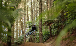
        We hope you've been enjoying Trailforks!

        Create a FREE account to view trail comments and much more.

        • By nzmbjamie & contributors
        • #228650 - 6,788 views

        Frequently Asked Questions About Tūteata

        Where is Tūteata located?
        Tūteata is located in Whakarewarewa Forest, Rotorua, New Zealand. It is part of the Whakarewarewa Forest trail network. The trailhead is located at coordinates -38.17102, 176.30126.
        How hard is Tūteata?
        Tūteata is rated as Advanced difficulty. The physical rating is Moderate. The average grade is 12.1%.
        What is the elevation gain for Tūteata?
        Tūteata has 71 ft of elevation gain. The trail has 689 ft of elevation descent. The elevation ranges from 1,384 ft to 2,001 ft.
        Is Tūteata a point to point trail?
        Yes, Tūteata is a point to point trail. The direction is Downhill Only. The trail type is singletrack.

        Hit the Trail

        Open in App

        Get this trail on your phone instantly.
        open trail in app

        Download Trail

        Save to wishlist, Garmin & download.
        save the trail

        Find Related Routes

        Find routes and users activities that include this trail.
        find routes for this trail

        You must enter a description before submitting.