more stats
3.2 miles
Distance
94 ft
Climb
-1,015 ft
Descent
00:28:49
Avg time
-920 ft
Altitude change
2,685 ft
Altitude min
3,653 ft
Altitude max
3,606 ft
Altitude start
2,687 ft
Altitude end
-5.5%
Grade
-39.1%
Grade max
16.7%
Grade min
2,425 ft
Distance climb
2 miles
Distance down
1,332 ft
Distance flat
00:28:49
Avg time

Tabakowy Details

  • Activities
    • Mountain Bike
    • E-Bike
  • Riding Area
  • Difficulty Rating
  • Voted Difficulty
    Green (1 vote)
  • Local Popularity
    80 in Mountain Biking [+]
    • 75 in E-Biking
  • Global Ranking
    #37700 in Mountain Biking [+]
    • #31925 in E-Biking
  • Trail Type
    Singletrack
  • Bike Type
    AM, XC
  • Direction
    Both Directions
  • Climb Difficulty
    Blue
  • Physical Rating
    Moderate
  • Dogs Allowed
    Yes
  • eBike Allowed
    Yes up to Class 1
  • TTFs on Trail
    Berm, Jump
  • Year Opened
    2018
  • Land Owner

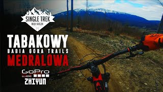
Dwukierunkowy szlak rowerowy łącznikowy ze Słowacją. Naturalny singletrack łatwy do pojazdu i zjazdu. Jeden ze szlaków kompleksu Babia Góra Trails.

Access Info

Drogi gminne z przysiółka Bębny na Halę Barankową.

Local Trail Association
  • trail association logo
  • Please consider joining or donating to the local trail association to support
    trail development & maintenance.

Recent Activity on Trail

Past Week
  • 0 rides
  •  
6 Months
  • 1 rides
  • 29.6 km avg distance
All
  • 57 rides
  • Last: Jun 3, 2026
c1c2c3c4
January
February
March
April
May
June
July
August
September
October
November
December
update trails status or condition

Tabakowy Trail Reports

statusdatedescription
Aug 10, 2025 @ 9:40am
Aug 10, 2025
Czysto, pusto, idealnie.
Jun 14, 2025 @ 8:46am
Jun 14, 2025
Jul 2, 2024 @ 11:32am
Jul 2, 2024
Uwaga zieleń zaatakowała Tabakowy, zrobiło się niebezpiecznie. Trasa jest dwukierunkowa, z racji dużych przyrostów drzew zrobiło się mocno...
Jun 8, 2024 @ 11:27am
Jun 8, 2024
Na trasie posprzątane, przejezdna, do końca czerwca trwają prace przy zrywce drewna ale tylko w tygodniu. Jest informacja, że w weekendy...
Oct 29, 2023 @ 1:42am
Oct 29, 2023
more »
Status:
on Aug 10, 2025
Very Dry
Avg: 4.26 (5 votes)
Your vote: 0

view (812)
close
3D
Trail Conditions
  • Unknown
  • Snow Groomed
  • Snow Packed
  • Snow Covered
  • Snow Cover Partial
  • Freeze/thaw Cycle
  • Icy
  • Prevalent Mud
  • Wet
  • Variable
  • Ideal
  • Dry
  • Very Dry
Trail Flow (Ridden Direction)
Trailforks scans users ridelogs to determine the most popular direction each trail is ridden. A good flowing trail network will have most trails flowing in a single direction according to their intension.
The colour categories are based on what percentage of riders are riding a trail in its intended direction.
  • > 96%
  • > 90%
  • > 80%
  • > 70%
  • > 50%
  • < 50%
  • bi-directional trail
  • no data
Trail Last Ridden
Trailforks scans ridelogs to determine the last time a trail was ridden.
  • < 2 days
  • < 1 week
  • < 2 weeks
  • < 1 month
  • < 6 months
  • > 6 months
Trail Ridden Direction
The intended direction a trail should be ridden.
  • Downhill Only
  • Downhill Primary
  • Both Directions
  • Uphill Primary
  • Uphill Only
  • One Direction
Contribute Details
Colors indicate trail is missing specified detail.
  • Description
  • Photos
  • Description & Photos
  • Videos
Trail Popularity ?
Trailforks scans ridelogs to determine which trails are ridden the most in the last 9 months. Trails are compared with nearby trails in the same city region with a possible 25 colour shades. Think of this as a heatmap, more rides = more kinetic energy = warmer colors.
  • most popular
  • popular
  • less popular
  • not popular
ATV/ORV/OHV Filter
Max Vehicle Width
inches
US Cell Coverage
Legend
cell carrier legend

Radar Time
Activity Recordings
Trailforks uses anonymized public activity data. ?
Activity Recordings
Trailforks uses anonymized public activity data. ?
Personal Heatmap
Activity Types
all / none
Options
2
Date range month
Winter Trails
Warning A routing network for winter maps does not exist. Selecting trails using the winter trails layer has been disabled.
Missing Trails
Most Popular
Least Popular
Trails are colored based on popularity. The more popular a trail is, the more red. Less popular trails trend towards green.
Jump Magnitude Heatmap
Heatmap of where riders jump on trails. Zoom in to see individual jumps, click circles to view jump details.
BC Backroad Status

Service Road Atlas is a free to use, community-driven service for viewing and creating reports on the numerous back-country service roads around B.C. and Alberta.

map legend
Slope Aspect
Direction the slope faces
Flat N NE E SE S SW W NW
Trails Deemphasized
Trails are shown in grey.
disable
Only show trails with no bike usage.
Enable
Suggested Layers
Based on selected activity type

    Save the current map location and zoom level as your default home location whenever this page is loaded.

    Save
        Directions to tabakowy trailhead (49.611850, 19.469370)

        Photos

        35 more »
        141 |
        Nov 13, 2022 @ 11:17am
        Nov 13, 2022
        121 |
        Sep 11, 2021 @ 11:11am
        Sep 11, 2021
        205 |
        Sep 11, 2021 @ 11:10am
        Sep 11, 2021
        245 |
        Dec 1, 2020 @ 4:03am
        Dec 1, 2020

        Videos

        1 more »
        Mędralowa - Tabakowy // Babia Góra Trails,...
        11:13 | 723 | Dec 1, 2020 , Zawoja

        1 Review & Comments


        We hope you've been enjoying Trailforks!

        Create a FREE account to view trail comments and much more.

        • By vasillyTF Pro BGT & contributors
        • #151479 - 12,539 views

        Frequently Asked Questions About Tabakowy

        Where is Tabakowy located?
        Tabakowy is located in Babia Góra Trails, Zawoja, Poland. It is part of the Babia Góra Trails trail network. The trailhead is located at coordinates 49.61185, 19.46937.
        How hard is Tabakowy?
        Tabakowy is rated as Blue difficulty. The physical rating is Moderate. The average grade is 5.5%. The climb difficulty is rated Blue.
        What is the elevation gain for Tabakowy?
        Tabakowy has 94 ft of elevation gain. The trail has 1,015 ft of elevation descent. The elevation ranges from 2,685 ft to 3,653 ft.
        Is Tabakowy a point to point trail?
        Tabakowy is not a point to point trail. The direction is Both Directions. The trail type is singletrack.

        Hit the Trail

        Open in App

        Get this trail on your phone instantly.
        open trail in app

        Download Trail

        Save to wishlist, Garmin & download.
        save the trail

        Find Related Routes

        Find routes and users activities that include this trail.
        find routes for this trail

        You must enter a description before submitting.