
Open in App
Get this trail on your phone instantly.

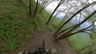
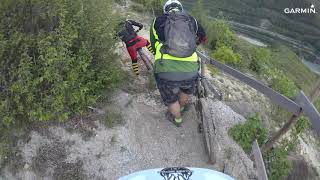
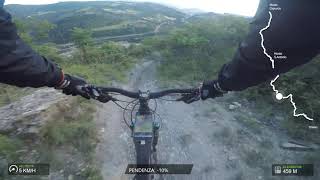
Bellissimo trail all-mountain, in parte dedicato, che parte da dietro la chiesetta di Monte San'Antonio. In generale è scorrevole ma presenta diversi tratti molto tecnici e ripidi. Si sviluppa lungo il crinale del monte, passando dal bosco a tratti aperti ed esposti. Il terreno è prevalentemente terroso nel bosco mentre è molto roccioso e cedevole nei tratti all'aperto, consigliato a rider esperti per le difficoltà che presenta ed in quanto non esistono chicken line o bypass per le parti più difficili. Non è mai difficile da seguire, è stato tracciato molto bene e ai pochi bivi che si trovano sono state apposte delle frecce blu.
| c1 | c2 | c3 | c4 |
|---|---|---|---|
January | February | March | April |
May | June | July | August |
September | October | November | December |

Service Road Atlas is a free to use, community-driven service for viewing and creating reports on the numerous back-country service roads around B.C. and Alberta.
Save the current map location and zoom level as your default home location whenever this page is loaded.
SaveWe hope you've been enjoying Trailforks!
Create a FREE account to view trail comments and much more.
You must enter a description before submitting.

