more stats
1.6 miles
Distance
445 ft
Climb
-33 ft
Descent
00:20:42
Avg time
414 ft
Altitude change
3,013 ft
Altitude min
3,427 ft
Altitude max
3,013 ft
Altitude start
3,428 ft
Altitude end
5%
Grade
-11%
Grade max
49.6%
Grade min
1 mile
Distance climb
1,178 ft
Distance down
771 ft
Distance flat
00:20:42
Avg time

Taxi Cab Details

  • Activities
    • Mountain Bike
    • Gravel Bike
    • Hike
    • Trail Running
  • Riding Area
    Harmony/Washington Ridge
    Nevada City, California
  • Difficulty Rating
  • Voted Difficulty
    Blue (1 vote)
  • Local Popularity
    95 in Mountain Biking [+]
    • 75 in Trail Running
    • 70 in Hiking
  • Global Ranking
    #51628 in Mountain Biking [+]
    • #78501 in Trail Running
    • #85777 in Hiking
  • Trail Type
    Singletrack
  • Bike Type
    AM, XC, Gravel
  • Direction
    Uphill Primary
    Popular In Reverse
  • Climb Difficulty
    Blue
  • Physical Rating
    Moderate
  • Season
    all season
  • Dogs Allowed
    Yes

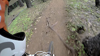
Beautiful old school legacy trail. Mostly about 4" wide. Great views back to Nevada City especially at sunset. Mind the star thistle Bidirectional but mostly used to climb up to Harmony Ridge.

Local Trail Association
Traditionally Indigenous Territory

Recent Activity on Trail

Past Week
  • 2 rides
  • 19 miles average
6 Months
  • 56 rides
  • 17 miles avg distance
All
  • 444 rides
  • Last: Jun 22, 2026
c1c2c3c4
January
February
March
April
May
June
July
August
September
October
November
December
update trails status or condition

Taxi Cab Trail Reports

statusdatedescription
Jun 20, 2026 @ 11:22am (America/Boise)
Jun 20, 2026
Thistles. So many thistles. Overgrown thistles everywhere. Do not ride right now. My legs and arms are so bloody.
Apr 16, 2026 @ 1:31pm (America/Boise)
Apr 16, 2026
Some areas are unusually wet. Very ridable.
Mar 21, 2026 @ 11:01am (America/Boise)
Mar 21, 2026
Mar 3, 2026 @ 12:53pm (America/Boise)
Mar 3, 2026
A couple trees require special navigation, but great to ride.
Oct 23, 2025 @ 1:22pm (America/Boise)
Oct 23, 2025
Great traction. Clear of debris. Virtually excellent.
more »
Status:
on Jun 20, 2026
Very Dry
Avg: 3.91 (7 votes)
Your vote: 0

view (3,978)
close
3D
Trail Conditions
  • Unknown
  • Snow Groomed
  • Snow Packed
  • Snow Covered
  • Snow Cover Partial
  • Freeze/thaw Cycle
  • Icy
  • Prevalent Mud
  • Wet
  • Variable
  • Ideal
  • Dry
  • Very Dry
Trail Flow (Ridden Direction)
Trailforks scans users ridelogs to determine the most popular direction each trail is ridden. A good flowing trail network will have most trails flowing in a single direction according to their intension.
The colour categories are based on what percentage of riders are riding a trail in its intended direction.
  • > 96%
  • > 90%
  • > 80%
  • > 70%
  • > 50%
  • < 50%
  • bi-directional trail
  • no data
Trail Last Ridden
Trailforks scans ridelogs to determine the last time a trail was ridden.
  • < 2 days
  • < 1 week
  • < 2 weeks
  • < 1 month
  • < 6 months
  • > 6 months
Trail Ridden Direction
The intended direction a trail should be ridden.
  • Downhill Only
  • Downhill Primary
  • Both Directions
  • Uphill Primary
  • Uphill Only
  • One Direction
Contribute Details
Colors indicate trail is missing specified detail.
  • Description
  • Photos
  • Description & Photos
  • Videos
Trail Popularity ?
Trailforks scans ridelogs to determine which trails are ridden the most in the last 9 months. Trails are compared with nearby trails in the same city region with a possible 25 colour shades. Think of this as a heatmap, more rides = more kinetic energy = warmer colors.
  • most popular
  • popular
  • less popular
  • not popular
ATV/ORV/OHV Filter
Max Vehicle Width
inches
US Cell Coverage
Legend
cell carrier legend

Radar Time
Activity Recordings
Trailforks uses anonymized public activity data. ?
Activity Recordings
Trailforks uses anonymized public activity data. ?
Personal Heatmap
Activity Types
all / none
Options
2
Date range month
Winter Trails
Warning A routing network for winter maps does not exist. Selecting trails using the winter trails layer has been disabled.
Missing Trails
Most Popular
Least Popular
Trails are colored based on popularity. The more popular a trail is, the more red. Less popular trails trend towards green.
Jump Magnitude Heatmap
Heatmap of where riders jump on trails. Zoom in to see individual jumps, click circles to view jump details.
BC Backroad Status

Service Road Atlas is a free to use, community-driven service for viewing and creating reports on the numerous back-country service roads around B.C. and Alberta.

map legend
Slope Aspect
Direction the slope faces
Flat N NE E SE S SW W NW
Trails Deemphasized
Trails are shown in grey.
disable
Only show trails with no bike usage.
Enable
Suggested Layers
Based on selected activity type

    Save the current map location and zoom level as your default home location whenever this page is loaded.

    Save
        Directions to taxi-cab trailhead (39.280850, -120.993220)

        Photos

        12 more »
        311 |
        Dec 13, 2018 @ 7:51pm
        Dec 13, 2018
        262 |
        Dec 13, 2018 @ 7:46pm
        Dec 13, 2018
        372 |
        Jul 13, 2012 @ 7:15pm
        Jul 13, 2012
        79 |
        Mar 30, 2021 @ 1:47pm
        Mar 30, 2021

        Videos

        2 more »
        Taxi Cab to Miner's Trail Nevada City
        9:15 | 99 | Jun 20, 2024 , Nevada City
        Yellow Taxi Cab
        2:03 | 727 | Aug 23, 2014 , Nevada City

        Routes with this trail

        4.5 19 miles 2,468 ft 12 Loop
        All three faces of Harmony Ridge.
        7 miles 1,457 ft 2
        Lake Vera to Market roads trails ditches
        9 miles 1,258 ft 4 Loop
        Recommended route in Nevada City.

        3 Reviews & Comments


        We hope you've been enjoying Trailforks!

        Create a FREE account to view trail comments and much more.

        • By RedhawkTF Pro BONC & contributors
        • #31806 - 5,294 views

        Frequently Asked Questions About Taxi Cab

        Where is Taxi Cab located?
        Taxi Cab is located in Harmony/Washington Ridge, Nevada City, California, United States. It is part of the Harmony/Washington Ridge trail network. The trailhead is located at coordinates 39.28085, -120.99322.
        How hard is Taxi Cab?
        Taxi Cab is rated as Blue difficulty. The physical rating is Moderate. The average grade is 5%. The climb difficulty is rated Blue.
        What is the elevation gain for Taxi Cab?
        Taxi Cab has 445 ft of elevation gain. The trail has 33 ft of elevation descent. The elevation ranges from 3,013 ft to 3,427 ft.
        Is Taxi Cab a point to point trail?
        Taxi Cab is not a point to point trail. The direction is Uphill Primary. The trail type is singletrack.

        Hit the Trail

        Open in App

        Get this trail on your phone instantly.
        open trail in app

        Download Trail

        Save to wishlist, Garmin & download.
        save the trail

        Find Related Routes

        Find routes and users activities that include this trail.
        find routes for this trail

        You must enter a description before submitting.