more stats
4,226 ft
Distance
4 ft
Climb
-522 ft
Descent
00:07:00
Avg time
-518 ft
Altitude change
955 ft
Altitude min
1,473 ft
Altitude max
1,473 ft
Altitude start
955 ft
Altitude end
-12.3%
Grade
-43.7%
Grade max
5.6%
Grade min
299 ft
Distance climb
3,927 ft
Distance down
00:07:00
Avg time

TBK Dva Details

  • Activities
    • Mountain Bike
    • E-Bike
    • Winter Fat Bike
  • Riding Area
    Trail Biely Kríž
    Bratislava
  • Difficulty Rating
  • Voted Difficulty
    Blue (1 vote)
  • Local Popularity
    90 in Mountain Biking [+]
    • 100 in E-Biking
  • Global Ranking
    #16153 in Mountain Biking [+]
    • #2274 in E-Biking
  • Trail Type
    Singletrack
  • Bike Type
    DH, AM, Fat
  • Direction
    Downhill Only
    Popular Direction Shown
  • Physical Rating
    Moderate
  • Dogs Allowed
    Yes
  • eBike Allowed
    Yes up to Class 1
  • TTFs on Trail
    Berm, Jump, Gap Jump, Rock Garden, Roller Coaster
  • Ride in Rain
    Yes

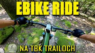
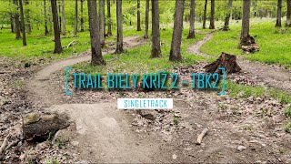
TBK 2 starts at the top of Piesky (447m). It is a fast, medium-difficulty trail that is almost exclusively downhill. Trail consist of smaller and bigger jumps and gap-jumps, which can be bypassed if needed, and a lot of berms. This part ends above the parking lot on Rybničná street in Rača.

Character: Fast trail, contains berms, ripples, smaller and larger jumps and gaps

source: OZTBK
Local Trail Association

Recent Activity on Trail

Past Week
  • 3 rides
  • 17 miles average
6 Months
  • 50 rides
  • 22 miles avg distance
All
  • 343 rides
  • Last: Jun 19, 2026
c1c2c3c4
January
February
March
April
May
June
July
August
September
October
November
December
Status:
on Jun 18, 2026
Ideal
Avg: 4.55 (25 votes)
Your vote: 0

view (4,559)
close
3D
Trail Conditions
  • Unknown
  • Snow Groomed
  • Snow Packed
  • Snow Covered
  • Snow Cover Partial
  • Freeze/thaw Cycle
  • Icy
  • Prevalent Mud
  • Wet
  • Variable
  • Ideal
  • Dry
  • Very Dry
Trail Flow (Ridden Direction)
Trailforks scans users ridelogs to determine the most popular direction each trail is ridden. A good flowing trail network will have most trails flowing in a single direction according to their intension.
The colour categories are based on what percentage of riders are riding a trail in its intended direction.
  • > 96%
  • > 90%
  • > 80%
  • > 70%
  • > 50%
  • < 50%
  • bi-directional trail
  • no data
Trail Last Ridden
Trailforks scans ridelogs to determine the last time a trail was ridden.
  • < 2 days
  • < 1 week
  • < 2 weeks
  • < 1 month
  • < 6 months
  • > 6 months
Trail Ridden Direction
The intended direction a trail should be ridden.
  • Downhill Only
  • Downhill Primary
  • Both Directions
  • Uphill Primary
  • Uphill Only
  • One Direction
Contribute Details
Colors indicate trail is missing specified detail.
  • Description
  • Photos
  • Description & Photos
  • Videos
Trail Popularity ?
Trailforks scans ridelogs to determine which trails are ridden the most in the last 9 months. Trails are compared with nearby trails in the same city region with a possible 25 colour shades. Think of this as a heatmap, more rides = more kinetic energy = warmer colors.
  • most popular
  • popular
  • less popular
  • not popular
ATV/ORV/OHV Filter
Max Vehicle Width
inches
US Cell Coverage
Legend
cell carrier legend

Radar Time
Activity Recordings
Trailforks uses anonymized public activity data. ?
Activity Recordings
Trailforks uses anonymized public activity data. ?
Personal Heatmap
Activity Types
all / none
Options
2
Date range month
Winter Trails
Warning A routing network for winter maps does not exist. Selecting trails using the winter trails layer has been disabled.
Missing Trails
Most Popular
Least Popular
Trails are colored based on popularity. The more popular a trail is, the more red. Less popular trails trend towards green.
Jump Magnitude Heatmap
Heatmap of where riders jump on trails. Zoom in to see individual jumps, click circles to view jump details.
BC Backroad Status

Service Road Atlas is a free to use, community-driven service for viewing and creating reports on the numerous back-country service roads around B.C. and Alberta.

map legend
Slope Aspect
Direction the slope faces
Flat N NE E SE S SW W NW
Trails Deemphasized
Trails are shown in grey.
disable
Only show trails with no bike usage.
Enable
Suggested Layers
Based on selected activity type

    Save the current map location and zoom level as your default home location whenever this page is loaded.

    Save
        Directions to tbk-dva trailhead (48.233970, 17.145040)

        Photos

        15 more »
        44 |
        Sep 8, 2025 @ 12:19pm
        Sep 8, 2025
        43 |
        Sep 8, 2025 @ 12:19pm
        Sep 8, 2025
        99 |
        May 26, 2024 @ 11:47am
        May 26, 2024
        91 |
        May 26, 2024 @ 11:47am
        May 26, 2024

        Videos

        7 more »
        Ako sa dá skvele zabaviť na TBK trailoch v...
        28:32 | 39 | Jan 6, 2026 , Bratislava
        Somár a Trail Biely kríž v zime
        6:12 | 226 | Dec 21, 2022 , Bratislava
        Trail Biely Kríž / TBK2 / Bikepark Malé...
        4:28 | 544 | Aug 13, 2021 , Bratislava
        Biely Kríž-tbk2
        3:04 | 495 | Dec 9, 2020 , Bratislava

        Routes with this trail

        14 miles 3,158 ft 9 Loop Race
        We invite you to the / informal / continuation of TBK Enduro race 2019. This time in the form of the final...

        Reviews / Comments

        No reviews yet, be the first to write a review or ask a question.
        Use trail reports to comment on trail conditions.


        We hope you've been enjoying Trailforks!

        Create a FREE account to view trail comments and much more.

        • By ZelenaliskaTF Pro TBK & contributors
        • #104941 - 6,140 views

        Frequently Asked Questions About TBK Dva

        Where is TBK Dva located?
        TBK Dva is located in Trail Biely Kríž, Bratislava, Slovakia. It is part of the Trail Biely Kríž trail network. The trailhead is located at coordinates 48.23397, 17.14504.
        How hard is TBK Dva?
        TBK Dva is rated as Blue difficulty. The physical rating is Moderate. The average grade is 12.3%.
        What is the elevation gain for TBK Dva?
        TBK Dva has 1 m of elevation gain. The trail has 159 m of elevation descent. The elevation ranges from 291 m to 449 m.
        Is TBK Dva a point to point trail?
        Yes, TBK Dva is a point to point trail. The direction is Downhill Only. The trail type is singletrack.

        Hit the Trail

        Open in App

        Get this trail on your phone instantly.
        open trail in app

        Download Trail

        Save to wishlist, Garmin & download.
        save the trail

        Find Related Routes

        Find routes and users activities that include this trail.
        find routes for this trail

        You must enter a description before submitting.