


Open in App
Get this trail on your phone instantly.

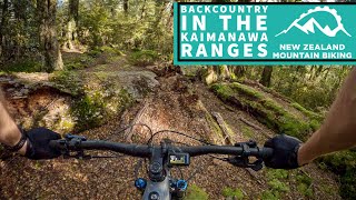
This is an out and back ride with a mix of bike carrying. What looks un-rideable as you carry your bike on the way out, is a good fun technical ride on the way back. Most fun is had riding back. Either turn around at the end of the tight switchbacks above where the Tikitiki Stream and Kaipo River join, or head on to Oamaru hut, another 1.5hrs, for an overnighter.
Below from Classic NZ Mountain Bike Rides:
The semi-rideable track climbs 330m from the carpark to a clearing where the old Te Iringa Hut used to be, then skirts around Mt Te Iringa (1241m) before dropping down to a swingbridge just downstream from the junction of Tikitiki Stream and Kaipo River.
Cross the swingbridge and turn left to take the main track down the Kaipo Valley to Oamaru Hut (12 bunks) by the confluence of the Kaipo and Oamaru rivers.
This is a big day packed with with technical riding, so it is recommend staying the night at the hut overnight and soaking up the wilderness, rather than racing through. From here you have to ride back the same way you came as all other tracks are closed to bikes..
Turn right off Highway 5 (Napier-Taupo Rd) 27km southeast of Taupo and drive down Taharu Rd. After 9.5km, turn right on to Clements Mill Rd. Stop at the car park 6.5km down this road.
| c1 | c2 | c3 | c4 |
|---|---|---|---|
January | February | March | April |
May | June | July | August |
September | October | November | December |

Service Road Atlas is a free to use, community-driven service for viewing and creating reports on the numerous back-country service roads around B.C. and Alberta.
Save the current map location and zoom level as your default home location whenever this page is loaded.
SaveWe hope you've been enjoying Trailforks!
Create a FREE account to view trail comments and much more.
You must enter a description before submitting.

